Robbers Roost Canyon
| Rating: | |||||||||||||||||||||||||||||||
|---|---|---|---|---|---|---|---|---|---|---|---|---|---|---|---|---|---|---|---|---|---|---|---|---|---|---|---|---|---|---|---|
| | Difficulty:3A III (v3a1 III) Raps:5, max ↨230ft
Red Tape:No permit required Shuttle:None Vehicle:Passenger | ||||||||||||||||||||||||||||||
| Start: | |||||||||||||||||||||||||||||||
| Parking: | |||||||||||||||||||||||||||||||
| Condition Reports: | 22 Oct 2025
"Surprisingly fun route!c, absolutely worth running. The only real Superstition thrash it has is part of that stretch between R4 and R5. The rappels ar |
||||||||||||||||||||||||||||||
| Best season: | BEST in Nov;Dec;Jan;Feb
|
||||||||||||||||||||||||||||||
| Regions: | |||||||||||||||||||||||||||||||
Introduction[edit]
An interesting canyon adventure in the Superstition Mountains with a visit to an old bandit hideout and a large rappel.
From Phoenix, drive east on US60, turning left on Peralta Road at the far side of the town of Gold Canyon. Drive on Peralta Road (FR77, though I don't think it is signed) for 6.2 miles to park at a large pullout on the left with fencing that currently has prominent yellow bumpers on the fence wires. This is the Carney Springs trailhead - begin the hike here.
Approach[edit]
Hike north on the Carney Springs trail, which begins as an old road to an abandoned camping area, then thins into a normal trail after the site. The trail is well traveled, but be careful to ignore one or two side branching trails and stay on the main track heading north. After passing through a fence line, you will reach a cairn supporting a post. It indicates that Wave Cave is to the left. You have two options here: 1) go left and gain the ridge via Wave Cave, or 2) Take the shorter, more direct Carney Springs trail
Carney Spring Approach Head straight past the post. The trail becomes a bit more difficult to follow as it becomes more steep, just keep your eyes on the many rock cairns that lead the way up. After about 1.7 miles you will reach a saddle with a makeshift sign pointing the way for the continuation of the Carney Springs trail as it heads west to Superstition Peak...
Wave Cave Approach Head left at the post towards Wave Cave. A well defined trail contours around and crosses the next drainage before climbing up towards the dark hole on the side of the slope. The cave is quite large and there is evidence people sometimes spend the night. Once you have had your fill of the views, continue North contouring around the slope on a primitive route marked by occasional cairns. Travel becomes easier once you drop into the drainage. Gain the ridge and join the Carney Spring Trail. Follow it back to the saddle marked by a sign...
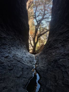
Turn right here staying at your current elevation to locate a more thin, but well marked trail that heads east, then south east to eventually locate the Robbers Roost hideout. Be careful to follow the cairns through the maze of rock that will lead you through an easy way into a deep room with an enormous, suspended boulder in the middle.
Descent[edit]
R1: 15’ off rock pinch (anchor below boulder) or downclimb into a very cool space with lots of signatures and a large chockstone suspended above.
R2: 20’ off rock pinch located at the far end of this interesting space. Lands into a possibly shallow pool (less than knee deep) that would be difficult to avoid. A solid tree at the bottom of this rappel would serve as a good anchor for a guided rappel if you wish to attempt to keep the rest of your group’s feet dry.
R3: 50’ off large tree (best done LDC), or a brushy downclimb RDC.
R4: 90’ off small tree, that may be somewhat tricky to get to, at the edge of the next drop. Recommended to trail rope to avoid some inconveniently positioned patches of prickly pear.
After this rappel, head down the bouldery, brushy slope to reach the main drainage below. Hike alongside it where it is chocked with brush, then enter in where it becomes more steep and rocky. Follow the drainage until another merges from the right, just before the final rappel.
R5: 230’ from a large boulder RDC. Though this is a long rappel, the wall is less than vertical for most of its length, making it easy and a good place to test comfort on long drops.
Exit[edit]
After the final rappel, exit LDC and follow a well-defined trail as it meanders down the hillside passing a small cave and ultimately merging with Carney Springs Trail.
Alternatively, for a more direct (but more unpleasant) exit, you may follow the drainage for a short distance and then thrash through brush on the right until you reach the trail.
Red tape[edit]
Beta sites[edit]
 Super Amazing Map : Robbers Roost Canyon
 HikeArizona.com : Robbers Roost Canyon - Tonto NF
Trip reports and media[edit]
- https://www.facebook.com/pat.winstanley.7/media_set?set=a.1017599631632067.1073742045.100001461198708&type=3&uploaded=12
- https://www.youtube.com/watch?v=f-kE_okwhs4&list=WL&index=3
Robbers Roost October, 2025 https://youtu.be/0avQggUWkSg?si=ALsn7dYpIVLQYVIh
