Rock Creek (California Sierras)
| Rating: | |||||||||||||||||||||||||||||||
|---|---|---|---|---|---|---|---|---|---|---|---|---|---|---|---|---|---|---|---|---|---|---|---|---|---|---|---|---|---|---|---|
| | Raps:5-7 + many jumps, max ↨120ft
Red Tape:No permit required Shuttle:Optional Vehicle:Passenger | ||||||||||||||||||||||||||||||
| Location: | |||||||||||||||||||||||||||||||
| Condition Reports: | 7 Jul 2025
"High flow levels made it impossible to stay in the watercourse through the tyrolean traverse section. Dangerous hydraulics and sieves were present at |
||||||||||||||||||||||||||||||
| Best season: | Aug-Oct
|
||||||||||||||||||||||||||||||
| Regions: | |||||||||||||||||||||||||||||||
Introduction[edit]
- The "II" on the ACA rating given to this canyon is based on the approach for the middle gorge. Dropping in from the top makes this a full day trip.
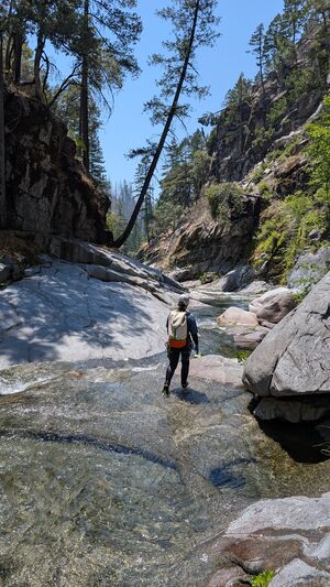
Rock Creek is a bit unique in just how filled it is with giant boulders. While sometimes I feel like this could be detrimental to a canyon's quality, it actually turns out to be really cool in Rock Creek and makes for some very interesting sections. Also the center gorge where Rock Creek makes an obvious tight bend is a short, but extremely high quality section of canyon.
Rock Creek could be divided into sections: (It would be reasonable to do all three in one day)
There is a lower section, which can be accessed on its own, although unfortunately does not have a whole lot of excitement, and can all be downclimbed, with lots of boulders and few jumps.
Above this is a the middle section which has long beautiful pools and a large double falls toward the bottom, and a tight impressive gorge that makes for the most exciting section above this. You can hike to the top of this as well. While this section is tight, and poses potential problems with high flows, somebody has put in a lot of effort to install some cables, that can be followed along ledges that allow you to bypass any potential problem areas.
Further up is an upper section that is also well worth the effort and contains a number of interesting boulder filled sections, including one narrow slot formed between a wall and a broken slab that is reminiscent of Kaiser Creek.
I'm not sure if it's worth going higher than that. It would definitely require substantially more effort and there is likely not too much in the way of exciting canyon there.
Approach[edit]
Accessing the lower section: Drive or hike up the first couple sets of small switchbacks to a green gate on the left (before the main road takes off straight east for a while). You could park here, and walk a short distance up the steep rocky road past this green gate. Up canyon a cut and an obvious trail, which narrows up, and has a ladder, going upstream toward a popular swimming hole. You can descend from here (not really worth it), or head upstream, boulder hopping your way to the base of the large waterfall (~80ft) that goes around either side of a boulder. To get there, you will want to cross the creek twice, and get all the way up to the bottom of the gorge, maybe 50 feet below the waterfall, where a steep path cuts up to the right and to a ledge that traverses along the top.
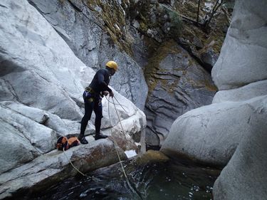
Middle gorge section: Continue boulder hopping upstream past this waterfall. I think progress is easier if you stay to the right. Go all the way until you see the last, gorgeous pool, of this section. Up to the left you can find a small trail that follows the base of the cliff. After climbing a ways, the route makes a fairly obvious turn up to the right, and begins a section of exposed class III climbing. Some solid trees in here help. An easy slab traverse off the top of this scramble brings you to the continuation of the small faint path, and around the ridge to the downstream side of the cable tyrolean traverse. You can rappel in here.
Accessing the upper section:
A switchbacking road that heads North of 70 at Rock Creek provides access to the canyon. It can be driven if you would like to shuttle, but hiking it is not a problem either as long as you start earlier as it is well in the sun. The road is very narrow, steep, and sandy with sharp switchbacks. We made it halfway up in my outback, but probably could have made it 95% of the way to the upper section if we were motivated. A small 4WD pickup would have no problems until the final switchback which has big ruts. A larger truck might be too big to squeeze up the road. There is parking at most of the switchbacks.
Upper Upper section: Pass the green gate and follow the road as it cuts off east, then does a whole bunch more switchbacks up over 2000 ft total. The final switchback is very rutted and you might want to park before. You'll get to the top at a sort of pass. Drop down the other side of the pass and stay to the right side of this drainage to get below some fairly thick manzanita staying in the pines. Before the drainage drops off steeply, cut off to the right to get on top of the ridge. We found a nice game trail that took us to a gully that drops straight north into the canyon. This gully kind of sucks, but seems like the best way down. Overall the route is not bad.
Descent[edit]
Upper section:
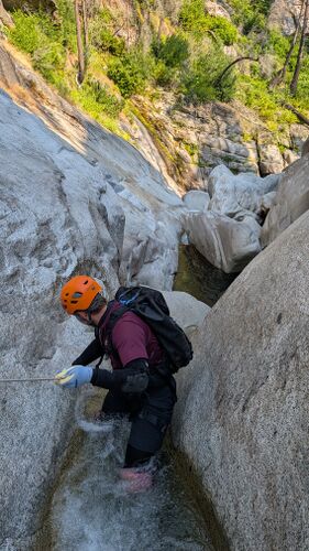
Where you hit the creek you can boulder hop on dry land down to a nice bed rock canyon where you will suit up. Soon after is a narrow slot which can be downclimbed with some high stemming, and would cause some problems with higher flow. Below here is a section with a large slab on the left and boulders on the right. Climbing down the left is easy, but the creek cutting to the right would be awesome to explore. More of the same continues, choosing between staying high and climbing through boulders down to the middle gorge. We only found one rappel necessary in this section.
Middle gorge: Walls head up and the boulders get bigger through here. You can climb down into a right crack where a slab slid off to the left, and the water finds a sieve to drop through the middle of. Scrambling around out of this crack will take you to the top of a cable tyrolean traverse, which can be used to bypass high flows. We rappelled off of here, down two stages.
A cascading falls into a pothole past here can be rappelled or bypassed then jumped on the left. If flows are high, you can follow a ledge to the left, and rappel down off a tree to the pool at the base of the gorge. But more fun, is to jump the next small drop, then the next exciting rappel here bolted off a boulder in the center. You can rappel two stages, bringing you down to the large ending pool at the bottom.
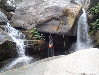
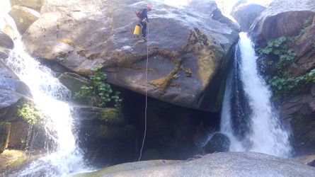
The canyon opens up downstream a bit, and the 120 foot falls follows, rappelled off the middle of a large boulder off of 3 bolts, followed by some beautiful pools, a fun slide, and the trail exiting left.
Lower section: Boulder hopping and a couple jumps.
Exit[edit]
You'll come out right near the railroad bridge at the bottom.
