Rock Creek (Indie, South Cascades)
| Rating: | |||||||||||||||||||||||||||||||
|---|---|---|---|---|---|---|---|---|---|---|---|---|---|---|---|---|---|---|---|---|---|---|---|---|---|---|---|---|---|---|---|
| | Raps:3-5, max ↨150ft
Red Tape:No permit required Shuttle:Optional 1mi Vehicle:Passenger | ||||||||||||||||||||||||||||||
| Start: | |||||||||||||||||||||||||||||||
| Parking: | |||||||||||||||||||||||||||||||
| Shuttle: | |||||||||||||||||||||||||||||||
| Condition Reports: | 16 Jun 2019
"First descent of Indie-Rock. Would be more fun with more water - probably would be more enjoyable earlier in the season - although Rock Creek will als |
||||||||||||||||||||||||||||||
| Best season: | Spring
|
||||||||||||||||||||||||||||||
| Regions: | |||||||||||||||||||||||||||||||
Introduction[edit]
Indie-Rock is a minor tributary of the more well-known Rock Creek. It enters downstream of Rock Creek's technical section. It runs low most of the year, so might be a good outing early in the season or for beginners. Don't bother with this one in mid-summer. The upper creek is a bit overgrown, but it soon subsides in a series of long chunky bedrock ramps that can, mostly, be downclimbed. These are mixed with occasional debris piles to climb over. There's a long hike out along Rock Creek making this one a high pay-to-play.
Directions[edit]
On driving up the hill watch for the place where the PCT crosses. This is the exit. The parking area is 100ft further up the road; a large pullout on the left. Road is rocky in places, but okay for 2WD if driven slowly.
- The best place to check flow is the bridge you cross just before driving up to the lower parking area.
- A Washington State Discovery Pass is NOT required to park here.
- This is also the trailhead for the Upper North Fork of Rock Creek.
Approach[edit]
There are two choices on the approach:
1) If hiking, continue up the road about 0.5mi and, just past a bend in the road, look for the Snag Creek trailhead on the right. (USGS maps do not show the correct location of the trail.) The lower part of the trail is a bit overgrown and was a little tricky to follow as of 2025. It basically heads northeast along the edge of the clearcut and then is easier to find when it enters the forest just above Snag Creek. The trail then follows the ridge northwest.
2) Alternatively, shuttle ~1mi up the road to a turnaround in an old clearcut, and bushwhack your way uphill about 0.1mi (+150ft elevation) to meet the trail.
The trail switchbacks up onto the plateau, gaining about 600ft, before flattening out and becoming easy hiking. Pass a large signboard where you pass from DNR land to National Forest. Small wooden posts also mark the mileage. On crossing an obvious drainage, head downstream into Indie-Rock.
Descent[edit]
- Downclimb 15ft.
- First long low-angle bedrock ramp. Downclimb or rappel.
- Second even longer low-angle bedrock ramp. Downclimb.
- Short 6ft "bobsled" slide. Might want a rope in high water.
- R1: 25ft. Anchored on a tree well back from the top. Slightly overhung at the bottom.
- "Waterslide Alley". Very long bedrock ramp with multiple short drops. Downclimb or rappel. Going for a tumble would be bad. Goes on and on.
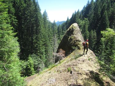
- R2: 50ft, but uses perhaps 150ft of rope (single strand) given where the anchor is located: high up on a tree atop the ridge DCR to run the flow direct. This allowed for a fun rappel and nice clean pull of the rope afterwards. There is an interesting pinnacle just above the falls.
- R3: 50ft. The water spreads out over the lip of the falls meaning there is a lot of plant life making for a thrashy rappel. Far left might have a better line. Land on a ledge near the bottom and thrash down the rest of the way DCR.
Exit[edit]
Note that water levels will quadruple or more entering Classic Rock.
Below the last falls it's ~1.8mi downstream to the PCT footbridge. It goes relatively quickly, however, as there's lots of gravel bars and bedrock to hike on. There's almost always an easy way forward. Throw in a couple of short narrows, boulder gardens, and logjam obstacles to keep you busy. Cool off in pools as needed. You will pass Post Rock on the way out.
There are two features that signal you're nearing the end:
- Big logjam: Bear DCR initially, following the water, then climb up/over/through the logs bearing back DCL.
- Blue-green cliff: It's located on the left just past the big logjam.
Exit the bridge DCL and follow the PCT southwest. There's a short climb out of the drainage, then the route is mostly flat thereafter. Follow the trail about 0.5mi back to your car, going straight at the junction with the Snag Creek trail.
Red tape[edit]
None.
Beta sites[edit]
Trip reports and media[edit]
Background[edit]
Kevin Clark and Keith Langenwalter first descended Indie-Rock in 2019.
