Rock Creek (Upper North Fork, South Cascades)
| Rating: | |||||||||||||||||||||||||||||||
|---|---|---|---|---|---|---|---|---|---|---|---|---|---|---|---|---|---|---|---|---|---|---|---|---|---|---|---|---|---|---|---|
| | Raps:4-7, max ↨50ft
Red Tape:No permit required Shuttle:None Vehicle:Passenger | ||||||||||||||||||||||||||||||
| Location: | |||||||||||||||||||||||||||||||
| Condition Reports: | 23 Jan 2021
"Flow was surprisingly low for mid-winter, but much fun was had. N.F. Rock seems to be a good one in the early season with a nice south facing drainag |
||||||||||||||||||||||||||||||
| Best season: | Dec-Apr
|
||||||||||||||||||||||||||||||
| Regions: | |||||||||||||||||||||||||||||||
Introduction[edit]
The upper northern fork of the more famous Rock Creek. This fork drains the southern slopes of Mowich Butte. With a smaller watershed, this fork sports lower flow and is open for business much earlier in the season; you can often run it far earlier than other creeks in the vicinity. It may not be worth your time after April or so.
The Upper North Fork of Rock Creek sports three tributaries which all have waterfalls. The best bit, however, is the main line below the confluence. These falls are often visited by waterfall photographers, so please use natural-colored webbing (or black) for anchors.
- Watershed: 0.9mi^2.
Approach[edit]
Google Terrain maps shows the "Sunset-Hemlock Rd" (FR 41) running along the ridgecrest - but this road has been closed and pretty much obliterated by Washington State DNR. Getting a car in there is not possible, making the PCT the only viable approach to this creek.
Directions[edit]
From the Bridge of the Gods, turn right on Hwy 14 and continue 1.5mi east to turn off left/north towards Skamania Lodge on Rock Creek Dr. Turn left again in 0.3mi onto SW Foster Creek Rd. Continue 0.4mi and continue straight onto SW Ryan Allen Rd for another 0.5mi before turning left again onto Red Bluff Rd (becomes gravel). Follow Red Bluff Rd for 5.7mi to a bridge across Rock Creek. (Steep Creek Falls is just upstream / left of the bridge.) Continue west on Red Bluff Rd for 1.5mi to a junction where the main road swings left to cross a bridge over Rock Creek. Continue up the main road for another 0.8mi and turn right at an unsigned junction (Jct 1380). Follow this unnamed road for 0.5mi. On heading up the hill, watch for the crossing of the PCT and continue 200ft to a large pullout with room for several vehicles on the left. Roads are rocky but 2WD okay if driven carefully.
Hike In[edit]
Follow the PCT north about 1.75mi. At this point, the trail crosses the western tributary just above R3. Continue on up the switchbacks another 0.25mi and enter the western tributary higher up.
Descent[edit]
West Tributary[edit]
Leave the PCT at a switchback at ~2350' elevation. Head west and drop down into the tributary (2min). This tributary seems to sport pretty low water.
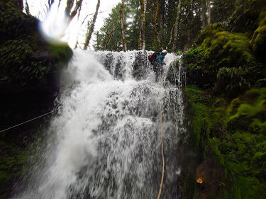
- R1: 50ft. Two stage. Beware pendulum swing potential.
- R2: 12ft drop into mini-narrows. Pass through 20ft long corridor to another 20ft falls. Anchor on tree DCL, need 100ft of rope SRT per the horizontal distance.
Head down a moderately overgrown stream about 2min to reach the PCT. R3 is immediately below the trail.
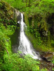
- R3: 25ft.
Head downstream wherever is easiest to reach the main fork, and head downstream.
Upper North Fork[edit]
- R4: 25ft. Can be bypassed DCR.
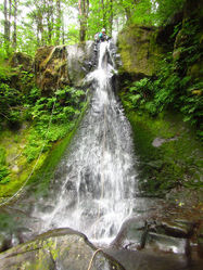
- R5: 30ft photogenic falls.
About 5-10min downstream, encounter a low-angle ramp into a chest-deep pool. Easily downclimbed.
- R6: 20ft. Possible swimmer in high water.
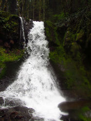
- R7: 35ft. Watch for sharp edges on the lip.
Exit[edit]
Continue downstream ~5min to the confluence with the Lower North Fork. Just before the confluence, watch for a game trail DCR that's an easy means of access up onto a spur ridge west of the creek. Atop the ridge, go directly up to reach the PCT. Once back on the trail, hike south ~1mi back to the trailhead.
Red tape[edit]
None.
Beta sites[edit]
Trip reports and media[edit]
Background[edit]
Creek was first descended by Kevin Clark and Kaitlin Rupert in July 2016.
The center and eastern tributaries on the Upper North Fork have been explored. Both of these options are probably not worth your time, however.


