Salmon River (Cascade Mountains)
| Rating: | |||||||||||||||||||||||||||||||
|---|---|---|---|---|---|---|---|---|---|---|---|---|---|---|---|---|---|---|---|---|---|---|---|---|---|---|---|---|---|---|---|
| | Raps:3-4, max ↨90ft
Red Tape:No permit required Shuttle:None Vehicle:Passenger | ||||||||||||||||||||||||||||||
| Start: | |||||||||||||||||||||||||||||||
| Parking: | |||||||||||||||||||||||||||||||
| Condition Reports: | 23 Aug 2025
"I was on Kevin’s crew but wanted to share my own review, as my experience and perspective were a bit different.. We started hiking at 6:30 a.m. ba |
||||||||||||||||||||||||||||||
| Best season: | Aug-Sept
|
||||||||||||||||||||||||||||||
| Regions: | |||||||||||||||||||||||||||||||
Introduction[edit]
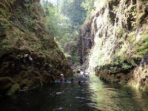
A beautiful river canyon located in the Salmon-Huckleberry Wilderness in the northern Oregon Cascades. The headwaters drain the southern slopes of Mt. Hood. While a popular kayak run in the early season, later in the summer the flow subsides and becomes a worthy canyon destination. While not a super technical canyon, teams should have their swiftwater game on. Even in late summer, the current can quickly become strong in the narrow parts of the canyon, or when passing between obstacles. Expect a lot of water, making this a more advanced canyon destination than many others in the region. A great creek to run on a 100F degree day in town.
- Be aware: the Salmon River trailhead is renowned for car break-ins. Do not leave anything valuable (or anything that looks like it might be valuable) visible inside your vehicle. Another safer option might be parking 0.5mi away at the campground.
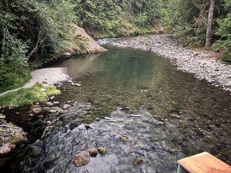
- The trailhead is popular in the summer as there are many backpacking campsites in the first two miles. Locals often come to play in the pools near the bridge.
Water Flow[edit]
The closest, live USGS river gauge appears to be Sandy River near Marmot, OR.
- Adequate thermal protection and flotation is essential. Floating the river is great fun, but proper defensive swimming technique should be employed to reduce the risk of foot entrapment. Swiftwater training is strongly recommended. This is a canyon river gorge.
- Prior to entering any hydraulics, always have a person ready with a throw rope, and be sure there are no obstructions blocking the exit. Expect to be tossed and turned in some of them. In late summer, the hydraulic threat reduces considerably and they may even disappear entirely. Those at the bottom of the waterfalls are easily avoided.
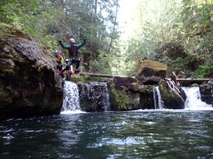
- The Salmon River offers many opportunities for jumping. Be aware: jumping is a leading cause of canyon injury (broken ankles and legs). Always send someone down first to check the depth and look for submerged obstacles. There's been at least one jump-related accident from the bottom of the canyon. A rescue would be extremely difficult, so don't go there.
- The best flow checkpoint is from the bridge at the parking area.
Approach[edit]
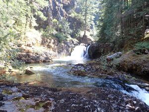
Follow the Salmon River Trail for about 4.3mi. Just before the final approach to Goat Creek, watch carefully for an obvious user trail (unsigned) dropping down the slopes to your right. Follow this winding trail downward (~0.1mi) to a campsite right at the Goat-Salmon confluence. This makes a great spot to suit up. The fun begins immediately downstream.
Descent[edit]
There are a number of smaller downclimbs / boulder gardens / obstacles that not described in the beta. Usually these can be easily bypassed on one side or the other. There are numerous opportunities for floating, but use caution when nearing swiftwater features/hazards.
- Boulder garden splits the river into four short drops (~5ft). Step over onto the first large rock on DCR side and downclimb. Jumping looks feasible, but beware hidden boulders just under the surface.
- Little Niagara Falls - easy bypass by downclimbing a groove DCR.
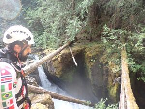
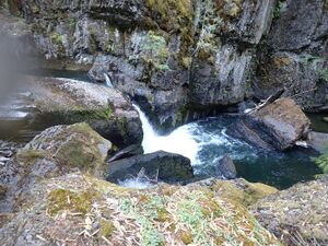
Not far ahead the river plunges into a watery chasm. This is Vanishing Falls, which might be the crux of the descent. In high water, this section could be quite dangerous. It is possible to follow game trails DCR to a large tree and rappel back in downstream of R2 (~80ft).
- R1 - Vanishing Falls - 40ft dry line into the watery chasm from log or tree DCR.
- R2. Perhaps 100 yards downstream is another short drop/rapid that the entire river is channeled through. When nearing the drop, exit the water on an ascending ramp DCR. Climb up to a dry rappel (30ft) fron a spindly tree to avoid the hazard.
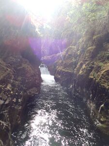
Just ahead, the canyon narrows and the current picks up speed for a short distance for a fun float.
- Wide Falls. Climb out on a narrow ledge DCR for a 15ft jump. The river here appears to be surging out of a cave-like space at the foot of the falls.
- 30ft unnamed falls. It's probably best to stay on the DCR side on the approach. Strong flow seems to be channeled DCL and there might be some risk of getting swept over if you get too close. There used to be a boulder cave bypass here, but it was plugged with woody debris in 2025. Climb up over the rocks DCR.
- R3 - Frustration Falls The river divides into multiple channels with numerous waterfalls plunging into a beautiful amphitheater below. There are several options depending on the flow:
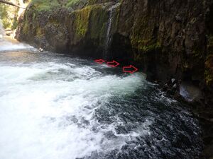
- A - Dry rappel from a tree DCR (~60ft) to a ledge and swim across the plunge pool. Beware potential recirculations, strong flow, and a cave-like undercut directly opposite the falls DCR which could be dangerous. The swim was not difficult for an experienced team in late August 2025. (Swimming behind the falls might be another option?)
- B - Rig a long traverse (??) from a single bolt along the natural channel on the far DCL side of the canyon. Follow the narrow waterway to a tree anchor and rappel back in downstream of the plunge pool.
- C - ??? We spotted an anchor on a tree on the far side of a gully from option A likely left by kayakers. This might be just another way down into the plunge pool. Unexplored.
- Penultimate Falls. Easy bypass via user trail DCR.
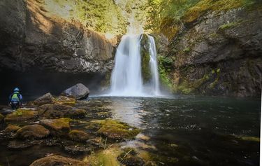
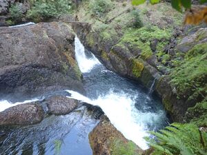
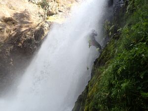
- R4: Final Falls. As featured in the banner photo above. Options:
- A - Rappel 90ft from tree DCL. This is a nice line that takes you right down a small chute adjacent to the main flow. Splashy fun in late summer.
- B - In 2025, a long fixed rope led to a small tree right that kayakers were using as an anchor. 80ft dry line into the pool at the bottom. Beware loose rock.
- A short distance downstream is one final narrow section. At the entrance is a short drop and potential recirculation which is easy to avoid.
Exit[edit]
The best exit is to continue downriver ~1.2mi. There's some boulder-hopping, but generally easy creek walking and many floating opportunities. This the best way out on a hot day. At about 1.2mi, look for a campsite just adjacent to the creek DCR for an easy climb up the bank.
Some alternate routes out would include:
- Exit 1: At 0.35mi downstream from Final Falls, ascend a dry gully ~650ft to the trail.
- Exit 2: At 0.7mi, bushwhack up forested slopes on rising traverse ~180ft to the trail.
Once back on the main trail, return the way you came to the trailhead.
Red tape[edit]
- A Northwest Forest Pass is required to park at the trailhead.
- This is a Wilderness area, so groups are limited to twelve. Use of power tools (ex: drills) are not permitted.
Beta sites[edit]
 CanyoneeringNorthwest.com (archive.org) : Salmon River Canyon
Trip reports and media[edit]
Background[edit]
First documented by Kevin Clark, Wade Hewitt, Thomas Costello, Brian Wellman, and Annalisha Cox in August 2025. Special thanks for Scott Brown and Carsten Jensen for the initial beta from their descent in 2018.
