Salome Canyon (Upper)
| Rating: | |||||||||||||||||||||||||||||||
|---|---|---|---|---|---|---|---|---|---|---|---|---|---|---|---|---|---|---|---|---|---|---|---|---|---|---|---|---|---|---|---|
| | Difficulty:3B V (v3a2 V) Raps:7+, max ↨60ft
Red Tape:No permit required Shuttle:None Vehicle:Passenger | ||||||||||||||||||||||||||||||
| Location: | |||||||||||||||||||||||||||||||
| Condition Reports: | 12 Apr 2023
"Tackled in one long, incredibly arduous day. The rock in the watercourse was unbelievably slick (particularly in Park) which slowed our progress consi |
||||||||||||||||||||||||||||||
| Best season: | Spring
|
||||||||||||||||||||||||||||||
| Regions: | |||||||||||||||||||||||||||||||
Introduction[edit]
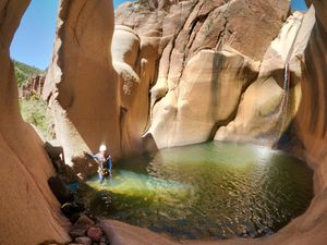
Park Creek + Upper Salome loop. 17 miles car-to-car. 5 mile approach, seemingly endless miles of boulder hopping, long swims, thick brush, a 4th / 5th class climb, and an arduous 6.5 mile exit - all for a comparatively short but beautiful section of granite narrows.
Among those who have suffered, most agree that this canyon is far more worthwhile and enjoyable as an overnight trip. Though the night is usually spent somewhere along Workman Creek, a bivy in the canyon could and has been done.
Approach[edit]
Drive 27 miles from the turn off on 288 to park at Reynolds TH and hike out to the main road then to the Circle Ranch camp site on FS 371. After 0.1mi you'll be at the back of the camp site and will pick up the McFadden Park trail #55 along a fence line. The trail is overgrown and relatively undefined in sections. After 1.2 miles cross old abandoned road with sigh for trail #55 and Park tank. From here the trail ascends 600 ft in about a mile through some switch backs. Once at the top of the rim the trail turns into a double track / 4x4 road. Easy walking to Park tank. Once you get to the tank turn West (left) along the North fence (far) side of the tank. Follow the faint road NW for about 0.75 mi till you find a convenient spot to drop into Park creek. Don't go too far or the road will rise above the creek and you'll have to bushwhack down steep into the creek bottom. After about 0.4 mi of hiking along the creek bed through ankle tiring rocks you make it to the first rappel in Park creek.
Note: the rock in the watercourse of Park Creek is likely some of slickest you will encounter in your canyoning career. Be prepared for this to slow your progress significantly.
Descent[edit]
R1 - 40' from a tree canyon left.
Rap 2 is about 400 feet down canyon from rap 1.
R2 - 40' from tree canyon left (if you were to rig in the watercourse it would be a nice undercut free hang into a pool).
Boulder hop and bushwack through the creek bed for 0.8 miles to rap 3.
R3 - 45' from a small tree in the watercourse.
Hike 0.3 miles to a pour-off 20' down climb.
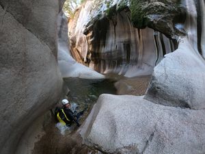
More boulder hopping and creek hiking brings you to a narrow section of basalt. You will eventually have to get wet. Then after 300' another down climb.
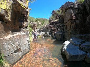
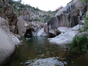
Hike 0.5 miles to a nice section of Pink Granite with pools. If you have not already, wetsuit up here and hike another 0.3 miles to a swimming section then a short distance to rap 4.
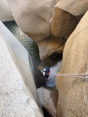
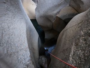
R4 - 60' from piton into arch pool. Beautiful.
R5 - 50' from rock pinch at other side of pool. Descends into Salome.
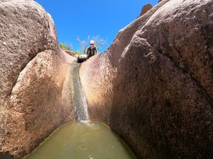
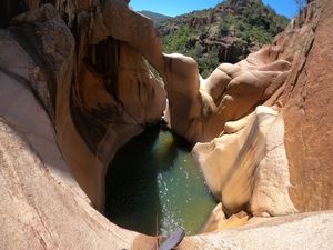
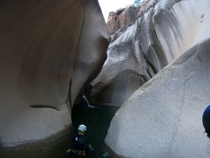
Turn South (left) and follow Salome Creek downstream for an obnoxious 1.3 miles to a nice granite narrows. A few hundred more feet takes you to a fun downclimb / slide into the massive grotto pool.
R6 - no established anchor, loop a giant knob of rock and simul-rap. One person goes down the watercourse and the other drops canyon left into a fissure (alternatively, send team down via meat anchor and last person can jump or rappel using large knob + someone below as a counterweight).
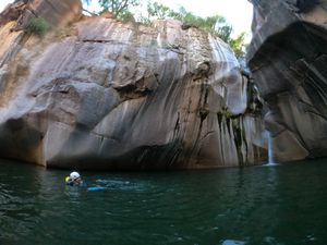
A long swim under a huge boulder is followed by another downclimb and the next rappel.
R7 - 50' from rock pinch into a deep pool.
Just after this rappel is a jump from a chockstone or another short rappel into a deep pool.
The final obstacle can be downclimbed / slid (about 30') in dry or low water conditions. In C conditions this drop should be rappelled.
200' feet further downstream Workman Creek enters canyon left. Mind the poison ivy by this confluence.
Exit[edit]
From the intersection of Salome and Workman Ceek, progress up Workman, swimming and completing short upclimbs for about 0.3 mi.
Note: if Workman is flowing high, these small climbs and swims will be much more challenging.
You will reach a pretty waterfall and must bypass it. A short ways downstream from the falls on canyon right is an up-climb on somewhat of a nose. Big first step and some loose dirt past a prickly pear. Low 5th grade for about 40 feet. There is a faint use trail at the top. To reach it, pick any point that you think you can ascend. They are all difficult, dangerous and full of cactus. It is recommended that a leader free climb it, then rig an anchor, and rappel back down, to ascend with packs and less confident members. Alternatively, backtracking even further, a somewhat dirty but manageable (and also cacti-infested) 4th class route can be found on canyon left.
Beyond the waterfall about 0.2 miles, pick up a use trail on canyon left. This trail is a huge time saver. It's faint in places but saves you from boulder hopping the whole way. Follow this trail 0.6 mi to the Hells Hole Trail camp sites. From the camp sites the trail turns into the official Hells Hole trail and ascends / switch-backs up 1000 ft to the intersection of Boyer Cabin trail #148 and Hells Hole Trail #284. Stay on #284 heading East. After about 1.0 mile the trail will ascend 500 more feet to a saddle then down the last mile back to Reynolds TH. From Workman Creek to Reynolds TH is a total of about 5.3 miles.
Red tape[edit]
Beta sites[edit]
 Stav is Lost : Upper Salome Creek (The Grotto) (April 19,2022)
 Super Amazing Map : Salome Canyon (Upper)
 CanyonChronicles.com : Salome Creek (Upper)
 HikeArizona.com : Salome Creek - Upper Loop
 Arizona Technical Canyoneering Book by Todd Martin : Upper Salome Canyon
 OnRopeCanyoneering.com : Upper Salome Creek (Grotto Pool) Canyon
Trip reports and media[edit]
- https://www.facebook.com/pat.winstanley.7/media_set?set=a.583454438379924.1073741859.100001461198708&type=3
 Candition.com : Salome Canyon
 Candition.com : Upper Salome Canyon (Grotto Pool)
