Satsop River Gorge (West Fork)
| Rating: | |||||||||||||||||||||||||||||||
|---|---|---|---|---|---|---|---|---|---|---|---|---|---|---|---|---|---|---|---|---|---|---|---|---|---|---|---|---|---|---|---|
| | Raps:0
Red Tape:No permit required Shuttle:Optional 0.5mi Vehicle:Passenger | ||||||||||||||||||||||||||||||
| Start: | |||||||||||||||||||||||||||||||
| Parking: | |||||||||||||||||||||||||||||||
| Shuttle: | |||||||||||||||||||||||||||||||
| Condition Reports: | |||||||||||||||||||||||||||||||
| Best season: | Jul-Sept
|
||||||||||||||||||||||||||||||
| Regions: | |||||||||||||||||||||||||||||||
Introduction[edit]
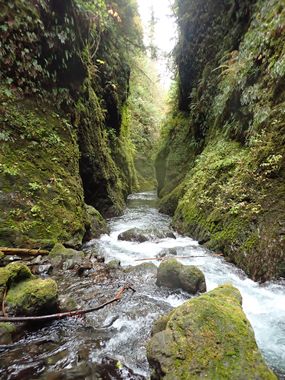
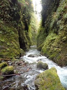
A stunningly beautiful river canyon. Be aware: entering the Gorge in high water could be dangerous. This destination is likely best visited on a hot day in late summer.
- A wetsuit is recommended. Have your flotation dialed.
- Satsop River Gorge is easily combined with other destinations in the Wynoochee Valley. It's possible to visit 2-3 of them in a single day.
- While this is listed as a non-technical creek, for the first descent in a given year, it may be wise to bring a short rope and harness. Logs washed downstream can get jammed in constrictions. More debris fills in behind them to create a natural dam. Sometimes, they can get quite large. Technical gear provides options should you need them.
Approach[edit]
From Wynoochee River Road, turn off east on FR 23. Follow FR 23, bearing right at two junctions for about 2.5mi to a bridge spanning the West Fork Satsop River on a high bridge. Just ahead on the far side is a large pullout for a trailhead for Spoon Creek Falls (marked with a post). Park here.
Hike (or shuttle) back up FR 23 the way you came for about 0.5mi. Watch carefully on the right for a user trail leading down to a large fallen cedar tree that someone's been cutting up. Follow the trail downward until it becomes faint and keep going (easy bushwhacking) until you can easily drop into the river. Head downstream.
- A wetsuit is recommended. Water can be cold even in late summer. Have your flotation dialed.
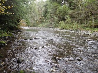
- Checkpoint: It's hard to get a real sense of flow from the bridge. A better checkpoint is the creek just before entering the river gorge.
Descent[edit]
Soon the river narrows up and plunge into the gorge. The scenery is outstanding. Note the vegetation line on the canyon walls to get an idea what high flows are like through here. Use caution in making your way past several short drops / rapids. One particularly narrow channel is easily bypassed DCR. In some sections, you can hop out in the current and float along while admiring the scenery.
Eventually the bridge comes into view, high overhead. Continue downstream a short distance until the narrows end and Spoon Creek enters from DCL.
Exit[edit]
At the confluence with Spoon Creek, look left for an excellent user trail that winds its way back up to the trailhead. There are two junctions. Go straight at the first, left at the second.
Red tape[edit]
None.
Beta sites[edit]
 CanyoneeringNorthwest.com (archive.org) : West Fork Satsop River Gorge
Trip reports and media[edit]
Background[edit]
Further Adventures[edit]
The Satsop River Gorge could easily be combined with a rappel of Spoon Creek Falls. Just past the parking area is a small campsite and it'd be easy to drop into Spoon Creek just above the big falls. Looks to be another short drop and hanging pool right above the big falls. This option is unexplored.


