Sentinel Falls
| Rating: | |||||||||||||||||||||||||||||||
|---|---|---|---|---|---|---|---|---|---|---|---|---|---|---|---|---|---|---|---|---|---|---|---|---|---|---|---|---|---|---|---|
| | Difficulty:4B IV R (v5a2 IV) Raps:12-14, max ↨530ft
Red Tape:No permit required Shuttle:Optional 1.5 hr Vehicle:Passenger Rock type:Granite | ||||||||||||||||||||||||||||||
| Location: | |||||||||||||||||||||||||||||||
| Condition Reports: | 10 Aug 2024
"All anchors looked like they hadnt been replaced since 2019. We replaced the first two bolted anchors and fiddlesticked the rest. At R14 we found no |
||||||||||||||||||||||||||||||
| Best season: | June-September
|
||||||||||||||||||||||||||||||
| Regions: | |||||||||||||||||||||||||||||||
Introduction[edit]
Sentinel Falls is an easily accessible canyon that drains from the west side of Sentinel Rock to the floor of Yosemite Valley. Being that it does not drain a significant area, it is not polished in the way that is characteristic of many other canyons in the Sierras. As a result, in a normal snow year it has the potential to be runnable earlier in the season than other Yosemite canyons such as Middle Earth. Conversely, there are a number of rope pull hazards throughout the canyon as well as talus fields that must be downclimbed. All in all, this is a very fun, technical, and challenging canyon that has many great rappels, including the fantastic 530' foot drop from the main fall that ends the canyon.
Flow
Due to the massive lengths of these drops (mainly the last one), it is discouraged to do this canyon in high or possibly even moderate flow. In addition to the height of the drops, high and moderate flows can possibly put some of the anchor stations in the flow, reducing the amount of purchase on leges with anchors. It is recommended to check the CFS of the Merced river "11266500 MERCED R A POHONO BRIDGE NR YOSEMITE CA" This gauge read 190 CFS when it was done by our group and we collectively concluded that the flow at this level posed no significant safety issue in and of itself for a moderate or experienced canyoneer.
Approach[edit]
Shuttle
Although it would be possible to do this without a shuttle by hiking up 4 Mile Trail, the ideal way to do this is to drop a car in the valley at the 4 mile trailhead near 37°44'1.88"N, 119°36'6.66"W then drive to the the Sentinel Dome trailhead at 37°42'44.56"N, 119°35'11.20"W. From there it is an easy 1.5 mile hike from the trailhead to the drop in point at 37°43'20.72"N, 119°35'36.53"W. Keep left at the fork just off the roadway to take the Taft Point trail.
Dropping in
When dropping in, please be aware that this is a very popular area for hikers. Several were in the area and observed us when we began the canyon. It is strongly recommended to use a retrievable anchor as to not encourage anyone to enter the watercourse.
Descent[edit]
As this canyon is completed relatively infrequently all parties should be equipped to build, rebuild and evaluate a variety of anchors. At least one party arrived at the ultimate rappel to find that the rock which previously contained the bolts was completely missing (they were thankfully equipped with a hand bolting kit, quick links, plenty of webbing, etc). The understanding and use of ghosting techniques is highly recommended; R1 should likely be ghosted to not present an attractive nuisance for hikers.
Rappels in the upper part of the canyon possess a great threat of sticking a rope, in particular R1-R4. This is where the canyon is at its most narrow point, and although many rappels are on slabs, there are boulders, cracks, horns, and other obstacles of which to be mindful. Historically a group has stuck a rope in a crack on R3 and had to cut it; rappels throughout the canyon require attention as there are rope eating cracks and you are often tempted to combine multiple stages to avoid building anchors for extra nuisance rappels.
This canyon is often a good candidate for ghosting techniques throughout the canyon if run in normal flows; this will help in many cases with rope pull.
R1 - 100’. There are a number of trees that can be used as an anchor. It is very important to ghost this drop as to not encourage hikers in the area to enter the watercourse. The rappel is down a 45 degree slab and will end in a hallway canyon right. Be sure not to rappel past the R2 anchor, as this can easily lead to sticking a rope at the hallway.
R2 - 100’ - There is a chockstone in the bottom of the hallway that is about 4’ under where you get off rope. The anchor we used is here. The canyon continues a 45 degree slope and stair steps down polished rock. There are potential obstacles here for a rope to get stuck during a pull. In low flow, this may be downclimbable DCL for a moderately experienced canyoneer.
R3 - 240’ (approximate) - Anchor is a bolt and a nut canyon left. If flow is present, you will get wet on this one as well as the next. This is the first vertical rappel of the canyon and ends at a small ledge. The first descent party stuck a rope in a crack on this drop and were unable to retrieve it. Note: this rappel is appreciably longer than 200' and requires a longer rope if completion in one pitch is desired. Alternately, rappel approximately 170' to an intermediate ledge and rig R3(b) - 70' (approximate) from a webbing anchor canyon left of a small pothole, then continue to the R4 anchors.
R4 - 130’ (approximate) Anchor is in a hallway canyon left. A large boulder slung in webbing adjacent to a pair of old angle pitons. You will continue down the same wall of the previous rappel. Anchor station is likely to be under flow in moderate or high water. Be sure to lay the rope over top of the flake at the start of this rappel; a crack where it meets the ledge below is more than capable of sticking your rope. Note: as of September 2019 the length of this rappel is an estimate; future groups could measure and refine it.
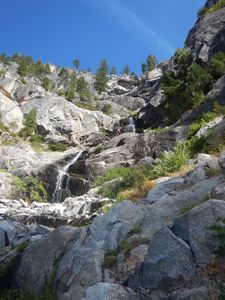
At this point there is a steep talus field that must be downclimbed. It’s recommended to go canyon left. It may also be possible to escape the canyon here by climbing a low-angle gully canyon left.
R5 - 70’ down 45 degree angle. Pinch anchor in center of canyon
R6 - 200' This is one of the best rappels of the canyon. Beautiful polished rock of the watercourse gives way to a nice overhung rappel. You will get wet on this one. Anchor around a tree canyon left.
This roughly begins a point in the canyon where there is a system of cascading ledges or boulders. Many rappel options are less than 100’. Some of these are nuisance rappels and some can be downclimbed. Use good judgement when choosing to downclimb; the rock is often slicker than expected and boulders are likely to shift due to low foot traffic.
R7 - 20’ down a ledge at the bottom of the previous fall, anchored off a rock chock. Optionally, additional 50' to a lower ledge, but this potentially places the rope across sharp rock edges. A redirect at the 20' level may help avoid sharp edges.
The next section is extremely approximate. Many of these anchors are gone or not as described. Be prepared to build and evaluate your own anchors to complete this canyon safely.
R8 - 50’ - Pinch anchor canyon right on top of a boulder
R9 - 70’ from a cairn anchor on a ledge.
R10 - 50’. Recommend rappelling, but advanced down climb can be done canyon right by traversing a thin ledge. Use caution if attempting this.
R11 - 70’ down a ledge
R12 - 70’ down a ledge. Can be bypassed canyon right. Loose rock on descent.
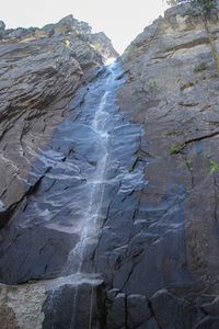
R13 - 230' to a ledge. Anchor is two bolts on canyon left. This is the top of the main fall of Sentinel Creek and is broken up in 2 uneven stages. In regular flow you will get wet on both of these drops. Unlike R3, no intermediate anchor is readily available.
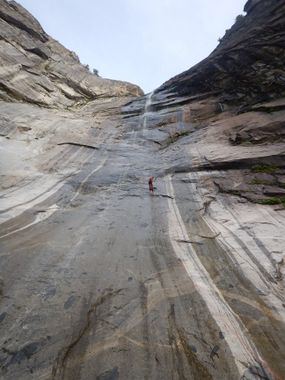
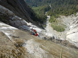
R14 - 530’ This is the main drop, and is the crown jewel of the canyon. Historically this was a two bolt anchor off a rock face that sheared away between 2019 and 2024. As of 2024 the anchor is now a bolt and redundant knot chocks canyon left on an adequate ledge. In moderate or high flow the anchor station may be in the watercourse leaving little purchase for safety on the ledge and increasing the fall hazard. On this rappel the rock is beautiful and polished all the way down and gives way to a smooth apron for the last 150’ or so. The upper and mid section of the drop is very slick with algae and moss. While this rappel is generally not overhung you will be on rope for quite a while for this drop so you may want to consider hanging your pack.
Exit[edit]
Exit is a steep hike downhill. You will want to favor the wall canyon right until you get to the trees. Once in the trees, continue hiking downhill until you join with the 4 mile trail.
Red tape[edit]
BOLTING: Bolting in Yosemite National Park must be done by hand only.
CAMPING: Campsites in Yosemite Valley are notoriously hard to get. Plan far in advance and attempt to acquire a site early. Traffic on the valley floor in the afternoon can come to a stand still and add 2 or more hours to exit the park.
Desperate folks may apply the day before for the Camp IV lottery. This was done by the Park Service to avoid the long lines the morning of. https://www.nps.gov/yose/planyourvisit/camp4.htm
FOOD STORAGE: The canyon exits near Four Mile Trailhead and Sentinel Falls picnic area. There are no bear boxes here. Plan on stashing your food early at another location. It is illegal to leave food, beverages, deodorant, tooth paste, sunscreen, and other products in your car. Leave your name and a date on products left in bear boxes. Rangers have been known to clear out items that look discarded.
There are Bear Boxes located in El Cap Meadow at the bridge (37.723773, -119.630701) and Curry Village next to the RV parking (37.738943, -119.570154). Plan ahead or get a hefty federal fine. (The park has its own jail and court house).
The Sentinel Falls picnic area closes at dusk so avoid parking in there.
SPEED TRAP: Law Enforcement eagerly awaits your presence as you enter the main valley floor. As you come to the Chapel the speed drops down and they routinely nail speeders. Slow down and enjoy the mass droves piled off on the sides of the road.
Beta sites[edit]
Trip reports and media[edit]
FIRST DESCENT EXPLORATION TRIP 8-3-19 LED BY JUSTIN PUGH, AND TEAM - TRIP REPORT AND PHOTO ALBUM:
https://www.facebook.com/scott.swaney/media_set?set=a.10157514056067930&type=3
Background[edit]
First descent was done on August 3rd 2019. It was lead by JPugh, with John Metzger, Scott Swaney, Randy Worth, and John Bowling.


