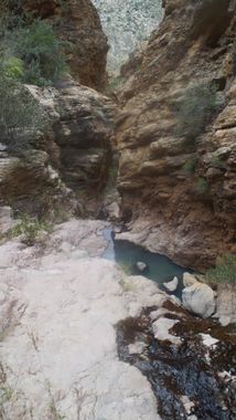
Shark Canyon
| Rating: | ||||
|---|---|---|---|---|
| | Difficulty:3A III (v3a1 III) Raps:1-2, max ↨30ft
Red Tape:No permit required Shuttle:None Vehicle:4WD | |||
| Location: | ||||
| Condition Reports: | ||||
| Best season: | ||||
| Regions: | ||||
Introduction[edit]
An OK little canyon with a long approach and one short rappel, Shark Canyon is a tributary of upper Fish Creek. There may be other, possibly better ways to approach Shark Canyon - we made the approach via Tortilla Trailhead (same as Minnow and Zig Zag Canyons) by hiking down the road to it's end and dropping into Fish Creek from there.
Approach[edit]
From where the road ends near an old windmill and some water tanks, pass through a fence to the east to make your way towards Fish Creek. The trail goes farther south than you need to so leave the trail soon after it begins and head east. There is a faint trail that leads down to Fish Creek here, but it isn't all that easy to pick up, so keep your eyes open. Once in Fish Creek, head north (left) and boulder hop your way up to Shark Canyon. The landscape is quite steep and crowned with cliffs in the area, so we decided to hike right up the canyon to see what we could find. After finding a rappel, we back tracked a short distance to find a way to scramble up above and around the drop, then hike along the slopes above the canyon until reentry was possible. There was some steep, not entirely solid rock to climb on the scramble up - class 4. We rappelled off of a tree to access the canyon, exploring up and down. The exact spots where we scrambled up and rappelled down would be impossible to describe with any accuracy, so I won't try. Suffice it to say it is an adventurous approach.
Descent[edit]
Some interesting sculpted rock, a few pools, some fun downclimbs and the one rappel of about 30 feet take you back to where you started.
Exit[edit]
Thankfully, the trail is much easier to follow on the exit, as it's beginning is marked with a large rock cairn.
Red tape[edit]
Beta sites[edit]
 Super Amazing Map : Shark Canyon
