Shotgun Creek
| Rating: | |||||||||||||||||||||||||||||||
|---|---|---|---|---|---|---|---|---|---|---|---|---|---|---|---|---|---|---|---|---|---|---|---|---|---|---|---|---|---|---|---|
| | Raps:3-4, max ↨140ft
Red Tape:No permit required Shuttle:None Vehicle:Passenger | ||||||||||||||||||||||||||||||
| Start: | |||||||||||||||||||||||||||||||
| Parking: | |||||||||||||||||||||||||||||||
| Condition Reports: | 25 May 2025
"Nice little creek, though as with other smaller creeks the creek walking borders on bushwhacking. The big drop was really nice, gives you a good showe |
||||||||||||||||||||||||||||||
| Best season: | Apr-June
|
||||||||||||||||||||||||||||||
| Regions: | |||||||||||||||||||||||||||||||
Introduction[edit]
A nice short canyon run along the Molalla River suitable for an after-work adventure. It could also be combined with others in the area. The area was lightly singed by the Labor Day fires of 2020, but is not nearly as bad as Pelkey Creek to the south.
- Checkpoint: Check the waterflow from the road or walk up to the last falls (R3).
- Watershed: 1.7mi^2.
Parking[edit]
From Molalla, take S Feyrer Park Rd east for ~2mi. Upon crossing the river, turn right on S Dickey Prairie Rd for ~5mi. Turn right and re-cross the river to the west side to enter the Molalla River Recreation Area. Turn left and follow the S Molalla Forest Rd for ~5mi to a large pullout with a restroom on the right.
Approach[edit]
Backtrack north along the Molalla River Road for 0.2mi and turn off left on an old road (now trail). Walk around the gate and continue upward for about 0.8mi. Bear left at all junctions. The location of the first rappel is obvious from the road. Suit up and drop in just above it.
Descent[edit]
- R1: 45ft. More rope may be required as the anchor (tree DCR) is set some distance back.
- R2: 15ft. Tree DCR.
Walk down the creek a ways.
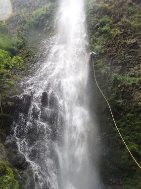
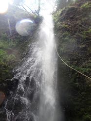
- R3: Shotgun Falls from tree high DCL. You'll need to exit the creek and climb up well before the falls due to a mass of fallen trees. About 140ft of rope is needed from the anchor. Use caution when throwing your rope as there may be people below. Beware loose rock near the top of the falls.
- Just downstream is a final short drop. This might be another rappel some day, but as of 2020 it's a mess of logs and woody debris. Bypass on user trail DCL instead.
Exit[edit]
From Shotgun Falls, follow the user trail DCL out to the road. (For extra bonus points you can wander through the culvert under the road). Follow the road back to your car (300ft).
Red tape[edit]
None.
Beta sites[edit]
Trip reports and media[edit]
Background[edit]
- There are a couple of other short waterfalls quite a bit further up the creek, but they may not be worth your time.


