Silver Creek Canyon
| Rating: | |||||||||||||||||||||||||||||||
|---|---|---|---|---|---|---|---|---|---|---|---|---|---|---|---|---|---|---|---|---|---|---|---|---|---|---|---|---|---|---|---|
| | Raps:2-3, max ↨40ft
Red Tape:No permit required Shuttle:None Vehicle:High Clearance | ||||||||||||||||||||||||||||||
| Location: | |||||||||||||||||||||||||||||||
| Condition Reports: | 5 Oct 2025
"A lovely day out. AW virtual gauge was at 0.11 cfs... up 10x from 2 weeks ago at 0.01 cfs and the experience was no different. All jumps were still in |
||||||||||||||||||||||||||||||
| Best season: | Jul-Oct
|
||||||||||||||||||||||||||||||
| Regions: | |||||||||||||||||||||||||||||||
Introduction[edit]
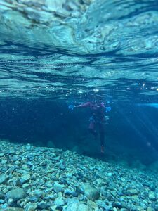
Silver Creek is a fun canyon close to Seattle. It is a swift water canyon so expect to spend a lot of time in cold water and make sure you can identify water hazards. The creek has a large drainage that is sensitive to rainfall, but the characteristics of the canyon and current anchor placement make it runnable in a range of flow conditions.
The trail parallels the creek, so the flow can be verified during the approach, including a peek into R2 which would potentially be a high danger spot in high flow. American Whitewater has a ![]() vitual gauge calculated using Skykomish river Flow. For flow above 40 cfs, belays may be helpful above some of the rappels.
vitual gauge calculated using Skykomish river Flow. For flow above 40 cfs, belays may be helpful above some of the rappels.
Approach[edit]
The Index-Galena road reopened in 2023. From the turnoff on Highway 2, navigate to: 47.891757168201245, -121.44180691123768 aka the concrete bridge called "S Bridge" and turn left to cross the bridge. Follow the road for .2 mile and take the right-hand fork in the road. Park shortly after if in a low clearance or large vehicle (the road is narrow and turn around space is very limited) and walk the road or continue along taking care to navigate several tricky spots until the the parking space where the "road" becomes a trail. Don't block the road as gold miners will frequent this area. Parking by the North Fork of the Skykomish adds about a mile to the approach.
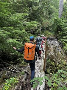
Follow the approach trail that parallels the creek. There are several landslides but these have been propped up or spanned with logs by locals or possibly other recreationalists (possibly kayakers or gold panners) to make the walk very pleasant. You will shortly come across a "zipline" spanning a major washout. This washout/creek is the exit. Take the trail to the right going downhill and use it to rejoin the path on the other side. There should be no sketchy moves to cross any of these washouts. Keep your eyes open for several old mines on your left.
Eventually you will take a trail on the right down into the canyon.
If making a full day of it, you can follow the full route and drop in just before Quartz creek comes in from the other side of the canyon for the scenic creek walk which is quite pleasant, or find the early drop in trail shortly after the large log bridge at 47.91997, -121.43926 which puts you in directly above R1. Both entrance options are easy drop ins with semi developed social trails and should not require any tricky downclimbing. If the terrain is difficult to navigate or you feel the need for a rope, you're in the wrong spot.
Descent[edit]
If doing the full route, walk down the creek for about a half mile. There are several small slides and jumps. Soon you will come across a short technical section.
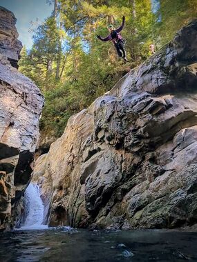
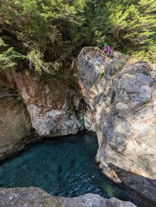
- R1: 40' dry rappel off of two bolts far up on canyon right, at the tree line. There are options for jumps off both sides of the canyon. Always check your depths
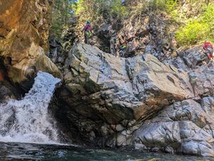
- R2: 15' off of chain linked bolts on canyon left. Anchor is set far back and will need 25-30' of rope to cover the horizontal. This can also be jumped with minimal difficulty from DCL. At 40 CFS, the rappel avoids the main flow. DCR side of pool has a slight undercut.
- R3: 20' off bolts DCL. This is a very easy jump into a large pool. The right side of the pool below is slightly undercut and should be avoided.
Downstream are two fun slides and couple small jumps. Exit DCR when a stream comes in at one of the landslides.
Exit[edit]
Scramble up the stream and follow the trail back to the cars.
Red tape[edit]
Beta sites[edit]
 CanyoneeringNorthwest.com (archive.org) : Silver Creek
 Super Amazing Map : Silver Creek Canyon
