Slollicum Creek (Upper)
| Rating: | |||||||||||||||||||||||||||||||
|---|---|---|---|---|---|---|---|---|---|---|---|---|---|---|---|---|---|---|---|---|---|---|---|---|---|---|---|---|---|---|---|
| | Raps:16-20, max ↨180ft
Red Tape:No permit required Shuttle:Required 2.7km Vehicle:High Clearance Rock type:Mixed, mostly slate | ||||||||||||||||||||||||||||||
| Location: | |||||||||||||||||||||||||||||||
| Shuttle: | |||||||||||||||||||||||||||||||
| Condition Reports: | 13 Sep 2025
"Slollicum did not disappoint!. Big airy rappels, and fun, high exposure multi pitch sequences.. Existing hardware in good condition. Team adde |
||||||||||||||||||||||||||||||
| Best season: | Aug-Oct, BEST Aug-Sep
|
||||||||||||||||||||||||||||||
| Regions: | |||||||||||||||||||||||||||||||
Introduction[edit]
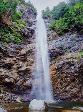
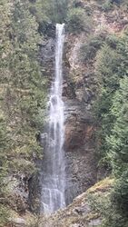
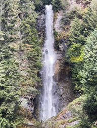
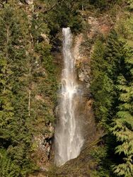
Nestled in the steep peaks towering high above Harrison Lake, Upper Slollicum Creek feels a world away from the boaters, kiteboarders, tubers and swimmers splashing leisurely in the waters below. The creek is special for its verticality, at one point dropping 400m in height across 480m of horizontal distance, and has massive waterfalls measuring 100m, 90m and 80m that have been pitched out with hanging rebelays. Special bonuses include breathtaking views of the blue-green waters of the lake and colorful red-white-tan-and-black striped shale interspersed with granite and quartzite. The creek faces west and the waterfalls create perfect circular rainbows in the spray on sunny afternoons.
The descent of Upper Slollicum is a fun technical challenge for small, well-trained teams who can efficiently manage hanging rebelays and the elevated risks and rigging/rope management challenges that come with them.
Approach[edit]
From Harrison Hot Springs, travel north on Rockwell Drive. After 5.2km, take the left fork onto Hicks Lake Road. After 1.2km, take the left fork onto Harrison East Forest Service Road. Continue for 6.6km to where the bridge crosses Slollicum Creek. Park your exit vehicle(s) here. Look upstream to check waterflow and admire the last big falls.
To reach the start of the hike, drive back the way you came for 1.7km and take a left onto the first logging road. Depending on closures due to foresting you have two options:
Regular Approach[edit]
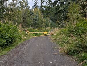
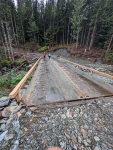
Follow the principle logging road for 4km, south initially, then east as it climbs, and eventually north. Park near a yellow barrier across the road ("Upper Trailhead"). Hike the remainder of the way on the road. Keep left at a Y-junction (~2.7km), and follow the road down to the creek and a large bridge which is the drop-in point. In total this approach is 3.5km, climbing 270m of elevation.
Closure Approach[edit]
Drive up the logging road for 0.2km and take a left at the fork; at the next junction stay right, at the 3rd junction take the left. In total it is 0.8km on this logging road until you reach the Slollicum Peak Trailhead. Park here. Hike the Slollicum Peak Trail for 0.7km until it re-joins the logging road, and continue per regular approach. The approach has 370m of elevation gain in 2.7km.
Descent[edit]
Slollicum Creek is primarily shale, which is beautiful but can be fragile. Solid assessment of the rock quality at each bolted anchor is recommended, especially for the first team each season or after heavy rains.
R1 – 6m from DCL tree, or downclimb.
Jump or Slide – 2m through the flow, followed by a 5m downclimb
R2 – 12m wet line from single bolt DCL, or dry from DCR trees.
Jump – 8m from DCC into a deep pool, landing past the whitewater to avoid an underwater ledge. R3 bolts are at the far side of the pool.
R3 – 15m from DCR unlinked bolts.
There is a fairly long creek walking section before the creek makes an obvious diving descent and you encounter breathtaking lake views from on high.
R4 – 20m from single bolt DCC . Warning: DCL has many sharp edges, and is a core-shot hazard - DCR lesser so.
R5 – 12m access rappel from DCL bolt, or downclimb, to access R6 anchor.
R6 – 40m from DCL from a choice of unlinked bolts. The first set of bolts (hidden on downstream side of boulder) can be used to avoid the majority of the flow. The second set of bolts, further DCL, allows you to stay more in the flow if you hook a horn near the top to keep your descent as far left as you can; the last person can still avoid most of the flow by leaning canyon right.
The next obstacle is a 2-stage down-climb. First steeply down DCR-to-DCL, then back DCR again. To bypass this there's a single bolt at the top DCR for a dry rappel.
Upper Slollicum Creek Falls (SCF)[edit]
R7 – 1st pitch Upper SCF – 35m from DCR unlinked bolts. Out of sight over the big lip and then a little further down to a 6" ledge to stand on, at the DCR edge of the flow. Whistle signals can be hard to hear here!
R8 – 2nd pitch Upper SCF – 55m from DCR unlinked bolts to the pool below.
R9 – 15m from DCL unlinked bolts, or downclimb.
R10 – 17m from giant log spanning the creek. .
R11 – 15m DCR from single floor-level bolt , or downclimb DCL in low flow.
Middle Slollicum Creek Falls (SCF)[edit]
R12 – 1st pitch Middle SCF – 22m from a single bolt set-back DCL , to a rebelay below the big ledge DCL (out of sight around the corner). There is a nice 2ft wide ledge to stand or sit on.
R13 – 2nd pitch Middle SCF – 35m from DCL chain-linked anchor.
R14 – 3rd pitch Middle SCF – 35m from DCC unlinked bolts on the lip of the big drop, between two streams of the flow.
Short boulder scramble to the next drop DCR.
R15 – 30m from singe DCR bolt .
Lower Slollicum Creek Falls (SCF)[edit]
R16a – traverse line: - 5m traverse line to access rappel anchors on the face.
R16b – 1st pitch Lower SCF: 25m from DCR unlinked bolts to a hanging rebelay visible on slab directly below. Watch out for loose rocks at your feet kicking down on those at the rebelay below.
R17 – 2nd pitch Lower SCF: 50m from DCR rebelay unlinked bolts to a deep pool below
Scramble and boulder-hop a short way trending DCR.
R18 – 20m rappel from DCL tree, well out of the flow. .
Exit[edit]
Exit the creek just before the bridge via a social trail DCR and scramble up to your vehicles.
Red tape[edit]
None.
Beta sites[edit]
Trip reports and media[edit]
Background[edit]
Upper Slollicum was first descended by Artem Bylinskii and Nic Gobin in September 2020. The canyon was equipped by Becca Polglase, Joe Cruikshank, Gretchen Mallari and Madeline Hwang in August 2022.
