Snoqualmie River (South Fork)
| Rating: | |||||||||||||||||||||||||||||||
|---|---|---|---|---|---|---|---|---|---|---|---|---|---|---|---|---|---|---|---|---|---|---|---|---|---|---|---|---|---|---|---|
| | Raps:4-5, max ↨100ft
Red Tape:No permit required Shuttle:Optional 15 min Vehicle:Passenger | ||||||||||||||||||||||||||||||
| Location: | |||||||||||||||||||||||||||||||
| Condition Reports: | 11 Aug 2025
"Low water made for a lot of slow creek walking. Many of the slides and jumos were very shallow and had to be done carefully or skipped. The last rappe |
||||||||||||||||||||||||||||||
| Best season: | July - Sep
|
||||||||||||||||||||||||||||||
| Regions: | |||||||||||||||||||||||||||||||
Introduction[edit]
One of the best waterparks in Washington. Water flow can be checked at the drop in parking area. If the middle rock at the top of the entry jump is covered in water, the flow is high or higher
Waterflow[edit]
The USGS stream gauge on the South Fork Snoqualmie River at Garcia ([1]) provides a good correlation of water levels in the canyon upstream.
Approach[edit]
Driving[edit]
- From Seattle (I-90 Eastbound), take Exit 52 West Summit. Turn left (north) to proceed under the highway and turn left (west) onto NF-58.
- From Ellensburg (I-90 Westbound), take Exit 53 East Summit. Turn left (west) on Yellowstone Trail Rd to go under I-90. Turn right (north) onto WA-906 and go about 0.7 miles, continuing on NF-9041. Turn left (west) on NF-58.
In a quarter mile, NF-58 passes under the westbound lanes of I-90. Very soon, you will arrive at a gravel pullout with a low rock wall on the right (north) side of the road. This is the parking area for the starting point of the canyon.
Shuttle[edit]
Continue west on NF-58 for 1.8 miles. At the fourth switchback, there is room to park on the side of the road. This location is very close to Denny Camp Falls. Park a car here for the shuttle. Alternatively, drive further on NF-58 to the Franklin Falls Trail 1036 trailhead parking area.
Hike[edit]
Fall in the Wall can be viewed from the low rock wall. Take a short social trail to reach the jumping point above the pool (DCL) at the base of Fall in the Wall.
Descent[edit]
Upper stage to Franklin Falls[edit]
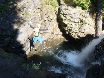
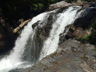
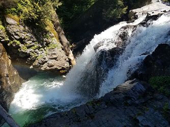
- Jump: Start with a 10' jump into the pool below "Fall in the Wall". The jump from the DCL rock platform can be reduced by down-climbing closer to the water's edge. The target is the deep pool just downstream from the whitewater at the bottom of the falls. The current will carry you downstream through the short narrow section between the rock platform and the opposite wall. Avoid jumping too far upstream or too far out as the recirculating current can carry you upstream toward the falls. (Photo).
- Continue walking/swimming downstream until an obvious narrowing in the water flow. There are multiple options to reach the pool below. Use the DCL rim to gain a vantage point of all the options.
- Slide: an 8' slide drops you 10' into the boil below. If the flow is medium-high or above you can be knocked into the DCR wall as you drop.
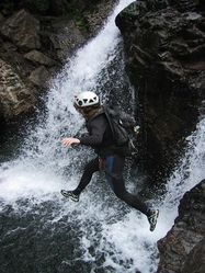
- Jump: a 20' jump (more of a step-off than a jump) from the left rim drops you in the center of the deep pool below. The walls of the pool are overhanging, so what seems like a narrow gap from the top is actually huge at water level. (as of late summer 2020, this pool has filled in with sediment a bit - definitely shallower than last year, but still jumpable - just expect to hit bottom harder than usual)
- Rappel: numerous tree anchors on either side, or the overhead tree. (There's sketchy metal bars on the left rim - best to avoid them).
- Bypass: pick a way through the undergrowth DCL to rejoin the river downstream of the pool. Alternative smaller jump locations possible downstream.
- Continue downstream, down-climbing, jumping, and sliding as you choose. A number of the smaller pools are surprisingly deep and can be very fun. There are also a few places where exit on DCL is possible via social trails.
Franklin Falls[edit]
Note: The base of Franklin Falls is a popular hiking destination. The USFS has requested that canyoneers avoid descending Franklin Falls during peak hiking times to reduced the temptation of untrained people into technical terrain
The main Franklin Falls has two smaller falls just above it, not visible from below.
- Jump: The first of the falls can be jumped (shallow) or scrambled around like the rest of the river up this point. But be sure to climb out of the large pool DCL and head up onto the river bank, looking for webbing around a conveniently positioned tree.
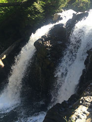
- R1: 30' from a tree DCL (photo), into a large pool. Swim across to get your first glimpse of the lip of the main falls. Adventurous hikers can sometime be found at these pools.
The next bolts are accessed by scrambling DCL to the outside elbow of the canyon. If concerned about slipping into the flow, make use of the single hand-line bolt which can be used to protect the scramble.
- R2: less of a rap, and more of a safety line for approaching the lip of the main fall. Use this bolt to protect access to the 6' pothole, and then for the walk across to the lip of the main falls. Or, just jump down into the pothole and walk to the main rap if flow is low.
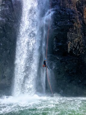
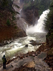
- R3: Franklin Falls itself: 100’ from bolts at the very lip of the falls DCL. Expect tourists below to watch on in amazement.
Downstream of Franklin Falls[edit]
It is possible to exit the canyon from the base of Franklin Falls by following the main trail (the one with nicely built steps) down to wherever you parked. The section below Franklin Falls drops 60’ over 1/2 mile; it has two bolted rappels, 15’ and 40’, and two notable jumps, 8’ and 15’. Be extremely cautious as most of the pools in the lower section have boulders or underwater ledges and are hazardous for jumping. There is a well maintained hiker trail all along the route DCL.
- R4: 15’ from single bolt DCL
- R5 (Denny Camp Falls): 30' from bolts DCL
Exit[edit]
The last rappel of the route, Denny Camp Falls, is a waterfall that shoots out creating an arch. Immediately after this rappel is a large pool, a use trail DCL from the bottom of the pool takes up to the actual official trail which then takes to the parking lot. Don't forget the last jump of the canyon just below this trail - it's a fun way to wash up before the hike out.
If you didn't shuttle, you can walk the wagon road trail that parallels the road, then only have to walk the road a short ways back to Fall into the Wall.
Red tape[edit]
Any one of the following passes is required to park at the trailhead:
Beta sites[edit]
 CanyoneeringNorthwest.com (archive.org) : South Fork Snoqualmie River
 Super Amazing Map : Snolqualmie River (South Fork)
