Snow Creek (San Jacinto Mountains)
| Rating: | |||||||||||||||||||||||||||||||
|---|---|---|---|---|---|---|---|---|---|---|---|---|---|---|---|---|---|---|---|---|---|---|---|---|---|---|---|---|---|---|---|
| | Difficulty:4B V PG (v4a2 V) Raps:
Red Tape: Shuttle:Required 35 mi Vehicle:Passenger Rock type:Granite | ||||||||||||||||||||||||||||||
| Location: | |||||||||||||||||||||||||||||||
| Condition Reports: | 17 Apr 2021
"19 hours car to car. I was feeling pretty sick on the approach, but decided to continue on with the descent. Once we got to the drop in we realized th |
||||||||||||||||||||||||||||||
| Best season: | Mar-Jun
|
||||||||||||||||||||||||||||||
| Regions: | |||||||||||||||||||||||||||||||
Introduction[edit]
Snow Creek is the premier mountaineering snow climbing route in SoCal, when the snow conditions are right. On a good snow year, you can climb snow from 5200 feet elevation all the way to the San Jacinto summit at 10,800. The trick is timing so the snow is firm, but not icy, and not too soft to prevent post-holing. On a low snow year, climbing around a few of the higher waterfalls will be needed, but on a high snow year, the snow will cover these higher falls, leaving only the Giant Chockstone Falls to climb around.
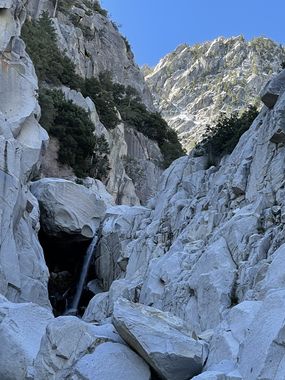
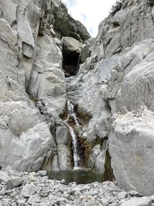
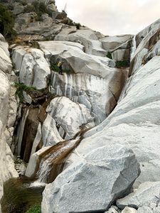
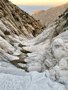
However, as a canyoneering descent, Snow Creek can be done in "crummy" climbing conditions. Preferable, the snow is too soft to climb, but perfect for safe glissading, making for up to 5000 vertical feet of sliding fun! But if the snow is too firm, then Snow Creek will be EPIC rappelling to get down safely. Bring a LONG rope, a FiddleStick and a equally long pull cord, as there are plenty of strong mountain pines for anchors. Normally the snow will not be thick enough to descend Folly Falls on snow (at 6700 feet) and Small Falls (at 6000 feet), thus a couple of mandatory rappels, before reaching Giant Chockstone Falls (at 5700 feet, banner pic). Below which is a long string of cascading waterfalls (with plenty of rappel anchor challenges) and potholes (from 5200 to 4000 feet elevation), which even have some jumps (down low near the potholes). After which, you climb out of Snow Creek onto the ridge separating Falls Creek and traverse over to the 180 foot water fall in Falls Creek. From there, follow the Falls Creek beta for more descent fun and or exit options.
Note: continuing down Snow Creek below 4000 feet is not fun, you quickly get into the forbidden square mile (section 33 owned by the DWA which is trespassing!), and you are likely to get caught trying to exit as the DWA caretaker lives where the creek crosses the access road. Thus, hop over to Falls Creek and enjoy another canyon. :)


