South Branch Feather River (Log Ride)
| Rating: | |||||||||||||||||||||||||||||||
|---|---|---|---|---|---|---|---|---|---|---|---|---|---|---|---|---|---|---|---|---|---|---|---|---|---|---|---|---|---|---|---|
| | Raps:5-12 + 10+ jumps, max ↨135ft
Red Tape:No permit required Shuttle:Optional 45min, 7mi Vehicle:High Clearance Rock type:Granite | ||||||||||||||||||||||||||||||
| Location: | |||||||||||||||||||||||||||||||
| Condition Reports: | 27 Sep 2025
"Lovely fall day out. Temperatures were more moderate, and most of us were happy we had our thicker wetsuits. Flow was moderate (or even moderate low). |
||||||||||||||||||||||||||||||
| Best season: | Summer
|
||||||||||||||||||||||||||||||
| Regions: | |||||||||||||||||||||||||||||||
Introduction[edit]
This is a very scenic California Sierra canyon with lots of green moss, crystal clear water and white waterfalls. The stream is always very wide and the waterfalls spread out, so it may be safe to descend even in high water.
Below are some reference pictures to let waterflow analysis forecast the current flow. Please note that Feather River gauges are NOT reliable when the dams are releasing. Always check Yuba river gauges for confirmation.
2020 Complex Fire: The canyon was burned out in the 2020 Complex fire and was closed until 2025. The road to the Milsap Bar is now open, but the road above it is washed out and blocked by fire debris 2 miles up for about half a mile. There is room to park and turn around there. It's very reasonable to just hike up the road either from there or the campground, as the upper part is also clear. As of Fall 2025, the Forest Service has confirmed that there are no plans on repairing the road between Milsap Bar and the canyon until funding is recieved. However, they did say that trailheads for the upper and lower sections may be accessible by vehicle by driving in from the East. They also said that trees are constantly falling on road, so no garuntees of making it out there.
Approach[edit]
Until the road repair is finished, shuttle the first 2 miles, or hike all 7 miles from the campground. (It's only a little over 2000ft of elevation, so pretty manageable by fit groups).
Descend more or less the same route as previously, just note that that old trail doesn't exist, so you'll be making your own way. Sticking slightly right of the track to the ridge might work better.
Descent[edit]
The original beta from sierracanyons.org recommends to descend the two sections of the canyon in different days, but I suggest you do them all in one day. I did this canyon first time in 2010 with a group of 4 experienced people, we went in with bivys and sleeping bags and stoves and everything to spend the night... and even with our heavy packs we did both sections in 7h. I went back in 2014 with a group of 9 people, some of them newbies, and it took us 10.5h car to car to do it all. Should you decide to split the canyon into two days, the Seven Falls trail to the middle is about half an hour each way, well used and quite obvious, though very steep. This could make for an easy weekend-driving up Saturday morning, running lower in the afternoon, then camping at a pullout near the Seven Falls trailhead and running upper Sunday morning.
You should gauge the canyon flow at the exit (campground) and again at the start (when you first drop into the canyon). The canyon is so wide and the flow is so spread out that it might be safe to descend even at moderate to high flow. Checking the flow at the exit also allows you to know where to look for the ropeswing/exit so you don't proceed needlessly too far downstream at the end of the day
The upper part of the canyon is more scenic while the lower part is more technical. Finding pre-rigged anchor stations may not be easy, so bring lots of webbing and be ready to build your own anchors. During the descent you may find anchor stations at canyon left, at canyon right, in the middle or all of the above. Most pre-rigged anchors will involve dry rappels away from the waterfalls, but experienced Class C canyoneers should have more fun ignoring them and building their own anchors to rappel next-to or in-the-middle-of the white waterfalls. WARNING: Do NOT rappel in the waterfalls if using any dry canyon techniques such as toss-and-go, double-strand-rappel, biner-block, etc.
Upper Section
J1. 40' Off a boulder platform in the center of the watercourse or downclimb to a 10' jump LDC
R1. 20' LDC
J2. 15' RDC
R2. 30' Tree LCD
R3. 40' Chockstone RDC
R4. 40' Tree RDC
R5. 130 RDC Pinch point out of water course or pinch between boulders. The pinch will result in the lower half of the rappel being in the flow, and require more than 275' of rope for rappel + pull
R6. 60' Off a small tree slightly back from the fall edge, center-right of the watercourse
R7 30' RDC downclimb to tree, or downclimb
There are also several small slides in this section, check them carefully for bumps or edges.
Lower Section
R1. 150' LDC off a single bolt or 135' RDC off a rock feature
R2: 130' LDC off a single bolt
R2 Alt: 130' Tree RDC to a large ledge. The rock can be very slippery here, and extending the rope another 15' can be helpful in getting to the water in a controlled fashion. Depending on flow, you can also slide a little chute that lands you in the splash zone of the waterfall, letting it push you under and then swim out!
R3. 100' RDC pinch point against the wall
R4. 130' 2 bolts on large boulder - a 50' free hang rappel to a long slope. There is a sharp edge here on the boulder - edge protection would be advised. An optional rappel is a wrapped boulder far RDC that takes you down an ugly boulder lined crack, but perhaps avoids rope wear issues. There is a fun little slide and hydraulic at the base of this rappel, or you can stay RDC and land on a few rocks.
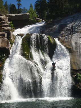
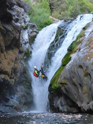
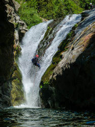
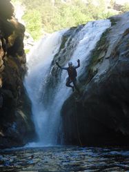
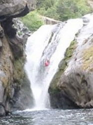
R5. 30'+ boulder on left or jump/slide from small hanging pothole LDC. This is the waterfall for the 4 reference pictures 2014-07-05, 2015-06-12, 2010-09-09, 2015-05-25.
Long slog (long) you will save time if you can skirt the edges out of the watercourse. (There are lots of little slides and jumps to make the creek hike out enjoyable if you look for them. Or you could just slog I guess. -Rick I)
R6/Jump 3. 25 - 30' Rap off a wobbly boulder on RDC ledge or a tree higher up (if you don't mind a lot of poisoned oak). Or jump from a lower ledge that is easily down climbed to access (recommended). As of Sept 2025, there are boulders in the jump zone, so send someone down to scope. Finish a very long slog to Mislap Bar. You have found the campsite when you see a tree swing on your right.
Exit[edit]
If you do upper+lower, the last mile of the route involves boulder hopping in the stream till you get to Milsap Bar Campground, where you might be able to spend the night for free. If you plan to do only the upper, you will have a steep climb out on a well traveled use trail that takes about half an hour.
Red tape[edit]
Beta sites[edit]
- Beta was originally posted on sierracanyons.org (now defunct), Open PDF for Upper Open PDF for Lower
- Explore Pangea
Be aware when reading the above beta that the written description for anchor locations is mostly correct (right or left), but the (ldc) refers to "looking down canyon" not "left down canyon".
Trip reports and media[edit]
- Video featuring the first descent
- Facebook Album 2010
- Pictures from 2010
- Video Showing a descent of the Lower section in 2025
