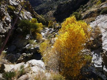
South Canyon (Pinaleno Mountains)
| Rating: | |||||||||||||||||||||||||||||||
|---|---|---|---|---|---|---|---|---|---|---|---|---|---|---|---|---|---|---|---|---|---|---|---|---|---|---|---|---|---|---|---|
| | Difficulty:2A I (v1a1 I) Raps:0, max ↨0ft
Red Tape:No permit required Shuttle:None Vehicle:4WD - High Clearance | ||||||||||||||||||||||||||||||
| Location: | |||||||||||||||||||||||||||||||
| Condition Reports: | |||||||||||||||||||||||||||||||
| Best season: | spring or fall
|
||||||||||||||||||||||||||||||
| Regions: | |||||||||||||||||||||||||||||||
Introduction[edit]
A short non-technical canyon hike through a tributary of Marijilda Creek in the Pinaleno Mountains with some nice scenery and moderate downclimbing challenges to get around the few drops in the canyon.
From Phoenix, drive east on the US60 through the city of Globe, then take US70 to Safford. Turn right (south) onto US 191 in Safford and drive for 7.4 miles, then turn right again onto state route 366 and drive for 3.3 miles to turn right onto forest road 57 (unsigned) to drive for another 3.7 miles to reach Gibson Canyon trailhead. FR 57 is quite rocky near the start, but improves a bit the farther you go. The only other obstacle of consequence is a creek crossing (Marijilda Creek) at about 2.6 miles that at least at the time of this writing was about 4 inches deep and fairly flat. Assuming your vehicle can safely make this crossing, continue straight past the creek, ignoring a right branching road very shortly afterward to drive the remaining 1.1 miles to the trailhead on the left which is signed "57 end" and has mileage posted for Gibson Canyon trail 308.
Approach[edit]
From the trailhead, continue west on the road you were driving on a short distance until the road ends abruptly and the thin, overgrown trail begins. Gibson Canyon trail sees only intermittent use and is of varying quality depending on how much recent activity is has seen - follow the trail through the high grasses as best as you can, following a few cairns along the way. The trail basically follows Marijilda Creek to the west and up the slopes of the mountain to get around the two major drainages you will encounter along the way. The first drainage is South Canyon after 1.3 miles of hiking turn left and head down canyon here.
Descent[edit]
Simply hike down canyon bypassing all the drops and pools on one side of the canyon or the other. The bypasses are not completely without difficulty, but neither are they very exposed or difficult - just moderate sloped scrambling and boulder hopping for the slightly more than .5 miles to reach the confluence with Marijilda Creek which is quite distinct as the water flow becomes quite a bit more swift. Continue down Marijilda Creek as it heads east, then north east through more scenic pools, falls and boulder hopping. After a little less than a mile from the confluence you will reach the old water gauging station and a corrugated metal fence spanning the canyon. After ducking under the fence start looking for a very light use trail on the left that will take you the short distance along the creek to the end of a short spur road that leads up and left to the trailhead where you started.
