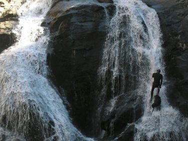
South Fork Tuolumne River (Flip Flop)
| Rating: | |||||||||||||||||||||||||||||||
|---|---|---|---|---|---|---|---|---|---|---|---|---|---|---|---|---|---|---|---|---|---|---|---|---|---|---|---|---|---|---|---|
| | Raps:1-4, max ↨105ft
Red Tape:Closed to entry Shuttle:Required 30 min Vehicle:High Clearance | ||||||||||||||||||||||||||||||
| Location: | |||||||||||||||||||||||||||||||
| Condition Reports: | |||||||||||||||||||||||||||||||
| Best season: | Aug-Sep
|
||||||||||||||||||||||||||||||
| Regions: | |||||||||||||||||||||||||||||||
Introduction[edit]
Approach[edit]
Descent[edit]
Exit[edit]
Beta sites[edit]
- Beta was originally posted on sierracanyons.org (now defunct) Open PDF
Trip reports and media[edit]
Background[edit]
Red tape[edit]
Canyon (sort of) Closure:
Due to the San Francisco Public Utilities Commission, The access Road, 1s28b is closed under USFS order https://www.fs.usda.gov/r05/stanislaus/alerts/forest-order-stf-16-2025-03-mtn-tunnel-project-fsr-1s28b-repairclosure through 12/31/2026. Updated Forest Service Orders can be found here: https://www.fs.usda.gov/r05/stanislaus/alerts
After reading this, our group thought it would be okay to start at Rainbow Pools and stay in the river to descend the canyon (the part between Rainbow Pools and the road was actually pretty nice with some good jumps). Once we got to the road, a construction worker called us over and started telling us how we would get a $10,000 fine. We apologized for any inconvenience we were causing, and explained how we were following the forest order, and said we'd be happy to turn around if needed. Eventually the 'County Inspector' (I think?) showed up and talked to us. He was friendly, did not give us a $10,000 ticket but asked that we not come to this section of river for the duration of the project.
So, basically, they are doing blasting, moving heavy equipment, and don't want people on the road, or in the creek beside the road. The forest order technically doesn't prohibit moving down the creek, but it does create a problem for the SFPUC folks, and they're probably going to say something to you about it if you go. So, best idea is probably to not.
The County Inspector suggested that the work on the tunnel is likely to continue for several years.
