Souther Creek
| Rating: | |||||||||||||||||||||||||||||||
|---|---|---|---|---|---|---|---|---|---|---|---|---|---|---|---|---|---|---|---|---|---|---|---|---|---|---|---|---|---|---|---|
| | Raps:2, max ↨110ft
Red Tape:Access is Restricted Shuttle:None Vehicle:Passenger | ||||||||||||||||||||||||||||||
| Location: | |||||||||||||||||||||||||||||||
| Condition Reports: | 16 Nov 2024
"Obtained permission from local landowners who even gave us a shuttle ride up to the top. Walked in on new trail and descended from there. A redirect o |
||||||||||||||||||||||||||||||
| Best season: | Apr-June
|
||||||||||||||||||||||||||||||
| Regions: | |||||||||||||||||||||||||||||||
Introduction[edit]
Be aware: Souther Creek is on private land. Please see Red Tape before running this creek.
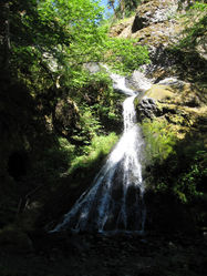
Souther Creek is a small drainage located between the towns of Stevenson and Carson on the north shore of the Columbia River Gorge. It has two good-sized waterfalls that makes for a short adventure. Flow can be extreme during the winter run-off but reduces to a trickle in late summer. Best visited during spring conditions with decent flow.
The original approach requires some navigation and bushwhacking through a poison oak infested forest. Long pants/sleeves recommended.
- Watershed: 1.6mi^2. The highest point of he drainage is about 2300ft elevation.
- Beware poison oak on the approach.
Approach[edit]
Check point: Walk in a short distance to check the flow on Sweeney Falls.
Directions[edit]
From Bridge of the Gods, head east on Hwy 14 for ~5mi. At a sharp bend where Hwy 14 crosses Souther Creek, park in a large unsigned pullout on the north side of the highway.
Hike In[edit]
From the pullout, walk east along Hwy 14 for 0.1mi to the next drainage east. Spot an unsigned gate blocking an overgrown road. Bypass the gate and follow the logging road up. At a split in the road take the left branch to its end then do some easy bushwacking downwards to the creek while doing your best to avoid the poison oak. Enter the creek at approx. UTM 10 589750mE 5062697mN. It should be a gentle ramp all the way into the creek. Just upstream is a short mossy narrows and sizeable pool which makes a good poison oak rinse-off station.
Descent[edit]
Head downstream about 5-10min to the top of R1.
- Optional 6ft slide into a shallow pool. Or bypass DCL.
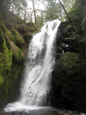
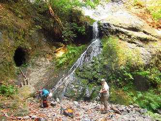
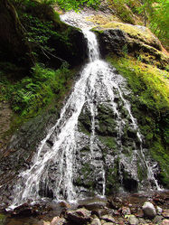
- R1: Crayfish Falls. 80ft from a tree high DCL. Interestingly the creek is starting to carve out a new fissure (too small to enter) DCL of the falls.
- Downclimb 8ft (DCL to DCR) after the bottom of the falls and climb over a new log pile.
Walk 5min to R2.
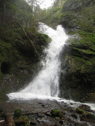
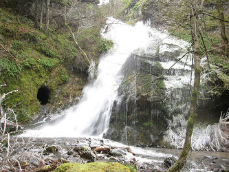
- R2: Sweeney Falls. 110ft from a tree on left. The anchor tree appears to be levitating because it is L-shaped. The falls drop down an elongated ramp, then turns right dumping into a fan-fall. Beware going for an inadvertent pendulum swing on the lower tier due to the shape of the falls. Do not follow the watercourse. Falls can be bypassed via an old user-trail DCR.
Take a minute below the falls to explore the mining tunnel that disappears some 70ft back into the bedrock on canyon right. Sometimes bats and giant scary cave-crickets are found herein.
R2 is featured in a number of hiking guidebooks and unfortunately collects trash. Please help us keep the area clean by packing out any trash you might encounter.
Exit[edit]
Head downstream a couple of minutes and exit DCR on obvious trail that climbs up out of the creek. Sometimes there's a fixed rope here to expedite exiting back up to Hwy 14.
Red tape[edit]
While people have been visiting these falls for many years, an examination of Skamania County property lines reveals the lower end of Souther Creek is indeed on private land. It's best to first obtain permission from the landowners before running the creek.
Beta sites[edit]
Trip reports and media[edit]
Background[edit]
Creek was probably first descended by Portland locals.
