Spur Canyon
| Rating: | |||||||||||||||||||||||||||||||
|---|---|---|---|---|---|---|---|---|---|---|---|---|---|---|---|---|---|---|---|---|---|---|---|---|---|---|---|---|---|---|---|
| | Difficulty:3B II (v3a2 II) Raps:3-5, max ↨55ft
Red Tape:No permit required Shuttle:Optional 1 miile Vehicle:4WD - High Clearance Rock type:Limestone | ||||||||||||||||||||||||||||||
| Start: | |||||||||||||||||||||||||||||||
| Parking: | |||||||||||||||||||||||||||||||
| Shuttle: | |||||||||||||||||||||||||||||||
| Condition Reports: | 26 Jul 2025
"This was a great surprise. We were all really pleased with this canyon. However, avoid the heat of summer and plan this one with cooler temps. |
||||||||||||||||||||||||||||||
| Best season: | May-Oct, hot in summer
|
||||||||||||||||||||||||||||||
| Regions: | |||||||||||||||||||||||||||||||
Introduction[edit]
Spur is a great half day limestone canyon in an unexpected location. Originally discovered and descended in the early 2000s by Jeff Baird, Spur was added to ropewiki as a pinned location without details until 2025.
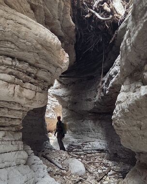
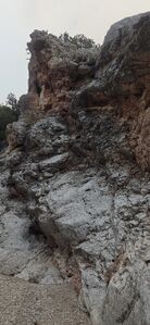
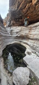
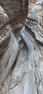
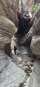
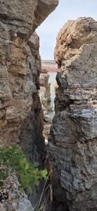
Spur alternates between nice, aesthetic carved limestone features and easy canyon walking between obstacles.
Approach[edit]
Drive East from Lovell, WY on Alt Highway 14 over Bighorn Lake. Turn North on John Blue Road, following the dirt road up John Blue Canyon. High Clearance 4WD is required. Navigate the network of two tracks on a GPS app (not google) to Park at (44.97233, -108.21981). Continue down the old road as your vehicle allows.
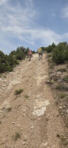
Hike down the road a short ways, then depart it at (44.96882, -108.22271) to follow the ridge down to the right and walk into the drainage at (44.96929, -108.22847).
Descent[edit]
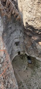
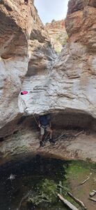
R0: 30' rope from a tree DCL or bypass by downclimbing 20' DCR or skirting further around DCL.
DC: 15' around a boulder
DC: 10' after crawling along the shelf DCL to avoid water in a pothole.
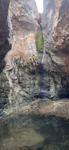
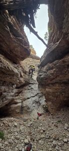
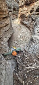
R1: 55' from a juniper higher DCR. This is the 'first mandatory rappel' and the juniper was chosen to avoid debris at the pourover.
R2: 40' from a slung boulder in a rock stack landing dry, but followed by wading through a
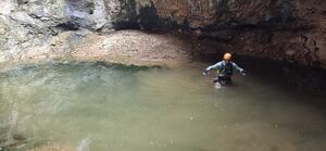
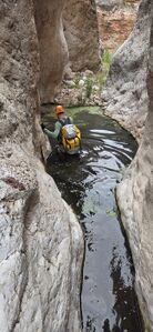
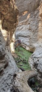
Pool nearly waist deep
Pool knee deep
Pool waist deep
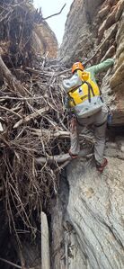
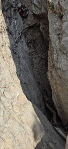
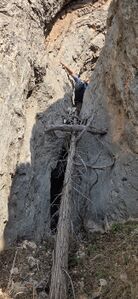
Log Jam able to climb up, but the back side was unsecure. Step onto the wall DCR into a higher escape gully DCR. A juniper provides a 55' rappel back into the canyon.
Walk beneath a Log Jam suspended overhead
Log Jam climb up and over
R3: 35' from a loop around a horn DCR to negotiate a 6ft tall undercut
Pool stem wide to avoid
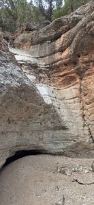
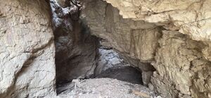
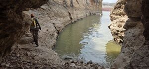
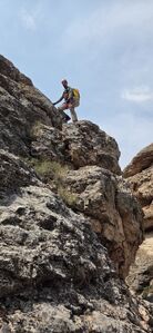
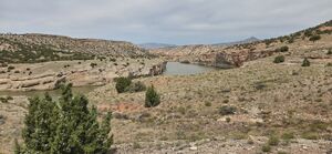
Walk under the cave formed by a large section of the limestone wall, which separated DCL and connected with the canyon wall DCR. Check out the reservoir, but return to upclimb DCR to get up onto the roof of the cave. A few 4th class moves with good hand holds and tacky limestone grip provide escape from the canyon where Spur meets the reservoir.
Exit[edit]
Contour South following game trails and head uphill slowly regaining elevation in the second gully. Intersect the old two track and follow this back to the parking location.
Red tape[edit]
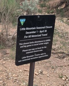
This area is Closed December 1 - April 30 for wildlife and big game.
Beta sites[edit]
 Super Amazing Map : Spur Canyon
 CanyoneeringNorthwest.com (archive.org) : Big Horn Canyon National Recreation Area
Copied text from the CanyoneeringNorthwest.com archive page (dated around the early or mid 2000s)
Big Horn Canyon National Recreation Area
Jeff Baird has contributed the beta and photos for John Blue Canyon and Spur Canyon. Though they aren’t in the Northwest, the canyons are definitely worthy of inclusion.
Spur Canyon
"I found this canyon from a satellite picture. It didn't have a name on the topo map, but we started calling it Spur Canyon. It's in Northern Wyoming, near the Montana border in Bighorn Canyon National Recreation Area.
The time needed for the canyon depends on how you approach the canyon, and how close you can drive to the head of the canyon with your 4 wheel drive. When we did the canyon, the water level in Bighorn Lake was very low, so we were able to get to the canyon from the bottom. But since then, the water has risen quite a bit, so the best option, unless you have a boat drop you off, is from the top of the canyon. It'll probably take around 4-6 hours.
Since the exit of the canyon drops into Bighorn Lake, you'll either need to return back up canyon, or have a boat pick you up. There are several areas in the canyon where you can escape, so if you don't have a boat, simply head back up canyon and out one of the exits.
From Lovell Wyoming, drive East on Highway 14. Turn North at 44.8567 108.1749 and drive into John Blue Canyon. If you have time, stop and take a look at John Blue's Cabin, an old mountain man's cabin (N 44.901167 W 108.154900). You'll soon come to the exit of a short slot canyon in John Blue Canyon. From here, head up the 4 wheel drive road that runs parallel to the slot canyon. There's a lot of crisscrossed roads, so a GPS is the best way to get to the canyon. Drive until you reach about 44.9508 108.1593 and turn left. From here, stay left until you can get as close as your car will handle to the top of the canyon. We got to within a 1/3 of a mile. The drop in point for the canyon is about 44.9689 108.2271.
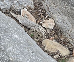
The first drop can be downclimbed, rappelled or bypassed on the right. The next short drops can be bypassed by ledges on the right (LDC). You'll then immediately come to the first mandatory rappel, which is about 20-30 feet. There is a tree at the top of the rappel you can use as an anchor. From there, do some bushwacking to get to the next rappel, which will be your biggest. It's about 40 feet down into a beautiful grotto. For an anchor, we used a scrawny tree that was a ways back from the lip of the rappel. From that point on, there's a lot of bushwacking, fun down climbs and narrows. Keep an eye out for some of the exit options as you head down canyon, because unless you have a boat, you'll need to come back up canyon and out one of the exits. There wasn't any swims when we did it, but there was some wading. The canyon ends in a short tunnel that empties into Bighorn Lake. From there you can back track to your exit, then hike back up to your car. Watch out for rattlesnakes!"
Trip reports and media[edit]
2025-07-26 a hot day in July chasing old beta to update ropewiki with new details, photos and kml. Ira Lewis, Wayne Herrick and Carl Bern.
