Stack Creek (East)
| Rating: | |||||||||||||||||||||||||||||||
|---|---|---|---|---|---|---|---|---|---|---|---|---|---|---|---|---|---|---|---|---|---|---|---|---|---|---|---|---|---|---|---|
| | Raps:4-6, max ↨130ft
Red Tape:Closed to entry Shuttle:Optional 5 min Vehicle:Passenger | ||||||||||||||||||||||||||||||
| Location: | |||||||||||||||||||||||||||||||
| Condition Reports: | 7 Jun 2015
"Two hour hike up to the Sidewalk-in-the-Sky. Thrashy approach to the tarns, then down to find the main canyon. Suspect the original crew may have dr |
||||||||||||||||||||||||||||||
| Best season: | May-July
|
||||||||||||||||||||||||||||||
| Regions: | |||||||||||||||||||||||||||||||
Introduction[edit]
Current Status: Closed. This creek was overrun by the Beachie/Santiam Fire in Sept 2020 and has been closed. Please check on local closures before planning a trip to this area. When the area eventually reopens, use extreme caution when descending the creek. Between landslides, fallen trees, and loose rocks, this area may be unstable and dangerous for years to come. The canyon may have changed dramatically. Do not rely on the beta below being accurate.
This is a committing canyon - check water levels before descending as most rappels will be directly in the water course. Stack Creek is long day with lots of bushwhacking. Expect a very high pay-to-play.
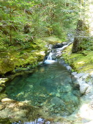
The water flow checkpoint is a large shallow pool right before the confluence of East Stack Creek with Stack Creek. You will have to scramble down from the road to the stream and hike upstream to the confluence, marked by a giant boulder in the middle of the watercourse.
Approach[edit]
From the trailhead, follow the trail toward the summit of Henline Mountain. Elevation gain is about 2400’ and took about 2hrs. Trail becomes faint near the top and vanishes abruptly at the summit. Thrash north of the summit a couple of minutes, then NE to drop down a ridgelet for 500-600ft through thick rhodies. Henline's NE ridge soon appears, stay on top of it to find a game trail. Scramble descender's right around a rock step at one point, then skirt right around three large rock formations blocking access along the ridge. The last is big and dropped down 100ft to skirt around it on the base of a small talus slope. Keep going to reach a mini-ridgelet just before the forest ends in a giant bedrock bowl (~4000ft elevation).
- Extra bonus detour: drop packs and scramble up the ridgelet a hundred feet or so to reach the knife-ridge above that’s known as the Sidewalk in the Sky. Great views of the basin below and not-so-great views of the clearcut just north of Henline Mountain. (There’s also a road down there which might make for an alternate access route to this area?) Reaching the sidewalk is about +1hr from the summit of Henline Mountain.
It appears the party who did the original descent of East Creek may have dropped directly down from the Sidewalk into the drainage. From where we dropped the packs, we backtracked southwest a hundred yards or so and went down an easier ridgeline to visit the two tarns located just west of the bedrock basin. The northern tarn was full of algae and nastiness; we skirted around the east side and climbed up to a local high point and dropped down the far side to find the outflow from the southern tarn which seems to be the primary source of water for the East Fork. We arrived at the outflow perhaps +45min from leaving the Sidewalk.
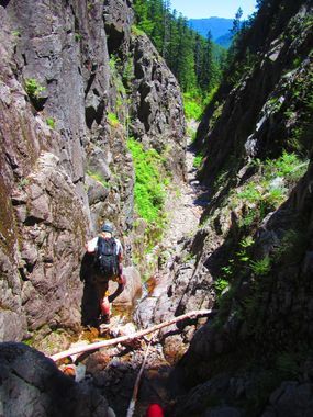
From the tarn outflow, follow the stream down an interesting crack-fault about 2min to where the creek abruptly goes around a corner and drops down a fan cascade. This is the top of R1.
Descent[edit]
- R1: 100ft down open slope, tree DCL.
- R2: 40ft, rock mid-creek.
- R3: ?? into flat-bottomed chasm area - can be bypassed DCL.
- R4: ?? small cascade - can be bypassed DCL.
- R5: 45ft low angle cascade. Downclimb, rappel, or bypass.
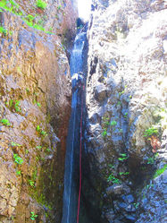
- R6: East Stack Falls - 130ft down a narrow body-width crack. This is the first falls described in the original beta. Boulder mid-creek. May want to extend the anchor as the pull can be difficult.
- R7: 30ft, boulder/pinch point DCL. Awkward start.
- 15ft drop. Rappel or bypass DCL.
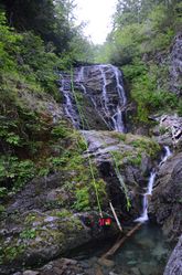
- R8: 60ft composed of several tiers. Boulder mid-creek.
- R9: two stage: 20ft, long-ish horizontal section and another step 45ft. Small tree DCL.
- R10: 45ft. Tree 20ft up steep slope DCL.
- R11: two stage: 30ft, 15ft. Tree DCR. Pull here can be bad.
- Short narrow slot you can downclimb in the water.
Exit[edit]
Once through the technical section, there are a few more drops that could be rappelled, but all can be bypassed one way or another. The original beta gives some good advice: don't underestimate the exit. Plan on some hours of streamwalking, climbing over/under/around/through various obstacles, looking for bypass routes, etc. It is long and tiring. Continue down, down, down - while wading pools and rock-hopping.
Look for the huge concrete foundations of an old bridge as a sign you're nearing the end. Just beyond, a large boulder marks the confluence with the main Stack Creek. Cross the main fork and follow user trail on DCR side to giant culvert and exit path to the road.
Red tape[edit]
None.
Beta sites[edit]
 CanyoneeringNorthwest.com (archive.org) : Stack Creek Canyon
Trip reports and media[edit]
Background[edit]
First known descent by Nate Meehan, Kathleen Moore, and Daniel Simpson, May 31st, 2014.


