Steels Creek
| Rating: | |||||||||||||||||||||||||||||||
|---|---|---|---|---|---|---|---|---|---|---|---|---|---|---|---|---|---|---|---|---|---|---|---|---|---|---|---|---|---|---|---|
| | Raps:5 rappels, max ↨80ft
Red Tape:No permit required Shuttle:None Vehicle:Passenger Rock type:Quartzite | ||||||||||||||||||||||||||||||
| Start: | |||||||||||||||||||||||||||||||
| Parking: | |||||||||||||||||||||||||||||||
| Condition Reports: | 26 May 2025
"Had the bail at the Steels Creek Falls rap. The initial two potholes were death hydraulics, and not everyone in the group was able to traverse them to |
||||||||||||||||||||||||||||||
| Best season: | Any Season
|
||||||||||||||||||||||||||||||
| Regions: | |||||||||||||||||||||||||||||||
Introduction[edit]
Steels Creek is a WNC classic, with a particular emphasis on deep pothole swimming and slippery footing. The nearby Gingercake Creek empties into Steels a quarter mile upstream of the start, making this drainage noticeably bigger with higher flows. This route develops dangerous hydraulics in certain sections and it is best to run it during low waters. Even when the state is in drought conditions, this route still maintains its Class C character.
Steels Creek has ample opportunities to bail early if weather turns or flow is too gnarly, since the MST parallels the waterway for most of the route. Because of that and the abundance of swimming holes, it's not too uncommon to run into intermittent groups of swimmers at the most accessible parts of the creek. The route features a mixture of bolted and natural anchors, as well as a retrievable traverse line section. Come prepared!
Approach[edit]
Access FR228 from HWY 181, about 3.4 miles south of the Brown Mountain Overlook. Drive 4 miles down the dirt road until you reach the end. There is a large parking area here that can fit 5-7 cars, depending on how well everyone parks. The white blazed MST trail picks up from here, at the end of the road. About 1.6 miles after turning onto FR228, you'll cross Little Fork Creek. If that crossing is spicy for your vehicle, then water levels are likely too high to run the creek.
From the parking, head north up the MST for 0.2mi. At that point, the trail crosses Steels Creek above a cascade and swimming hole, then picks back up on the other side. Make a mental note of this spot because it can be easy to miss this exit after coming back down the creek. Once back on the trail after the crossing, the MST will make a right hand turn and continue north. From this point, the start of the route is another 1.1 miles further up the trail - located here: 35.92548, -81.84714. There are two spots where the trail can be tricky to follow as it scrambles up rocky sections. Just keep looking for the white blazes on trees if you lose it.
In 0.5mi after the crossing, there will be a short spur trail down to a precarious and slippery ledge that overlooks Steels Creek Falls proper and the massive pothole/swimming hole. This is how you rejoin the route if you end up bypassing R2, or your bail option before committing to the R4 and the traverse line.
1 mile after the initial creek crossing, there will be another spur trail (located here: 35.92469, -81.84743) that goes down to the base of what is known as the Teacups - a series of about 7 potholes. The route begins just above the Teacups, which you can see from the MST. So once you get there, continue on the MST until you can see that you're past the pothole/bouldery formations, then dive off trail towards the creek. Suit and gear up here.
Descent[edit]
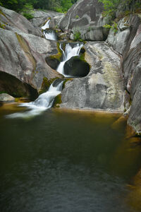
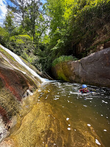
Swim, wade, and scramble through the Teacups. There are even a few spots for some small jumps. The Teacups finish with a long, sliding cascade into a swimming hole. Scramble down the bedrock DCR.
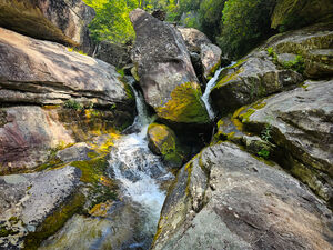
After the Teacups, continue downstream, scrambling through an impressive boulder-choked section of the creek. In about 10 minutes, you'll come to the first rappel.
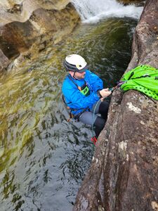
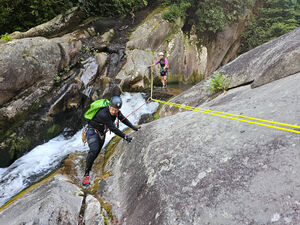
- R1: 75ft (23m) Beverly Hillbilly Falls. Rappel off an unlinked bolted anchor, located on the headwall facing the drop, and into a deep channel that makes a geologically impressive 90 degree turn. This is a swimmer. Note: Make sure you do not finish on the river left (rappeller's right) side of the flow. In moderate-high waters, the back flow current can potentially trap you in the nook. You can also practice pothole escapes in the calm waters of channel. The wall gradually gets taller, making it easy to select how hard you want to make the escape.
Continue creek stomping until you arrive at the top of Steels Creek Falls, 0.3 miles downstream.
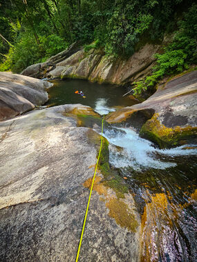
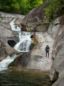
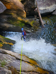
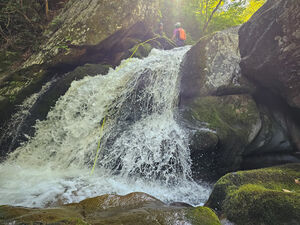
- R2: 70ft (22m) Steels Creek Falls. Rappel off a large Poplar tree, slung high, about 15' back from the rocky terrace DCR. Cross the flow at the top of the drop, where it's an easy couple steps over, and rappel down the dry slab river left (rappeller's right) to avoid the first pothole. Continue down the next short drop and finish in the bigger pothole DCL, where the water calmly eddies in the back. NOTE: These potholes have dangerous hydraulics in all but very low waters. If the entire pothole is aerated, or if uncertain about traversing this rappel at all, then bypass this pitch using a faint path on the DCR side the rocky terrace. In 20', you'll reach the approach trail, make a left, then in another 20-30 feet, there will be a spur path that goes down to The Kettle (the big swimming hole) and rejoins the route at the R3-R4 beta.
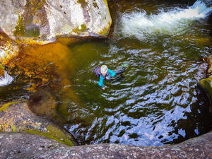
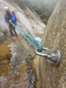
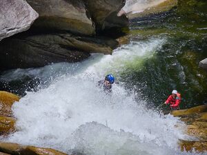
- Optional R3: 50ft (15m). Downscramble the easy 3rd class slab to reach the big swimming hole, locally known as The Kettle. If your team can't safely do that, there is a single ring bolt on the back wall of the pothole to set up a retrievable rope. Note: These potholes have dangerous hydrualics in high flows. If uncertain, stay on the dry slab and do not enter them. However, in low enough waters, you can scramble above the second pothole, slide in, and then slide out into the lower final pothole before reaching the Kettle. There is a video link demonstrating this in the "Beta Sites" section of the page.
Enjoy the swimming hole. There are several cliff jumping spots up to ~15ft. The next 50' rappel is immediately downstream and DCL across the flow. There is a single ring bolt to rig a retrievable traverse line to reach the unlinked bolted anchor proper for the 4th rappel.
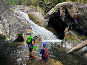
- R4: 55ft (17m) Lower Steels Creek Falls. Another fun rappel off an unlinked bolted anchor into a swimmer. Note: do not finish on the river left (rappeller's right) side of the flow. Even in lower waters, the back flow current can trap you in the big cave-ish feature. The terrain at the base of this drop makes you question if you're really in NC.
Continue creek stomping downstream for about another 10 minutes, passing many deep swimming holes, until you reach the 5th and final rappel.
- R5: 15ft (5m). Small cascade with a slung, mossy boulder DCR as the anchor.
Exit[edit]
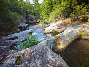
Continue downstream, passing more deep swimming holes and impressive rock formations, until you are at the initial creek crossing from the approach (15-20min from last rappel). Follow the trail for 0.2 miles back to the parking.
Red tape[edit]
Beta sites[edit]
Sliding into the potholes above The Kettle
