Strawberry Creek
| Rating: | |||||||||||||||||||||||||||||||
|---|---|---|---|---|---|---|---|---|---|---|---|---|---|---|---|---|---|---|---|---|---|---|---|---|---|---|---|---|---|---|---|
| | Difficulty:3B III (v4a3 III) Raps:9, max ↨150ft
Red Tape:No permit required Shuttle:Required 30 min Vehicle:Passenger Rock type:Granite | ||||||||||||||||||||||||||||||
| Location: | |||||||||||||||||||||||||||||||
| Condition Reports: | 31 Jul 2025
"Canyon had very limited water flow, mostly in the bottom 10% of the canyon. All raps were easily down-climbed excepting the final rappel, which probab |
||||||||||||||||||||||||||||||
| Best season: | April-June
|
||||||||||||||||||||||||||||||
| Regions: | |||||||||||||||||||||||||||||||
Introduction[edit]
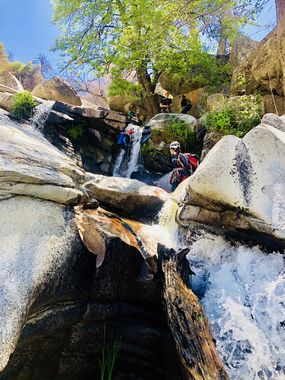
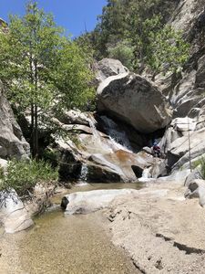
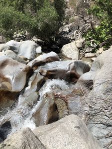
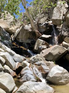
Strawberry Creek forms on the southern slope of San Jacinto Peak where water from rainfall, snowmelt, and spring discharge gathers. The creek flows down Marion Mountain through the city of Idyllwild, under Highway 74, and eventually becomes the San Jacinto River. The area burned in the Cranston fire of 2018, but the canyon itself was left relatively unscathed. The creek is rife with lizards and wildflowers in June and July and is often sheltered by live oak and sycamore trees. Water runs nearly year-round, but spring to early summer conditions will be cool and refreshing. The Idyllwild Arts jazz festival that used to be held in the summer concluded in 2024.
Approach[edit]
With a car shuttle, the canyon approach is entirely downhill. You can find legal parking on Idyllmont Rd or Double View Dr. just south of the creek, then descend down to it via use trails.
The less steep approach is to park off the road before reaching the bridge and passing onto Idyllwild Arts property (whether their road is a public right of way is unknown but could be investigated). If you choose to park before reaching the bridge, do not block the overgrown driveways (one driveway in particular is a rescue cache). Walk down the road until you turn off, pass across the school property through the woods and down to the creek.
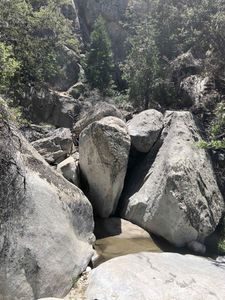
The canyon can be very hot during the summer. A water filter may be advisable to keep pack weight down. You will be scrambling and boulder hopping for many hours and miles; in truth there isn’t any “easy walking” after you descend into the creek.
Bring ample webbing as the majority of anchors are directly in the watercourse and comprised of pinches between rocks. A climber's nut tool is recommended as a way to clean and access anchors safely. Rope pulls are generally poor. Bring lots of rope in case you stick one in the canyon.
Descent[edit]
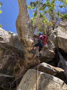
- R1: 30ft Webbing anchor around large tree, downclimb to the tree from above it. (Can be bypassed canyon left)
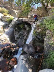
- R2: 40ft rabbit hole in middle of watercourse, two stage. (This rappel is easily bypassed canyon left but is an interesting rappel) (This rappel could use some bolts or an extended webbing anchor to make the rope pull practical) NOTE: a second stage webbing anchor on a pinch point DCL in the water course tunnel (dark in there) was installed 14JULY2019, thus fixing the pull issues. The top anchor can be ghosted around a large tree limb too.
- Note: There is a downclimb DLC that is easy at the start but has a lot of debris near the bottom. There is a large tree on top of a huge boulder that is easy to ghost (R2X).
- R3: 80ft webbing pinch (underwater anchor) with a multi-point off a tree. DCL four stages; can be a tricky pull.
- R4: 15ft webbing pinch DCL in watercourse (This rappel is easily bypassed canyon left)
- R5: 35ft pinch DCR awkward start five-foot overhang
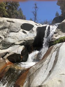
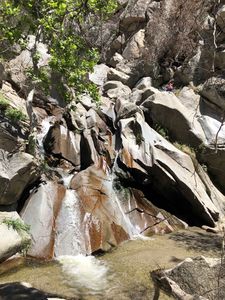
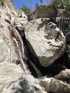
- R6: 80ft pinch middle canyon, DCL off the monster boulder. A beautifully sculpted low-angle rappel. (Note: can be ghosted.)
- R7: 40ft pinch middle canyon; from a large rock.
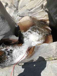
- R8: 80ft pinch in watercourse. Staying DCR for the second stage makes for a more straightforward rappel and pull. Note: bring a nut tool here. The crack for the current anchor 'sucks' in the quick link. Consider belaying the rigger down or meat anchoring them so that they can drop below this anchor to rig the rappel.
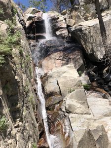
- R9: 150ft pinch point in the middle of the watercourse. Currently, there is a large, live tree further back from the edge that could make a great anchor. The current anchor is multi-point off a dead tree and a slung rock DCL (the face vs in the chute).
Exit[edit]
Following the final rappel, the watercourse grows wider as it joins an adjacent drainage. Exit via 1.2 miles of boulder hopping down to the bridge. When you reach the bridge, exit the watercourse to your waiting vehicles. Since 2020 it would appear that the watercourse has become significantly more overgrown. It may be wise to avoid the traditional exit until after the next large water event due to poison oak, stinging nettle, and chaparral.
An alternate exit without the need for a shuttle was demonstrated in June 2020. Immediately after the end of the technical section, instead of turning south, turn northeast and scramble up a small gully to the east (right) of the overgrown canyon that intersects with the main canyon. It's steep going at first but eases up later with hiking across fairly level ground until you meet the service road to the north. This exit took 1:40 to the road and then 0:30 of road walking to get back to the Lower Parking area. Additionally this should avoid issues at lower elevation with Grow issue.
Red tape[edit]
Ideally, park at Inspiration Point and drop down into the canyon from there. No access issues and you will not be crossing any private land.
There is a large active illegal marijuana grow around the 3400ft mark DCL above the canyon ridge. Those tending the grow have confronted canyoneers on some trips. If you stick to the canyon you will avoid the grow, and the growers... hopefully
Strawberry Creek is part of San Bernardino National Forest, but not designated as wilderness. Area status can be found here. If you plan to enter the creek via Idyllwild Arts, be prepared to see signs telling you that creek access requires a permit. You might contact Idyllwild Arts for said permit; they may or may not understand what you're asking for. Some parties keep a low profile and just walk on through the school during summer or on days where school is not in session. If you do access the creek via the school, stick to the kml track or you'll disturb local residents on the south side of the creek.
Beta sites[edit]
Trip reports and media[edit]
David Angel's first descent facebook photos
Background[edit]
First documented descent was on July 6th, 2019 by David Angel, Morgan D, Fredrik Farnstrom, Cyndi Lang, Sarah Truebe, and Randy Worth. Due to the popularity of the area with locals, and proximity to climbing areas, the possibility exists that this canyon has previously been descended. However, no evidence of anchors or visitation was found between rappels 3 and 9. Damaged plastic irrigation tubing - possibly from an illegal marijuana grow operation - was observed in several places; this may have been transported into the canyon during a fire or storm.
David Angel was first made aware of this canyon while he was attending band camp as a 13-year-old cellist. He made several trips down to the creek to have lunch with friends. He descended the canyon until the downclimbs became spicy. 26 years later he scouted the canyon and decided it would make an excellent first descent.
