Summit Creek (Oregon Side)
| Rating: | |||||||||||||||||||||||||||||||
|---|---|---|---|---|---|---|---|---|---|---|---|---|---|---|---|---|---|---|---|---|---|---|---|---|---|---|---|---|---|---|---|
| | Raps:2+, max ↨85ft
Red Tape:No permit required Shuttle:None Vehicle:Passenger | ||||||||||||||||||||||||||||||
| Start: | |||||||||||||||||||||||||||||||
| Parking: | |||||||||||||||||||||||||||||||
| Condition Reports: | 1 Oct 2023
"A fun stop while we ran Lower Lindsey. We only rapped the lower falls and then hiked out. Interesting art in display at the bottom. The falls are stra |
||||||||||||||||||||||||||||||
| Best season: | Apr-Jul
|
||||||||||||||||||||||||||||||
| Regions: | |||||||||||||||||||||||||||||||
Introduction[edit]
Status: OPEN. Be aware: the upper part of Summit Creek was overrun by the Eagle Creek wildfire in Sept 2017. Please use extreme caution when descending the creek. Between landslides, fallen trees, and loose rocks, this area may be very unstable and dangerous for some time to come. The canyon may have changed dramatically. Do not rely on the beta below being accurate. Please update the beta if you run the creek. Thanks!
Summit Creek is the first significant drainage immediately east of Shellrock Mountain in the Columbia River Gorge. Short and sweet, the creek has two significant falls and is relatively easy to knock out in an hour or so. Summit runs on the low side heading into late summer and is likely more fun with more water. Currently no trail leads to the upper narrows, so expect some bushwhacking and watch out for poison oak. Nice training creek; not too committing. Good afternoon adventure.
- Summit could be combined with Lower Lindsey for an easy day.
- Watershed: 0.82mi^2.
Directions[edit]
There are two possible parking areas for Summit Creek. Both of these are ONLY accessible from I-84 traveling eastbound.
- Take I-84 east into the Columbia Gorge. About 2.3mi past Wyeth (exit 51), park in a gravel pulloff just off the highway's shoulder. There is room for 4-5 vehicles. Be aware: this trailhead comes up fast and is easy to miss when moving at speed. Be ready for it. A gated powerline access track leads up from the pulloff to a junction with the bike trail above (2min). Do not block the gate. This is the same trailhead for Lindsey Creek.
- Alternately, continue east about 1.5mi to Starvation Creek (exit 55). There is more parking here, plus restrooms. Hike the paved bike trail back west paralleling the highway for 1.6mi to a junction with the powerline track mentioned above. Hike takes about 20-30min.
Approach[edit]
Follow the powerline access track upwards to a four-way junction where it meets the paved bike trail. Continue straight across and up until under the powerlines. Bear left/west and head up an obvious gully before reaching Summit Creek. Your goal is to drop into Summit Creek just at/above 600ft elevation at the top of a nice little narrows (approx: 45.6859, -121.7284). The vegetation is thickest just before the creek.
Descent[edit]
- Downclimb 4ft.
- Downclimb 15ft. Large log is wedged in the middle.
- Downclimb 15ft.
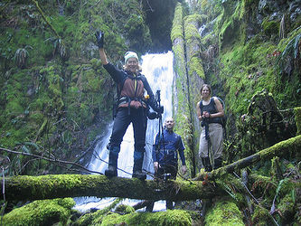
- R1: Upper Summit Falls. 30ft off a log DCL.
Head downstream 5-10min; hike in the creek or follow user trails along the banks. Eventually reach the spot where the powerline access trail crosses the creek. Keep going downstream another few minutes (easier atop the bank DCR) to reach the top of R2:
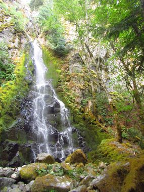
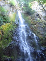
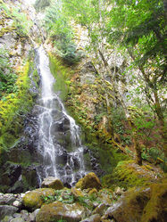
R2: Lower Summit Falls (aka Camp Benson Falls). 120ft from a big dead tree DCL. Above the falls is a bit of a mess post-fire. Most of the rope is needed for the horizontal distance as the tree is way back. In an ideal world, would be better to use a traverse line (or rappel) to a bolt station right on the edge for safety & ease of pull.
Below R2, follow the drainage downwards. There are several more short drops below that could be rappelled for fun, but all can be bypassed on one side or the other.
Exit[edit]
Stay in the drainage until you pop out of the woods into a boulder field. Traverse DCR to find a short user-trail winding down to a small meadow adjacent to I-84. Follow the bike trail east up the viaduct until you reach the junction you passed on the way in. Turn left to return to your car.
Red tape[edit]
None.
Beta sites[edit]
Trip reports and media[edit]
Background[edit]
Descended by Keith Campbell and Kevin Clark in September 2015.


