Summit Creek Canyon
| Rating: | |||||||||||||||||||||||||||||||
|---|---|---|---|---|---|---|---|---|---|---|---|---|---|---|---|---|---|---|---|---|---|---|---|---|---|---|---|---|---|---|---|
| | Raps:6-10, max ↨120ft
Red Tape:No permit required Shuttle:Optional Vehicle:Passenger | ||||||||||||||||||||||||||||||
| Location: | |||||||||||||||||||||||||||||||
| Condition Reports: | 14 Aug 2025
"Fun, easy day to start the Rondy. Just did middle section. Used DCL option on last rappel, bolt on R2 is pretty smashed, but feels solid. Might be goo |
||||||||||||||||||||||||||||||
| Best season: | July-Sept
|
||||||||||||||||||||||||||||||
| Regions: | |||||||||||||||||||||||||||||||
Introduction[edit]
The best part of this canyon is Middle Summit Creek, a very short but fun section that starts at Summit Creek Campground and ends shortly after Thunder Falls. For those with extra time and stamina, the full Summit Creek can be descended in one long day (12-14 hours) or broken up into two separate days for the Upper and the Lower sections.
Summit Creek Campground has been decommissioned. Dispersed camping is still allowed at the old site, but the pit toilets have been removed. Soda Springs Campground is a 10-minute drive (3 miles) further up the road and is still operational. This is a great base to explore Summit and the other canyons in the area.
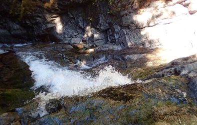
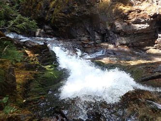
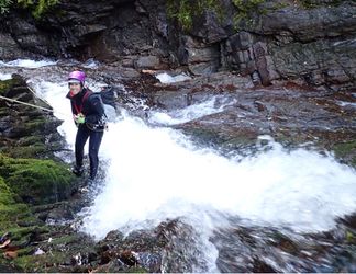
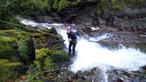
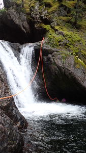
- Checkpoint photos are from the top of R1 in the middle section.
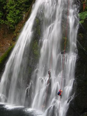
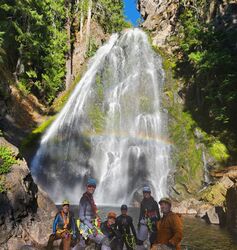
- Signature photo above is Thunder Falls.
Approach[edit]
Summit Creek Campground divides the canyon in the Upper and Lower sections. You will need to set up a shuttle to descend the Lower or Upper sections. No shuttle needed for the Middle section, which starts at the old campground (or the bridge crossing the creek) and end ends right after Thunder Falls.
Descent[edit]
Upper Section[edit]
3 miles, 5h to 5.6h, 3-4 rappels max 80ft, 1st rappel is Fish Ladder Falls (about 1.5 miles from the start).
- R1: 40'. Rappel DCL - tree. This is Fish Ladder Falls and consists of 3 drops separated by pools.
- R2: This is a two-stage rappel:
- First stage: 25'. Rappel DCR off tree into a small pool. Be careful getting to the tree due to exposure.
- Second stage: 80'. Rappel off a log further back. This will require extending the webbing in case other anchors do not exist.
- R3: 30'. Rappel or Downclimb.
Middle Section[edit]
0.1 miles, adds 1h-2h, adds 2-3 rappels max 120ft.
Access to R2 & R3 is possible from above with a short ~20ft rap from a tree of your choice. A worn trail along the side of the canyon shows hikers have tried to reach the top of Thunder Falls, but (hopefully) turned back.
- R1: 15'. DCL - from tree or downclimb DCL.
- R2: 20'. DCL - from single bolt. (Check the bolt and recent trip reports as it has sustained some damage in past flooding events.) There are two options: Disconnect at a small ledge about 4' above the water and jump out away from the falls, or rappel into the water. The current will push you against the wall DCL - be ready to use your legs to push you away from the wall and into the pool. In low/medium water flow, white water will exist but there is no hydraulic concern. The drop can be jumped, but check the depth first.
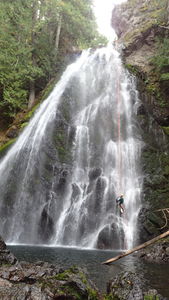
- R3: 120'. Thunder Falls has two rappel options:
- DCR: 1 bolt anchor + knot chock. You will be rappelling directly in a water line with a stronger water flow than DCL.
- DCL: 2 bolt anchor. A 200 ft rope doubled will barely get you to the bottom.
For both options, extend the pull and swim across the pool for an easier pull.
- R4: Downclimb 10 ft. Do not slide, this has broken ankles! Note the memorial plaque DCR below the drop.
Lower Section[edit]
3 miles, adds 4h-6h, adds 4 optional short rappels that can be bypassed/jumped and much scrambling/downclimbing. Expect significant increase in water flow after a tributary joins.
Exit[edit]
Middle Exit[edit]
After downclimbing the small cascade immediately after Thunder Falls, look for a memorial plaque on a rock DCR. From the plaque, look immediately across the creek for a DCL moss-covered talus field. Climb up the talus field a few yards to find a well-worn user trail that leads steeply up climber's left and back to the road. Follow the road a couple hundred yards back to the old campground.
Optional: lap the middle section two or three times more!
If you have time, you may want to check out the nearby Mount Rainier National Park. The Grove of the Patriarchs is a nice stroll among millennial trees, and a short side hike from this trail will allow you to check out the Olallie Creek flow checkpoint.
Red tape[edit]
None.
Beta sites[edit]
 CanyoneeringNorthwest.com (archive.org) : Summit Creek
 Super Amazing Map : Summit Creek Canyon
