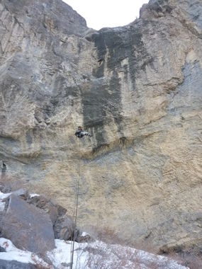
Sword Canyon
Jump to navigation
Jump to search
Also known as: The Sword.
| Rating: | |||||||||||||||||||||||||||||||
|---|---|---|---|---|---|---|---|---|---|---|---|---|---|---|---|---|---|---|---|---|---|---|---|---|---|---|---|---|---|---|---|
| | Difficulty:3A IV (v3a1 IV) Raps:16, max ↨190ft
Red Tape:No permit required Shuttle: | ||||||||||||||||||||||||||||||
| Location: | |||||||||||||||||||||||||||||||
| Condition Reports: | |||||||||||||||||||||||||||||||
| Best season: | Nov-Mar (avg for this region)
|
||||||||||||||||||||||||||||||
| Regions: | |||||||||||||||||||||||||||||||
Introduction[edit]
Approach[edit]
Descent[edit]
Exit[edit]
NOTE: THIS CANYON JOINS UP WITH THE WALL OF FEAR CANYON NEAR THE BOTTOM AND SHARE THE LOWER DROPS
Red tape[edit]
Beta sites[edit]
 Super Amazing Map : The Sword
Trip reports and media[edit]
Background[edit]
Originally explored by Scott Swaney on 2014-01-11 under the identifier "C RT 4.". See more at Scott Swaney's Death Valley Canyoneering Exploration.
