Swurrly Canyon
| Rating: | |||||||||||||||||||||||||||||||
|---|---|---|---|---|---|---|---|---|---|---|---|---|---|---|---|---|---|---|---|---|---|---|---|---|---|---|---|---|---|---|---|
|
| |||||||||||||||||||||||||||||||
| | Difficulty:4A III PG (v4a1 III) Raps:1, max ↨270ft
Red Tape:No permit required Shuttle:None Vehicle:High Clearance Rock type:Sandstone | ||||||||||||||||||||||||||||||
| Start: | |||||||||||||||||||||||||||||||
| Parking: | |||||||||||||||||||||||||||||||
| Condition Reports: | 8 May 2026
"This canyon is very VERY short. The first stemmy slot and downclimbs were somewhat forgettable. We didnt bother hiking our gear around as bet suggests |
||||||||||||||||||||||||||||||
| Best season: | Fall to Spring
|
||||||||||||||||||||||||||||||
| Regions: | |||||||||||||||||||||||||||||||

Introduction
Fun downclimbing leads to a deep and skinny slot, ending with an epic free-hanging, 300 foot rappel. While it is shorter than it's neighbor Burrly Canyon, it packs a lot in for its short length. The exit involves a 40 foot section of 5.7 climbing, So make sure to set a rope on it beforehand if you are unsure about your climbing abilities.
Approach
The parking area is located directly at the top of the canyon drainage. Head east a short distance to the rim of the canyon and follow it south for about 300 feet until you can descend into the canyon.
Descent
Head down the canyon drainage 600 feet or so until the first down-climb is encountered. From here it is possible to rim walk along the east rim (RDC) of the canyon for about 1000 feet to a place where you can climb down into the canyon and leave your gear and ropes. If leaving your gear at the start of the lower section, retrace your steps back up to the top of the canyon and descend the canyon from there. The upper section of the canyon doesn’t have any rappels and consists of stemming and down-climbing. None of the stemming takes you more than 10 feet off of the ground and the down-climbs are short as well. The canyon makes a left turn at the end of the upper section, with the walls on the RDC becoming shallow enough that escape is possible. This is where you would have stashed your gear if you chose to do so.


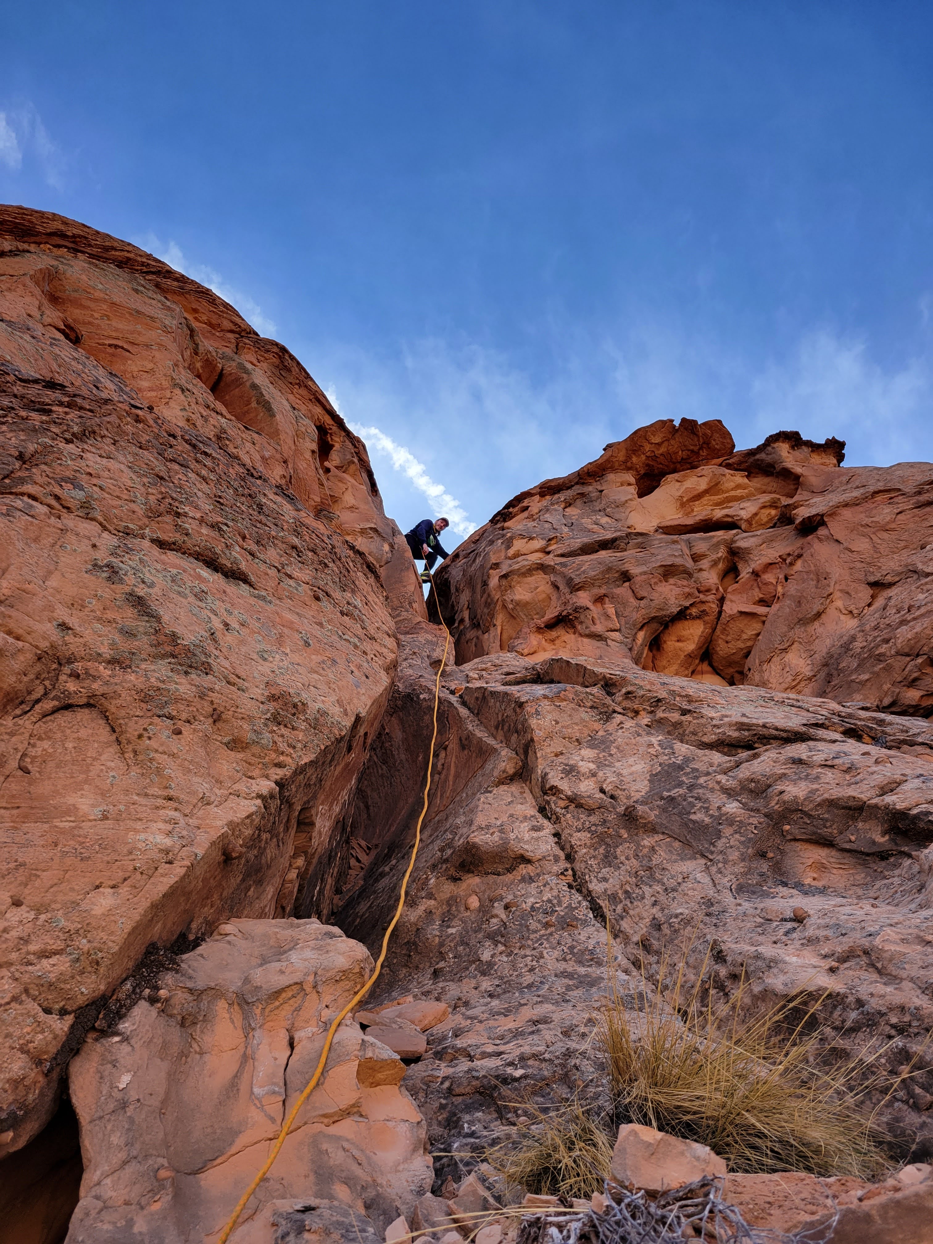
The lower section begins with a series of larger down-climbs and becomes much more narrow and dark than the upper section. A long, narrow hallway leads to the final drop. Make sure that you enter this section in the order that you want to descend the rappel because passing people here is very difficult. There are multiple solid chockstones at ground level that can be used as anchors. Depending on which anchor is used, between 20 and 40 feet of webbing will be needed to extend the anchor enough for a clean pull. A tight section is encountered on the rappel that will force any larger individuals to climb up and over it. After navigating through the tight section, it’s about 270 feet of free-hanging to the ground. With a 340 foot pull-cord, we were able to get a clean pull from a hill opposite the rappel.


Exit
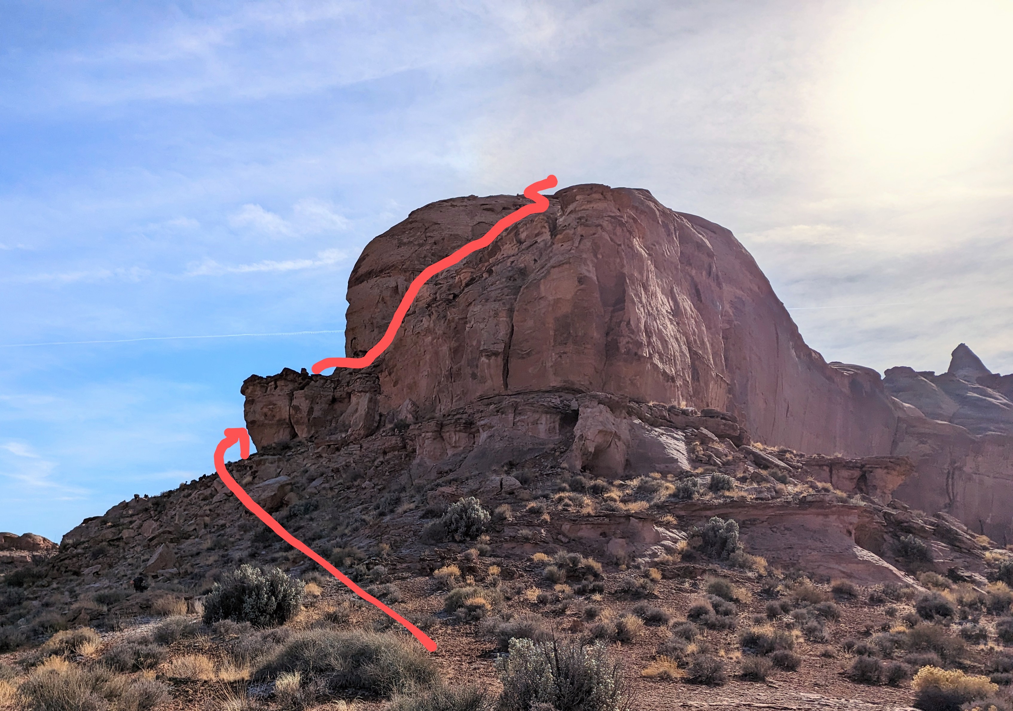
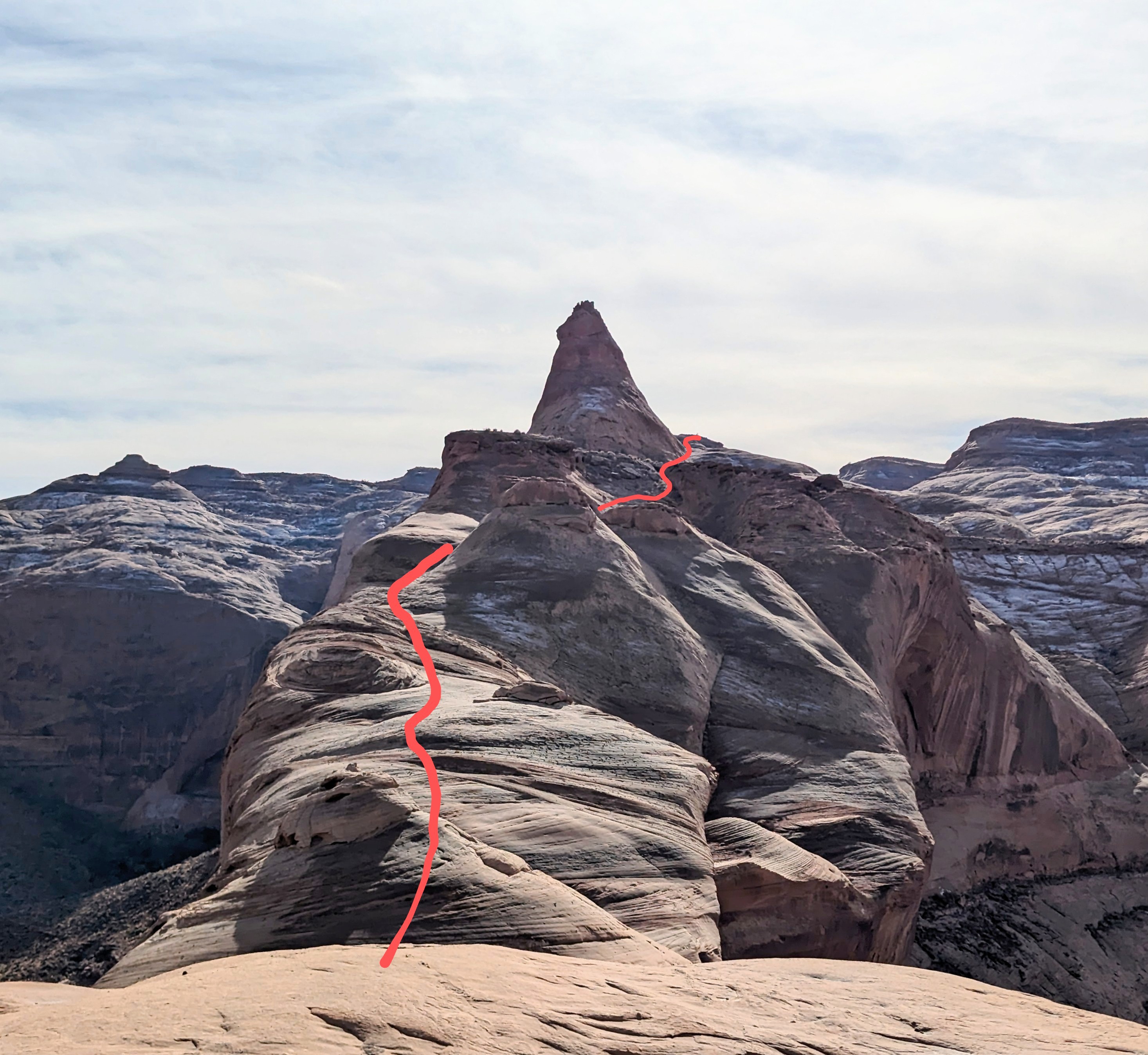
At the bottom of the final rappel, climb the hillside to the west (LDC) to the base of a cliff band and follow it North for 0.5 miles to the end of the peninsula. Right before you round the tip of the peninsula, there is a ramp. The ramp should lead you out to the tip of the peninsula and the start of the 5th class climbing section. If you fixed a line here before starting the canyon, this is where you will ascend about 40 feet. If you are climbing this section from the bottom, it goes at about 5.7. There are a few arches near the bottom that could be slung as protection and a crack half-way up that would take small cams. Climb up a short chimney and then exit the chimney with a stemming move out onto a face. Climb a second easier chimney that leads to low-angle scrambling. After reaching the top of the climbing section, look for a place to cross over to the ridge on the climbers left, and follow the ridge up the peninsula. There isn’t 5th class climbing from here on out, but parts of the exit would be dangerous or impossible if covered in snow. Follow the ridge until you are near the top of the mesa. Skirt along the western edge of the Swirly Canyon drainage until an exit is possible on your right near the very top of it. The parking area should be visible from here.
Red tape
Beta sites
Trip reports and media
The Exploration of Swurrly Canyon