Tierdrop Canyon
| Rating: | |||||||||||||||||||||||||||||||
|---|---|---|---|---|---|---|---|---|---|---|---|---|---|---|---|---|---|---|---|---|---|---|---|---|---|---|---|---|---|---|---|
| | Difficulty:3A II (v3a1 II) Raps:3, max ↨132ft
Red Tape:Permit required Shuttle:None Vehicle:Passenger | ||||||||||||||||||||||||||||||
| Start: | |||||||||||||||||||||||||||||||
| Parking: | |||||||||||||||||||||||||||||||
| Condition Reports: | 27 Apr 2024
"-. ===CONDITIONS===. Approach and Exit:. Standard approach and exit are obvious and nothing noteworthy to mention.. Water Exposure:.&# |
||||||||||||||||||||||||||||||
| Best season: | All year
|
||||||||||||||||||||||||||||||
| Regions: | |||||||||||||||||||||||||||||||
Introduction[edit]
The Dirt is Alive!:
If you look closely, you can see a microscopic community of life in the soil. Dark, lumpy surfaces are mature biological soil crust: a mixture of cyanobacteria, mosses, lichens, fungi, and algae. Young, living soil looks a lot like sand, and it needs to be left undisturbed for many years to mature and help plants grow. Just one footprint does years of damage. Dark, mature soil crusts are the basis of life in this desert. One footprint destroys years of growth. This remarkable soil community holds the sand together, absorbs moisture, produces critical nutrients for plants, and provides seed beds for new plants to take hold.
Please don’t walk on it. Stay on designated trails to protect living soil and plants.
One of three great loops (U-turn, NOT Tierdrop, Tierdrop) right off the park avenue trail head in Arches NP. Low risk of flash flood, easy access with little exposure, and quick exit means you could do all three in one outing.
Note, Tierdrop feature natural anchors only and webbing is NOT always in place. In addition, the anchors are often far away from the drop point requiring either a lot of webbing to reach the edge or a dicey pull with increased risk of a stuck rope. Always perform a test pull.
Approach[edit]
Up rock gully. Approx 400 foot climb. Class 2 climbing most of the way. The last 10-15 feet is class 3/4 with some exposure. Recommend spotting first climber up and then a handline for followers. For Tierdrop, turn left at top and stay along ridge, if it is windy consider staying lower but avoid areas with soil.
- Tierdrop is the far left large opening,
- Not Tierdrop is in the middle after going left, it is hidden from view by the dome slopes in the middle and access by trail below going from the far left.
- U-turn is the only one that goes to the right along the ridge after ascending the gully.
Descent[edit]
Please note that all the anchors in this canyon are natural. There are NO fixed anchors. Therefore Rap distance may vary widely depending on the current natural anchor. Anchor position changes with canyon remodeling. Two 60 M ropes are advised or one 60 M rope and and long pull cord.
- R1: long sloping drop with two primary anchor placements. One is large rock 50 feet from drop point the other is tree located LEFT of canyon also 50 feet back from drop point. Consider rope length and pull.
- R2: slope rappel on the rock pile ~103' of rope as cairn anchor is far back from the edge
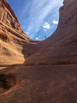
- R3: overhang with approx 100+ foot drop depending on anchor.
Exit[edit]
After the last rap follow the slickrock to the LEFT around the edge. There will be an eventual weakness to downclimb to the valley flour. This is the preferred exit to avoid soil erosion and development of causal trails.
Alternative: R4, rap off the slick rock ledge (40 feet) to the bottom.
Follow the water course down canyon and merge with the Park Avenue trail. Turn right at the junction with the social trail or enjoy the Park Avenue walk to the left then back. Head toward the rock staircase that leads up to the cars.
Red Tape[edit]
Permits[edit]
A permit is required for any and all canyoneering within the boundaries of Arches National Park. Permits have group-size limits that varies depending on canyon or route. Permits cost $6 for a group and currently there is no quota limit, but that might change at some point in the future. A separate permit is required for each canyoneering route.
Permits must be obtained online through the link below and are available online 8:00AM MT one day in advance up to 5:00PM MT the day of the trip. The permit must also be readily available, printed or on a mobile device, during the trip should a ranger ask to see it.
- Permit Link: https://www.recreation.gov/permits/4251908
Group-Size Limits[edit]
Canyoneering groups are limited to a maximum of 10 people for this canyon.
Larger groups sharing the same affiliation (school, church, club, scout group, family, friends, etc., or combination thereof) may divide into groups smaller groups provided they do not occupy the same canyon, drainage, general area, or the same route on the same day and also have the necessary permits.
- Canyoneering regulations are available here: https://www.nps.gov/arch/planyourvisit/canyoneer.htm
Park Entrance Fee:[edit]
A NPS park entry fee or park pass is required. Additionally, a timed-entry reservation may be required to enter Arches National Park.
Timed Entry Reservations:[edit]
- Information about timed-entry reservations is available through the park's website: https://www.nps.gov/arch/planyourvisit/timed-entry-reservation.htm
- Timed-entry reservations must be obtained online here: https://www.recreation.gov/timed-entry/10088426
Beta sites[edit]
 RoadTripRyan.com : Tierdrop Canyon
 Super Amazing Map : Tierdrop
 Climb-Utah.com : Tierdrop Canyon - Arches National Park
 Moab Canyoneering Book by Derek A. Wolfe : Tierdrop Canyon
 SummitPost.org : Tierdrop
 CanyonCollective.com : Tierdrop
Trip reports and media[edit]
- http://adamhaydock.blogspot.com/2013/09/tierdrop-canyon-arches-national-park.html
 Candition.com : Tierdrop


