Tinnitus
| Rating: | |||||||||||||||||||||||||||||||
|---|---|---|---|---|---|---|---|---|---|---|---|---|---|---|---|---|---|---|---|---|---|---|---|---|---|---|---|---|---|---|---|
|
| |||||||||||||||||||||||||||||||
| | Difficulty:4B II R (v5a2 II) Raps:3+, max ↨80ft
Red Tape:No permit required Shuttle: Vehicle:4WD - High Clearance Rock type:Navajo Sandstone | ||||||||||||||||||||||||||||||
| Location: | |||||||||||||||||||||||||||||||
| Condition Reports: | 13 May 2025
"High effort canyon for not much canyon. The grove rappel was interesting but thats about it. We ascended out the bottom of the canyon with a present |
||||||||||||||||||||||||||||||
| Best season: | Fall, Winter, Spring
|
||||||||||||||||||||||||||||||
| Regions: | |||||||||||||||||||||||||||||||

Introduction[edit]
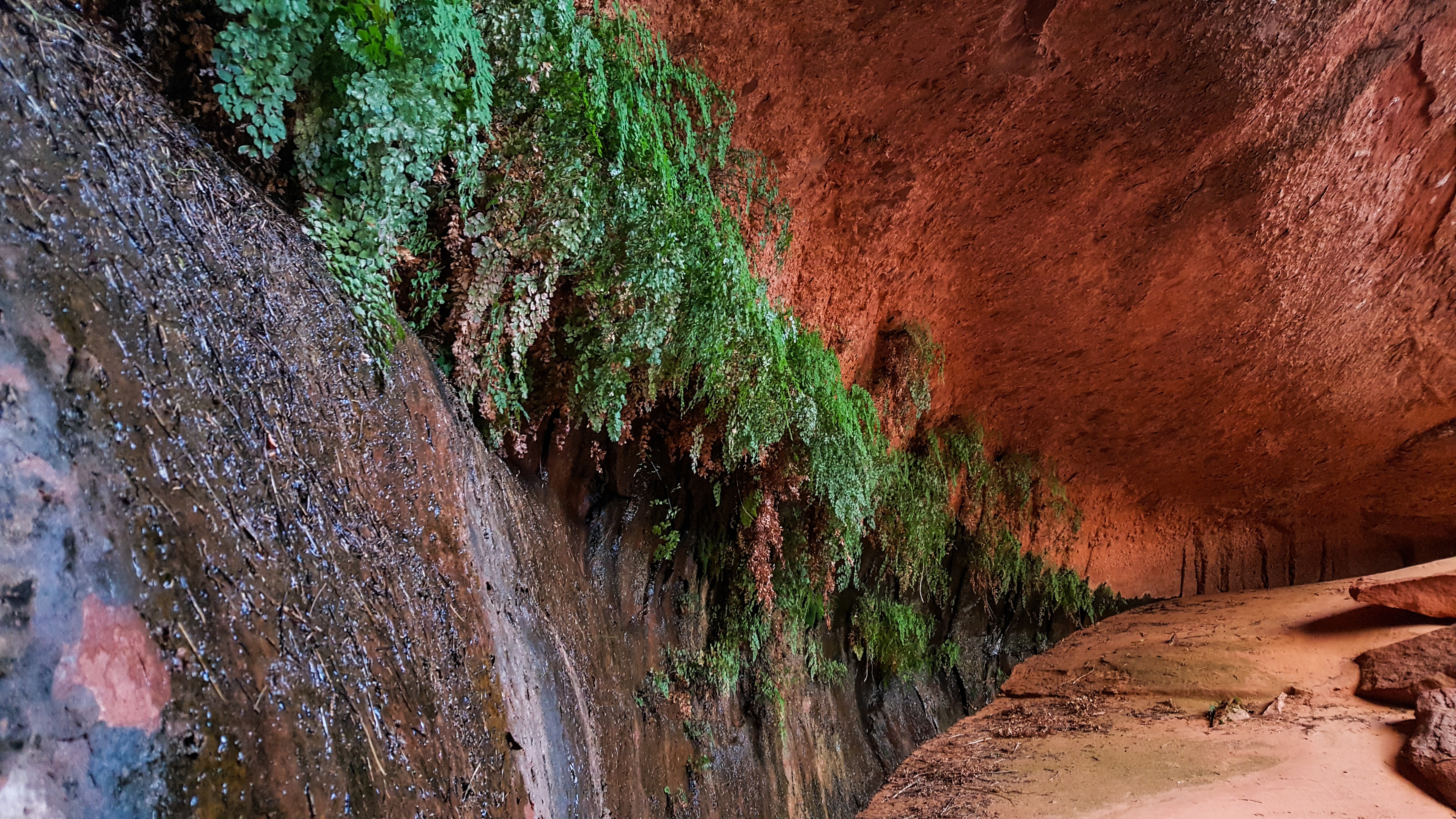
Tinnitus is a very short canyon that is packed with action and top of the line scenery. It is best combined with other warm springs canyons like sinusitis or glaucoma due to it's short length, but has the potential to take much more time for inexperienced groups. You can expect pothole escapes, sandtrap rappels, wading/swimming, and some brief R-rated high-stemming. You'll need to fix a rope on the rim near the end in order to escape the canyon if you don't have a boat waiting for you in the lake. The final cave rappel into the maidenhair fern garden is incredible and worth the trip just to see it.
Approach[edit]
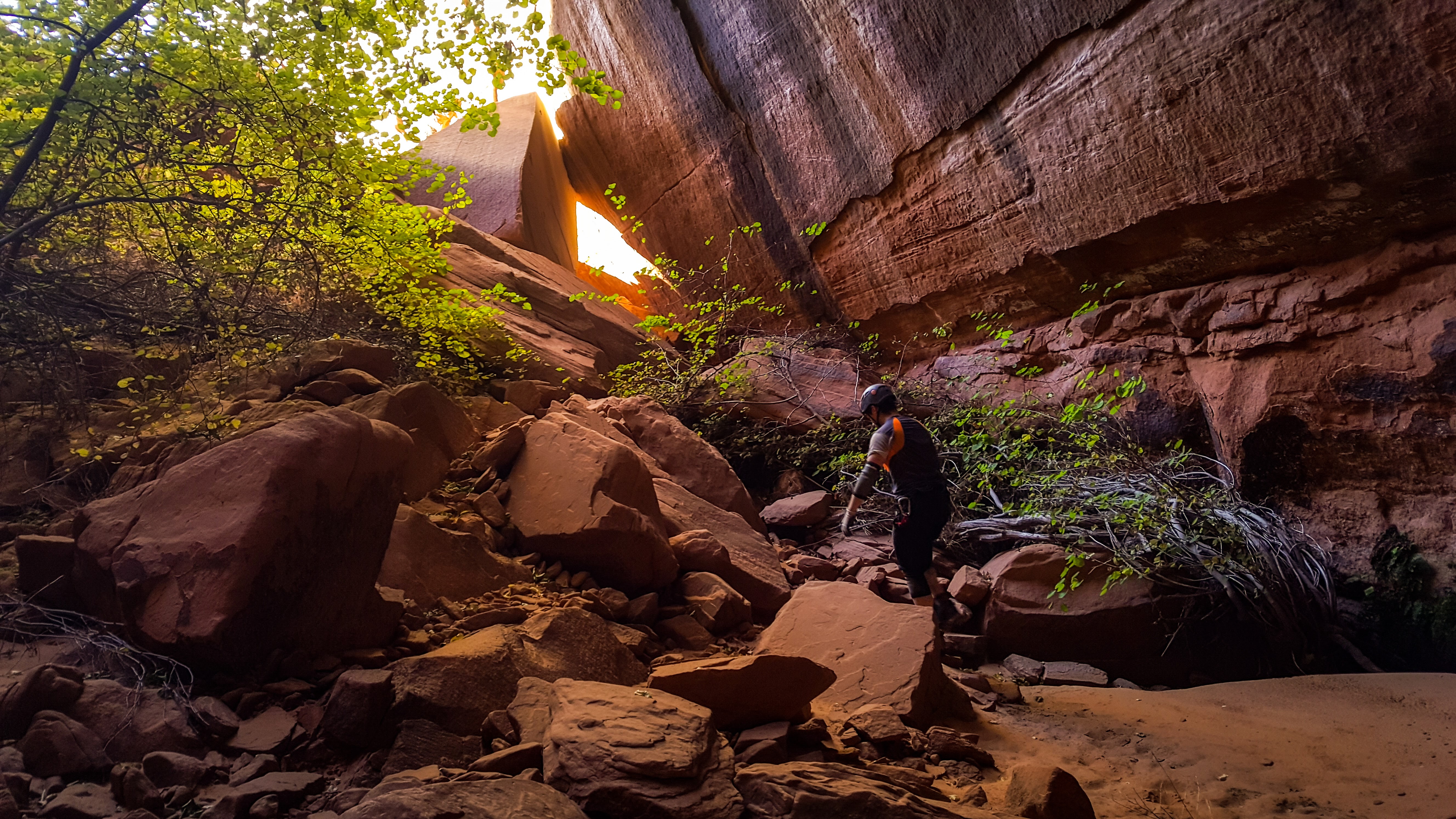
There is good parking and a turn-around spot on top of the hill. You can drive further down the road, but there is no good parking. From here follow the GPS tracks down through the initial cliff-band and down into the canyon drainage. Most of the drainage will be open with a few potholes that can be bypassed.
Descent[edit]
Once at the head of the canyon where the drainage suddenly narrows at the first rappel, you'll need to rim walk and set up your escape rope if you are not descending into the lake and exiting with a boat. There are a few different options as far as ascending out of the canyon is concerned. Walk the north rim of the canyon until you reach a crack system that descends into the canyon right before the canyon opens up. You'll want to check and make sure the rope reaches the top of the final rappel. If you choose this option, you'll get to the final rappel of the canyon and have you escape line at its start. This would be a two-stage ascent after doing the final rappel, ascending back up the rappel and then your escape line once your back at the top of the rappel. If you walk the north rim further down canyon to where it opens up, you can set a single 200ft line to ascend out of the end of the canyon instead of doing the two stage ascent at the final rappel. The two-stage ascent is probably better for bigger groups but whatever option works best for you. The first rappel can be setup using the sandtrap, but you'll want to toss some potshots first since it drops straight into a keeper-pothole. This is followed by a few potholes that you may need to do a packdrag or another sandtrap rappel to get into depending on water levels. The next section involves some wading or possibly swimming depending on water levels. The canyon then tightens and drops into potholes, it appears that it is too tight to go down into the potholes, so you can stem 20 or so feet above the ground to avoid them all. The final rappel is next and is anchored off a chockstone. This is where you escape line will be if you set it up in the crack. Continue down the rappel which is about 80 feet down a dark hole. You emerge into an amazing alcove covered in maidenhair ferns in a boulder filled area. Past the boulders you reach the lake which is the turn-around point for those without a boat. You'll likely have to rappel into the lake unless water levels are very high, and I'd bring a 200ft rope through the canyon just to be safe if you plan to rappel into the lake.


Exit[edit]
Ascend up the fixed line you set either in the open area at the end or back up at the top of the final rappel. If you are exiting by boat, you'll get to avoid the exhausting ascent out. If ascending out, you can follow the drainage back up to the top or the slickrock ridge to the north of it where you can exit the same way you came in.
Red tape[edit]
Beta sites[edit]
 Climb-Utah.com : Tinnitus - Lake Powell
- Super Amazing Map : Tinnitis