Tramway Canyon
| Rating: | |||||||||||||||||||||||||||||||
|---|---|---|---|---|---|---|---|---|---|---|---|---|---|---|---|---|---|---|---|---|---|---|---|---|---|---|---|---|---|---|---|
| | Difficulty:3A II (v3a1 II) Raps:0-2, max ↨75ft
Red Tape:No permit required Shuttle:None Vehicle:4WD - High Clearance | ||||||||||||||||||||||||||||||
| Location: | |||||||||||||||||||||||||||||||
| Condition Reports: | 16 Jun 2020
"the first rap is easy to bypass LDC with some class 3 scrambling. the second isnt too bad, decided to avoid a spicy little traverse by rapping. didn |
||||||||||||||||||||||||||||||
| Best season: | summer
|
||||||||||||||||||||||||||||||
| Regions: | |||||||||||||||||||||||||||||||
Introduction[edit]
Tramway Canyon is a short, mediocre canyon route with loads of brush and dead trees to thrash through with two rappels up to 75 feet.
From AZ 87 north of Clints Well take Lake Mary Road (forest road 3 - paved) west for 7.4 miles to turn left onto FR 81. Drive west on 81 for 3.1 miles, then turn left onto 81 E. Continue south on 81 E (ignoring the many side-branching roads), bearing right at a Y junction after 6.9 miles to turn onto FR 693. At the 7.7 mile mark stay straight (left) to take 693B (not signed here). At 8.3 miles bear left, then left again at 8.6 to finally arrive at the Tramway Trailhead at 8.7 miles. Bring a good vehicle with clearance and plenty of patience for this road, especially the last mile or so is very slow with big basalt boulders littering the roadway.
Approach[edit]
From the trailhead, hike north back on the road you drove in on for about .5 miles, then leave the road and cross-country hike to reach Tramway Canyon. You can probably take a relatively prominent drainage down - I missed the drainage, but found the steep slopes to be not that difficult to navigate to reach the canyon floor. Once in the canyon, turn right and head down.
Descent[edit]
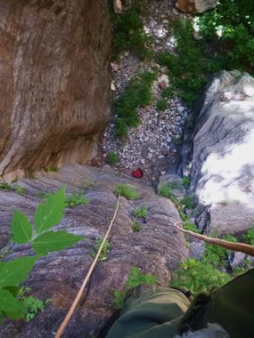
The upper canyon becomes more and more choked with brush and downed trees the farther you get and after some hiking you will reach a few somewhat sporty, but manageable downclimbs. In due time you will reach the first rappel of 75 feet from a tree on canyon left, shortly afterward is a downclimb of about 15 feet at a large boulder that can be done on either side of the boulder. Rappel number two is reached after some more bushwacking and is about 60 feet from another good tree at the top of the drop. Not too much more hiking and thrashing will bring you to West Clear Creek.
Exit[edit]
Once you reach West Clear Creek, turn right and follow decent, but overgrown use trails about .3 miles to reach the bottom of the Tramway Trail for the exit - a small cairn on a small rocky beach on the right just under a good campsite (and probably a few day hikers) mark the start of the trail. After taking a dip in the creek and fielding questions about how you weren't really "climbing", head up the steep, but well-defined trail about .5 miles all the way back to the trailhead.
Red tape[edit]
Beta sites[edit]
 Super Amazing Map : Tramway Canyon
 HikeArizona.com : Tramway Canyon
