Via Ferrata Terrisi
| Rating: | |||||||||||||||||||||||||||||||
|---|---|---|---|---|---|---|---|---|---|---|---|---|---|---|---|---|---|---|---|---|---|---|---|---|---|---|---|---|---|---|---|
| | Difficulty:Via Ferrata Raps:1, max ↨90ft
Red Tape:Access is Restricted Shuttle: Vehicle:4WD | ||||||||||||||||||||||||||||||
| Start: | |||||||||||||||||||||||||||||||
| Parking: | |||||||||||||||||||||||||||||||
| Condition Reports: | 25 Nov 2023
"We did this Via Ferrata after doing Chipitin and Matacanes canyons so we were a bit tired on the approach. The hike up is short and semi-steep on a we |
||||||||||||||||||||||||||||||
| Best season: | Autumn to Spring
|
||||||||||||||||||||||||||||||
| Regions: | |||||||||||||||||||||||||||||||
Introduction[edit]
This remote Via Ferrata was opened summer of 2023 on the backside of the Sierra Madres Mountain range. It was created to increase tourism to the area and to replace the Ruta Vertigo Via Ferrata since it has fallen into disrepair and access issues.
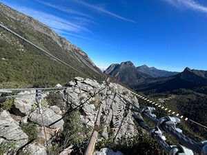
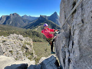
It's a beginner-friendly Via Ferrata with two routes. The West Route (easier) and the more challenging South Route. It has two ziplines, several suspension bridges, and stunning views.
Approach[edit]
The driving approach starts on Highway 20, the same road that takes you from Santiago to the mountain village of Potrero Redondo (Matacanes). However, instead of leaving the highway, you'll stay on it for approximately 35 km through the beautiful Sierra Madre Mountains to the town of Laguna de Sanchez. From there you'll leave the pavement and travel on a dirt road, which can be very rough at times, for an additional 10.5 km to the small mountain village of El Hondable. Park in front of an abandoned red building or along the road just before you arrive at the town. The Via Ferrata is 1,066 feet above you to the North on a prominent rock outcropping.
Hiking Approach From the vehicle head east up the hill, there is a fairly well-established trail that takes you up to the saddle to the east of the Via Ferrata. From the saddle, head west and slightly uphill to the Via Ferrata.
Descent[edit]
Via Ferrata Course
There are two separate courses. The shorter West Course and the longer, more challenging South Course. Depending on the number of people there, guides recommend starting with the West first.
West Course
You'll begin with an approximate 125-foot (38-meter) zipline over a vertical drainage. Once on the other side, you'll ascend affixed iron rungs to a cable bridge. Face outward to enjoy the stunning views. At the end of the bridge ascend to the suspension bridge and the end of the West Course.
South Course
Follow an obvious route to the south of the staging area. Clip in and follow the course counterclockwise around the corner to a 90-foot rappel. Many groups leave the rope in place and retrieve it once the course is completed. Bring either two 100-foot (30-meter) ropes or one 200-foot (60-meter) rope so you don't have to leave the rope in place. Be careful with rope placement, the rock is sharp. We core shot our rope. There are three bolts. Use either the middle or right bolts. Do not use the left bolt to avoid rope damage.
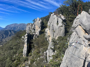
After the rappel follow the loose, steep trail counterclockwise around to the base of a pinnacle and ascend the rungs to the top. Once there, you'll traverse the long suspension bridge with a balancing beam center section.
This is followed by a lengthwise log bridge. From the end of the bridge circle clockwise around the outcropping on rungs to just above the rappelling station and the start of the approximately 130-foot (41-meter) zipline and the completion of the South Course.
Required gear
- Harness, helmet, and gloves.
- A Via Ferrata Lanyard or two carabiners and two personal anchors.
- At least one Via Ferrata pulley/trolley like the I|S|C Zippey Trolley. The trolley can be shared since it isn't far to take it back to the beginning of the ziplines.
Exit[edit]
Hike back the same trail.
Red tape[edit]
The Via Ferrata was built by a commercial company using public money on public land and therefore accessible for use by the public. There is a fee of 350 pesos per person to use the Via Ferrata. This fee does not include harness, lanyard, or pulley rental, nor is any rental available nearby. You'll have to bring your own equipment.
If you are not experienced enough to run the Ferrata on your own you can hire a local company to guide you. Many adventure companies in Monterrey can lead you and pay the usage fee. Aldea Matacanes


