Warren Creek
| Rating: | |||||||||||||||||||||||||||||||
|---|---|---|---|---|---|---|---|---|---|---|---|---|---|---|---|---|---|---|---|---|---|---|---|---|---|---|---|---|---|---|---|
| | Raps:11-17, max ↨140ft
Red Tape:No permit required Shuttle:Required 50min Vehicle:High Clearance | ||||||||||||||||||||||||||||||
| Start: | |||||||||||||||||||||||||||||||
| Parking: | |||||||||||||||||||||||||||||||
| Shuttle: | |||||||||||||||||||||||||||||||
| Condition Reports: | 16 Jul 2023
"Long shuttle and longer creek, but nice to tick off another canyon destination in the "back Gorge." Time is car-to-car, not including time spent setti |
||||||||||||||||||||||||||||||
| Best season: | Jun-Aug
|
||||||||||||||||||||||||||||||
| Regions: | |||||||||||||||||||||||||||||||
Introduction[edit]
Warren Creek is a tributary of the Columbia River draining a large area of the north side of Mt. Defiance. There are two primary objectives here:
1) Hole-in-the-Wall Falls (3C I) This is a fun shortie outing you can knock out in an hour or so and visits one of the most interesting features of the creek: Hole-in-the-Wall Falls. This route is described on a separate page.
2) Full Warren (3C IV) Warren Creek originates from Warren Lake, high on Mt. Defiance and is a worthy objective with a number of waterfalls along its course. It appears upper Warren was first descended in 2017, although it was not well documented until 2023. This adventure takes most of a day and requires a long shuttle (or long approach hike). With a 1.5mi bushwhack out, it's a somewhat high pay to play.
- The rating on this page may be slightly over-inflated as most of the ratings are actually for Hole-in-the-Wall Falls. Hopefully this will be corrected in time.
- The creek's watershed includes Warren Lake on Mt. Defiance: 1.84mi^2.
- A good checkpoint is to hike in on the bike trail to the bottom of Hole-in-the-Wall Falls.
- Expect a long day in the creek. Getting an early start is key. Bring a headlamp just in case.
Approach[edit]
Shuttle[edit]
A long shuttle is possible by taking I-84 east to Hood River, then south and up the Kingsley Road all the way to the end of pavement. Follow logging arounds around the south side of the reservoir over to Dead Point Road (FR 2820). Eventually turn right on FR 2821 for a final 2.3mi to the Warren Lake Trailhead. The shuttle takes a little over an hour. Arranging a drop-off by a non-canyoneering friend might be the preferred option here. Or it might be possible to hire a shuttle service out of Hood River.
- Warning: Google Maps lies and will try to route you on gated, non-existent roads, and ATV trails north of the Kingsley Reservoir. Do not follow their directions or you will be sad.
Hiking[edit]
If in need of punishment, it's also possible to hike up via the Starvation Ridge Trail. Total distance: ~4mi, 3800ft elevation gain. This eliminates the need for a shuttle.
Descent to Warren Creek[edit]
From the Warren Lake Trailhead, hike ~0.4mi, crossing an ATV track, and eventually meeting the trail coming up Starvation Ridge (elevation: ~3800ft). Turn left and continue 100 yards before bombing down steep slopes to the north to drop into the drainage when it's convenient. It is not worth going all the way to Warren Lake as the drainage coming out of the lake is reportedly dry and brushy. Continue down the drainage, losing over a thousand feet in elevation, to approximately 45.66168, -121.70073 at ~2650ft elevation where a flowing tributary enters DCR. This is a good place to suit up.
- In future, it might be nice to try to come down this eastern tributary as it might net you +1 nice rampy rappel right to the aforementioned suit-up area.
Descent[edit]
Expect steep, loose, slippery terrain, and occasional thick bushwhacking. In the upper canyon, there were signs of some recent landslide activity. Don't take risks here. This would be a very bad place to have an accident. Extracting someone with a broken ankle from the depths of Warren Creek would be extremely difficult. You'll need to walk for a bit between rappels.
Continue downcanyon to reach R1 at about 2500ft elevation. There are several downclimbs and minor obstacles.
- R1: 10ft. Short nuisance rappel from tree DCR.
- R2: 50ft from nicely placed tree DCL. This is the first major rappel. It's located at about 2500ft elevation.
- R3: 15ft nuisance rappel from small tree DCR.
- R4: 25ft down a narrow groove.
- R5: 40ft from tree DCL.
- R5: 35ft from thin tree DCL. There's a big log in the middle in the drop, so rappel is out of the water.
- R6: 25ft from tree DCR.
Eventually Warren Creek narrows up and reaches a corner. Two nuisance rappels are needed (R7 & R8) to get to the top of R9. The creek becomes very committing at this point. Escape might be difficult but not impossible. Rock walls soar skyward.
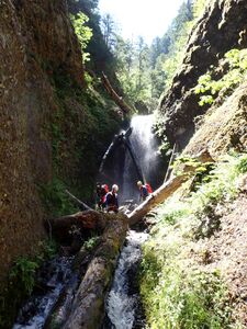
- R7: 10ft nuisance rappel (or downclimb) to top of a large logjam. Be careful walking around on top of it, as it's undercut and could be subject to collapse.
- R8: 20ft nuisance rappel to the bottom. Check out the cave-space underneath the logjam.
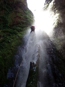
- R9: 85ft from log creek center. Drop is slightly overhanging and you will go into the full force of the flow. R10 comes immediately.
- R10: 55ft from fallen log DCL. Extended anchor for a better pull.
Walk downstream a short distance to the top of the Warren Falls sequence. (One previous group was able to escape from the top of the falls DCL on class 4-5 loose rock with one more lead climb above. The group describes negotiating steep forested terrain, while making their way up onto the ridge and eventually west over to the Defiance Trail. It looks pretty awful; hopefully you don't have to follow their footsteps.) Beware rockfall on this entire sequence. We had one small rock come down spontaneously from above while we were rigging R11. Stay well clear of the landing zone.
- R11: 40ft anchored on a fallen log DCL.
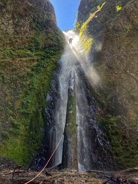
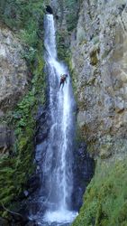
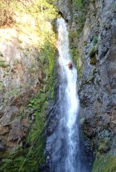
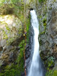
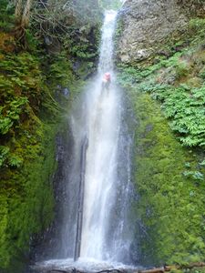
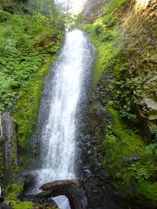
- R12: Warren Falls - 110ft anchored on fallen log creek center. This puts you into a very nice line down the DCR side of the falls. This is the signature photo of this page.
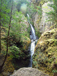
At the bottom is a great place to take a break and enjoy the majestic amphitheater. Just around the corner is the guardian falls barring passage from anyone hiking up from below.
- R13: 20ft from thin tree DCL. (Or very careful downclimb bypass DCR.)
This ends the main technical section of the canyon. From bottom of R12, it's time to pay for all this fun. It's about 1.5mi of bushwhacking to the Starvation Creek Trail. Head downstream on one side or the other, following occasional game or user trails. The area is not visited frequently, so expect occasional thick thrashing and numerous logjams. Stop as needed to cool off in pools. There are several short drops (8-15ft) along the way that can be bypassed, rappelled, or use a hand line. Sometimes rappelling is less work (and more fun) than fighting your way up and around. Persevere and, one day, you'll pop out at the hiker bridge.
Exit[edit]
At ~400ft elevation, reach a bridge crossing the creek and the trail. Options:
- 1) Exit the creek DCL here and follow the trail over the nose of the ridge to reach a junction in 5min. Turn right and follow the trail down to the base of Hole-in-the-Wall Falls.
- 2) Continue downstream about 5min to reach the top of Hole-in-the-Wall Falls. This sequence is described on its own page. The longest rappel on Hole-in-the-Walls is 140ft.
At the bottom of Hole-in-the-Wall Falls, follow the bike trail east to the Starvation Creek trailhead.
Red tape[edit]
None.
Beta sites[edit]
 Super Amazing Map : Warren Creek
- Zach Forsyth Trip Report
Trip reports and media[edit]
Background[edit]
Not clear if it was a first descent, but Zach Forsyth and several others descended Warren Creek in 2017. It is not known if they ran Hole-in-the-Wall Falls.
