Whale Creek
| Rating: | |||||||||||||||||||||||||||||||
|---|---|---|---|---|---|---|---|---|---|---|---|---|---|---|---|---|---|---|---|---|---|---|---|---|---|---|---|---|---|---|---|
| | Raps:7-10, max ↨230ft
Red Tape:No permit required Shuttle:Required 18mi | ||||||||||||||||||||||||||||||
| Location: | |||||||||||||||||||||||||||||||
| Condition Reports: | 11 Oct 2024
"I attempted to access whale creek by following a game trail up the ridgeline south of whale creek. This ended where it was too steep to continue at 22 |
||||||||||||||||||||||||||||||
| Best season: | March-aug
|
||||||||||||||||||||||||||||||
| Regions: | |||||||||||||||||||||||||||||||
Introduction[edit]
This creek was overrun by the major Riverside Fire in Sept 2020. The rock was terrible pre-fire so be very mindful of how to negotiate severely burn forest before attempting. Star rating is from the canyon pre-burn.
Whale Creek is/was one of the best canyons in the Clackamas River area. It is a wild and remote canyon with tall rappels in flowing water. The checkpoint for this canyon is the exit at Indian Henry campground, where the creek crosses the road. Inspect the flow and keep in mind the canyon narrows down in a couple spots to a mere 5ft wide. The most dangerous spot is probably the final chute rappel, which cannot readily be accessed to check directly.
Approach[edit]
Leave an exit vehicle at Indian Henry Campground off Hwy 224.
Getting to the start of the canyon takes close to 3 hours! This consists of a 45 minute drive, an hour road hike battling countless fallen trees, a 30 minute drop in to the creek, and finishing with a 30 minute creek walk through thick Devils Club. The shuttle is 16.2 miles. Go NW on Hwy 224 and turn south past Fish Creek Campground just before the bridge. Follow FR 5410 until it becomes impassable due to fallen trees. Backtrack a few hundred feet to a pull out and park at 43.131, -122.1016. Hike down the road for 2.5 miles to 45.1065, -122.0973 overcoming hundreds of fallen trees along the way. This will be the longest 2.5 miles you have ever hiked. Go left off the road and bushwhack downhill losing 400+' to the drainage. The bushwacking is thick at first but soon relents. Next battle extremely thorny Devils Club in the creek until you reach the first drop at 45.10727, -122.09157.
Descent[edit]
The technical section drops 1,000 feet in 0.5 miles, featuring several long drops that tumble down beautiful basalt columns into amphitheaters. Pulls are generally not a problem and visual or auditory signals are easily accomplished.
- R1: 50ft from tree.
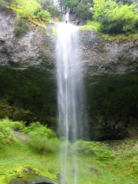
- R2: 230' from stout tree on left (2-tier: 50’ then 175’), mostly a light mist near the main flow. Anchor a few feet above ground on the tree and the rope barely touches the top ledge. The ledge 50 feet down is a rounded edge. Although both edges are very friendly from a rope abrasion standpoint, creeping the rope is recommended due to the overall length of the rappel and the fact that it is mostly free hanging. If you are doing a releasable anchor, you will need to rappel below the knot unless you have a 550 foot rope, to be able to lower someone 225 feet.
- R3: 110ft from tree Left, in the flow
- R4: 40ft
- R5: 110' from tree high on L, full shower on rappel, great (beware on the pull the rope falling and catching on rocks midway down the waterfall)
- R6: 30' single bolt on right (preceded by 10ft downclimb)
- R7: 75' from log in middle, 20ft chute into freehang (the water shoots out in a nice rooster tail but you are only in the flow momentarily)
Previous notes on the big rappel: NOTE: This rappel has been known to cause core shots in the past. From its current anchor from a tree L of the watercourse this may no longer be an issue. There are only two main points of contact. The first had a sharp edge but was made smoother by hitting it with a rock. The second part seems to be a long moss covered roll over with no sharp edges. Continue to use your best judgement and evaluate your rope positioning. Try to eliminate sharp edges if possible to prevent damage to your rope. As of 7/29/20 there is a large rock on the edge ready to fall. Do not knock this down on your teammates!! The notorious 230' drop has eaten several 300' ropes despite attempts to pad the edges. Under these circumstances the best way to protect the rope is to creep it: release rope at a speed of half an inch every 5 seconds while people are rappeling. After each rappeller, pull up and repeat the creeping process. This will eliminate abrasion on a single point on the rope. Note that creeping does not provide perfect protection... and will not protect your rope against accidental pendulum swings and poor rappel technique.
Alternately, it's possible to get down doing a dry bushwhack rappelwith a 200ft rope & pull line of equal length to rappel DCL of the main fall and do the drop in two stages. This avoids the sharp edges, but is a dirty rappel through the trees and may have good odds of sticking ropes.
Exit[edit]
Exit by scrambling down river until you reach the parking area. Quite pleasant as far as creeking goes as there is no Devils Club and it is not overgrown. When you reach the flats (nice open forest), stay L in somewhat more open forest until encountering user trails near the creek that lead back to the parking area.
Red tape[edit]
None.
Beta sites[edit]
Trip reports and media[edit]
Background[edit]
This canyon was reportedly first descended by Evan Topinka, exact dates and circumstances are unknown.

