Whitehorse Creek (Olympic Peninsula)
| Rating: | |||||||||||||||||||||||||||||||
|---|---|---|---|---|---|---|---|---|---|---|---|---|---|---|---|---|---|---|---|---|---|---|---|---|---|---|---|---|---|---|---|
| | Raps:7-10+, max ↨120ft
Red Tape:No permit required Shuttle:Optional 0.6mi Vehicle:Passenger | ||||||||||||||||||||||||||||||
| Start: | |||||||||||||||||||||||||||||||
| Parking: | |||||||||||||||||||||||||||||||
| Shuttle: | |||||||||||||||||||||||||||||||
| Condition Reports: | 2 Aug 2025
"Ran the full canyon as outlined in rope wiki. Flow has tailed off now as the snow has mostly melted from up high on the mountains. Still a great run a |
||||||||||||||||||||||||||||||
| Best season: | Jul-Sept
|
||||||||||||||||||||||||||||||
| Regions: | |||||||||||||||||||||||||||||||
Introduction[edit]
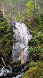
Whitehorse Creek is a tributary of the Hamma Hamma River and originates from Lake of the Angels, a high alpine lake in a basin at ~4900ft between Mt. Stone and Mt. Skokomish inside Olympic National Park. The creek passes out of the park, through the Mt. Skokomish Wilderness, and finally ends in Olympic National Forest. This page describes the section of Whitehorse Creek between ~1600 to 2600ft elevation.
Currently, there are two options:
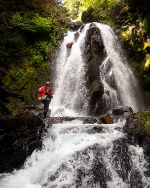
1) Main Section: This is the recommended route. Access is great, the rappels are fun, and this approach gets you right into the best part of the creek. Expect 7-10 rappels to 120ft.
2) Upper Whitehorse: Faster, experienced groups might enjoy this option which starts higher and adds about +6-8 rappels (short, but rapid-fire) in the upper canyon.
Water Flow[edit]
The watershed is about 1.5mi^2 with the highest point being Mt. Stone at ~6400' elevation. Be aware: the upper basin above Lake of the Angels can hold snow well into July. The best time to visit the creek is probably July through September. Whitehorse seems to hold more water than other canyons in the general area.
- Checkpoint: It's possible to take a look at the creek just off the Hamma Hamma Road west of the Putvin Trailhead. Be aware, the creek down here is large and swampy and this is not a good indicator of conditions higher up. Expect to find considerably more water in the creek. Another option might be to thrash in to take a look at the final waterfall on the creek (~5-10min from the road).
Approach[edit]
Main Section[edit]
Follow the Putvin Trail upwards for 1.2mi (~800ft gain) to meet an old logging track. Follow the track west 100ft to a signpost (~2370ft) where the Putvin Trail continues upwards towards Lake the Angels. Instead of going up, continue down the road to a switchback. This is a good place to suit up. When ready, bushwhack almost due west about 200ft, then descend carefully to the creek (losing about 100ft elevation) on the nose of a short ridge. If you find the right place, you should be able to enter the creek without need of a rope. You will drop in right above R9 as described in the beta below.
Upper Whitehorse[edit]
At the signpost described above, continue on up the Putvin Trail (becomes much steeper and rockier) for another 0.3mi (+300ft gain) to ~2690ft elevation. At the trail's closest approach to the creek, it abruptly turns to the right (approx. 47.58625, -123.25359). Look straight ahead to find a faint user trail (possibly an old climber's trail?) that contours ahead, then drops down through the slide alder into the creek. It was a tad overgrown, but there was zero bushwhacking in July 2021. Suit up at the creek.
- Note that USGS maps do not accurately show the location of the Putvin Trail.
Descent[edit]
From beginning to end, Whitehorse is pretty action-packed. There's barely any walking at all before the next obstacle presents. Depending on comfort and flow, you might do more or less rappels. Bring plenty of anchor material.
This beta isn't perfect please try to take notes and update.
Upper Whitehorse[edit]
- R1: 20ft from boulder pinch in the flow DCL.
- R2: 50ft from log DCR.
- R3: 50ft with a sweet rooster tail in the top section.
- R4: 40ft from boulder pinch.
- 15ft downclimb.
- R5: 35ft from tree DCL.
- Series of shorter downclimbs.
- R6: 50
Downclimb Downclimb
- R7: 55ft from log in the pool.
- R8: 30ft DCL from huge fallen log with downclimb below. Caution there is a strainer in the middle.
Main Section[edit]
- R9: 40ft from tree DCL. You can redirect the rope around a gnarled tree right at the lip to stay a bit more in the water.
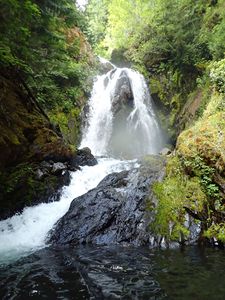
- R10: Photogenic set of twin falls. 65ft from cedar roots DCR. (This drop might benefit from a bolt station.)
- R11: 60ft from boulder pinch DCR. Immediately below is another short drop: downclimb or rappel.
- R12: 60ft from stunted tree DCL.
- R13: 25ft dry rappel from a tree DCR. Avoids a chute of water DCL that the entire creek is funneled through. Descending the chute might be dangerous in high flow.
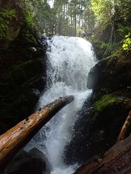
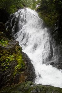
- R14: 110ft photogenic horsetail falls. Low water: great rappel from a large tree DCL. High water: rappel from a tree DCR. Lots of sticks in the bottom DCR to tangle the rope when its pulled.
Ahead, the creek narrows up through a series of short drops.
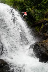
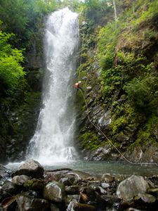
- R15: Whitehorse Falls - 120ft. Low-moderate water: use a two bolt station DCR. Using the bolts in high water could be quite dangerous as it sends you right into the maw of two overlapping rooster tails shooting out in opposite directions. High water: rappel from a tree DCL for a line mostly out of the water.
Downclimb through a short narrows to the beginnings of a chute DCR.
- R16: 40ft. Low-to-moderate water: downclimb to reach a two-bolt station DCR. Don't link these bolts, they are submerged in high flow. There is a giant log in the middle of this rap that will catch the tail of your rope when pulled. High water: rappel 70 feet from a tree far DCL (~20ft back from the edge).
Exit[edit]
Upon exiting the chasm, exit the creek DCR immediately before a logjam / swamp. Make your way wherever is easiest, heading more-or-less due south to pop out on the Hamma Hamma Road. The bushwhack should take less than five minutes. If you didn't stash a shuttle car nearby, just walk the road 0.6mi back to the Putvin Trailhead (easy and flat). Declare victory.
Red tape[edit]
- Be aware: the creek originates in a Wilderness area. Power drills, drones, etc. are not permitted. The creek "exits" the Wilderness at ~2350ft elevation, although the boundary follows the creek down to about 2100ft making the rules in this section a little blurry. Below 2100ft is definitely outside of the Wilderness area.
- A wilderness permit is required by all visitors (usually filled out at the Putvin Trailhead).
- If you are planning to camp inside Olympic National Park, you'll need a wilderness camping permit.
Beta sites[edit]
Trip reports and media[edit]
Background[edit]
Creek was originally explored by Nick Lonstad, Zack Forsyth, and others.
Whitehorse was first documented in July 2021 by Kevin Clark, Wade Hewitt, Sean Brady, Keith Occena, and Alex MacDonald. A second team returned in 2022 to scout out the lower (and better) entrance.
Future Explorations[edit]
Above the "Upper Whitehorse" section described here are a LOT more waterfalls. Descending from Lake of the Angels to the Hamma Hamma Road would probably be an epic canyon adventure (probably a very long day or even two days to complete). Beware what looks like a total mess of avalanche debris located around 3000ft.
