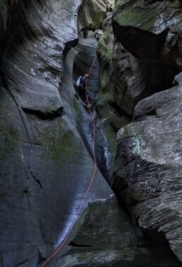
Wilbur Canyon
| Rating: | |||||||||||||||||||||||||||||||
|---|---|---|---|---|---|---|---|---|---|---|---|---|---|---|---|---|---|---|---|---|---|---|---|---|---|---|---|---|---|---|---|
| | Difficulty:3B III (v3a2 III) Raps:5-6, max ↨80ft
Red Tape:No permit required Shuttle:None Vehicle:4WD - High Clearance Rock type:Sandstone | ||||||||||||||||||||||||||||||
| Start: | |||||||||||||||||||||||||||||||
| Parking: | |||||||||||||||||||||||||||||||
| Condition Reports: | 3 Aug 2025
"Evening run, so entire canyon was shaded and things were cooler than normal, but 4/3 wetsuits were sufficient. Just under 4h car-to-car at a moderate |
||||||||||||||||||||||||||||||
| Best season: | Late Spring to Early Autumn;BEST in Jun;Jul;Aug;Sep
|
||||||||||||||||||||||||||||||
| Regions: | |||||||||||||||||||||||||||||||
Introduction[edit]
Another scenic West Clear Creek Canyon trip with rough, rocky approach roads. A good 4WD with some clearance will get you to the starting pin.
Without adequate clearance or 4WD capabilities, you can opt to hike the remaining section of road. This could stretch the trip out to more like 6-8 miles depending on where you park.
Approach[edit]
Descent[edit]
R1: 20'
R2: 80' off tree.
R3: 50' off rock pinch.
R4: 20’ off rock pinch.
R5: 50’ from bolt LDC.
Chimney downclimb / handline into narrow hallway section.
R6: 60' off bolt RDC into West Clear Creek.
Exit[edit]
Head up stream passing the first break on your right and a flat gravel beach on the left. This first break is the wrong gully and has been labeled on the kml.
The proper exit is just a couple hundred feet further upstream than the false exit and is clearly marked with cairns. While steep and loose, a fairly well-trafficked trail quickly becomes apparent. Once above the initial steep section, drop into and follow the drainage along the right side and eventually exit up to the rim along a trail (reference KML).
Red tape[edit]
Beta sites[edit]
- TheBetaProject.org: Wilbur Canyon
 OnRopeCanyoneering.com : Wilbur Canyon
 HikeArizona.com : Wilbur Canyon
 Arizona Technical Canyoneering Book by Todd Martin : Wilber Canyon
 Super Amazing Map : Wilbur Canyon
 ZionCanyoneering.com : Wilbur Canyon
 CanyonCollective.com : Wilbur
 https://www.stavislost.com/hikes/trail/wilbur-canyon
