Wildcat Tank Canyon
| Rating: | |||||||||||||||||||||||||||||||
|---|---|---|---|---|---|---|---|---|---|---|---|---|---|---|---|---|---|---|---|---|---|---|---|---|---|---|---|---|---|---|---|
| | Difficulty:3A II (v3a1 II) Raps:2, max ↨70ft
Red Tape:No permit required Shuttle:None Vehicle:High Clearance | ||||||||||||||||||||||||||||||
| Location: | |||||||||||||||||||||||||||||||
| Condition Reports: | 25 Apr 2025
"Great stemmy slot! Actually fairly pretty too! We drove to the top and dropped in from there. Highclearence 4x4 recommended for the trail to the top. |
||||||||||||||||||||||||||||||
| Best season: | Oct-Nov;Feb-Apr
|
||||||||||||||||||||||||||||||
| Regions: | |||||||||||||||||||||||||||||||
Introduction[edit]
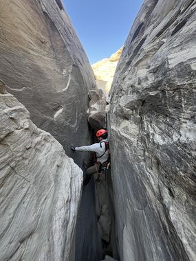
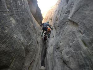
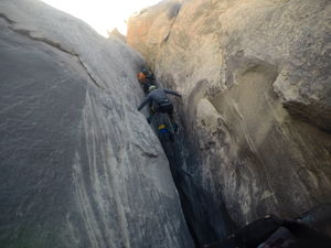
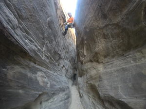
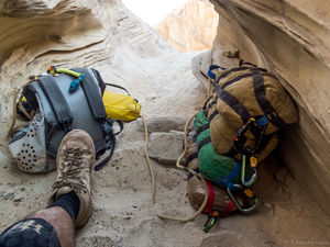
A short, fun and scenic high-stemming canyon with two rappels just north of Page, AZ. Wildcat Tank Canyon is a true high-stemming canyon, but the moves are relatively easy and it's a good first stemming canyon as you're never higher than about 30 feet above the canyon floor. The stemming is continuous for the majority of the canyon (with regular spots to stop and rest). Hang packs and wear knee pads.
Between the short, easy approach (about 30 minutes), the cool toadstool formations and beautiful views at the top, the fun moves in the canyon and zero exit hike, this is a great little canyon.
Approach[edit]
From Page, drive north on HWY 89 for 8 miles, then turn left onto an unmarked dirt road. This road is bit difficult to spot as you're driving, it is just north of a section of guard rail where the highway crosses a shallow wash (the lower reaches of Wildcat Tank) and directly across from a green mile marker sign for Kanab. After turning onto the dirt road, at .9 mile bear left to stay on the main road, crossing a cattle guard; at 1.3 miles you will reach a corral with a parking area, drive straight past the corral, then right and through a fence at 1.4 miles. Bear left at a Y in the road at 1.6 miles and follow this last section of road to its' end at a small car park. The parking area is right at the end of Wildcat Tank canyon.
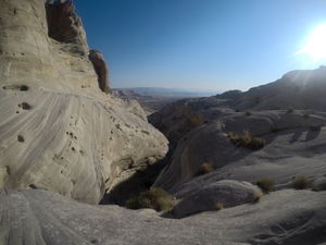
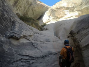
From the car park, follow a faint sandy road south, then east as it heads toward the lower drainage of the canyon, moving down to hike on the slickrock east along the canyon. Hike down into the wash via a low point in the slickrock, cross the drainage, then scramble up the other side to get onto the base of this sloped ridge. Follow light use trails in the beginning, then intermittent rock cairns as you wind your way up the ridge to the south/south west above the canyon. After the ridge becomes less steep and opens up a bit, stay alongside the canyon on the slickrock all the way to the obvious head of the canyon just under a short slope with some prominent "toadstool" rock formations.
Descent[edit]
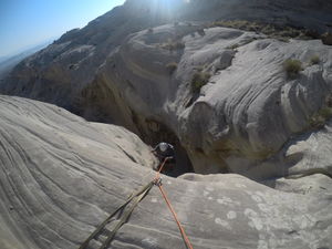
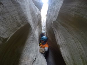
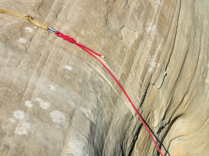
The canyon begins right away with a rappel of 60 feet off of a pair of bolts. After this initial drop, the canyon alternates between short open sections, narrow grinding hallways and a good amount of relatively low exposure high-stemming - simply work your way down canyon. Eventually you will come to the second rappel of 70 feet from two bolts. This second rappel drops you into a nice alcove with one more stemming down climb to reach the sandy bottom of the canyon.
R1: 60' two bolts.
R2: 70' two bolts.
Exit[edit]
Hike the short distance out of the canyon, out of the wash to the north and your car.
Red tape[edit]
Beta sites[edit]
 Super Amazing Map : Wildcat Tank Canyon
- https://www.stavislost.com/hikes/trail/wildcat-tank-canyon
Trip reports and media[edit]
Trip report 11/10/2019[edit]
Party of two, parked at the top, completed the canyon in 2.5 hours. Anchor at first rap was in good condition. I suggest leaving a fixed line and retrieve on the way back. Avoid pulling ropes here, there are already deep grooves in the sandstone. If you are doing the canyon from the bottom, use a toggle rigging to avoid grooves. As described, the rest of the route is high stemming. The bottom is usually wide enough for a person standing, but progress at the bottom is very slow. At the last rap, we inspected the knot shock and decided not to use it. There is no way to back it up, and the sandstone in the whole canyon is brittle. We used stacked potshots as an anchor at the last rap.
