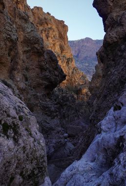
Yankee Canyon
| Rating: | |||||||||||||||||||||||||||||||
|---|---|---|---|---|---|---|---|---|---|---|---|---|---|---|---|---|---|---|---|---|---|---|---|---|---|---|---|---|---|---|---|
| | Difficulty:3A III (v3a1 III) Raps:3-5, max ↨165ft
Red Tape:No permit required Shuttle:None Vehicle:Passenger | ||||||||||||||||||||||||||||||
| Start: | |||||||||||||||||||||||||||||||
| Parking: | |||||||||||||||||||||||||||||||
| Condition Reports: | 27 Jan 2023
"Replaced R1, R2, and R4 webbing. Some very light flow through the canyon. Didn’t bother trying to keep feet dry as we needed to cross fish creek sev |
||||||||||||||||||||||||||||||
| Best season: | winter, spring, fall
|
||||||||||||||||||||||||||||||
| Regions: | |||||||||||||||||||||||||||||||
Introduction[edit]
A canyon located between Sierra and Tango Canyons with a shorter technical section but some fun rappels and great scenery.
Approach[edit]
The initial approach is the same as the other "call sign canyons" in the area: Foxtrot, Romeo, Sierra and Tango. From the car park at Fish Creek vista, follow the road a short distance and then descend into the drainage below which will lead to fish creek. Follow the creek upstream until it can be crossed, scramble up to the left, then hike northeast above and roughly following the shallow drainage below and on your right. The further you make it up this route, the more likely it becomes that you will start finding one of a few faint trails that leads up between the cliffs on your left and the drainage below you on your right - follow this steep path all the way to the top. From here is a complicated route heading north around the many upper drainages of Horse Mesa to eventually work your way up to the ridge that separates Sierra and Tango Canyons (the recommended route follows the uploaded GPS track). Make your way west up this moderate ridge heading towards then passing by a prominent rock tower to eventually reach a cliff band that can be easily bypassed a short ways back and on the left. Continue down the drainage from here to reach the next cliff band. This band can be fairly easily downclimbed on the far right side, or an anchor could be constructed for rappel.
Descent[edit]
Head down into the drainage and enter the watercourse with a short downclimb of about 15 feet.
R1: 20’ off a pinch point, handline, or downclimb.
R2: 165’ feet from a single bolt and hanger canyon left, takes you down a fun, sculpted series of ledges.
A few more sporty downclimbs takes you to, then through a short, but decent section of narrows until you reach the next rappel.
R3: 40’ off pinch point.
The final rappel is found shortly thereafter from a perch that offers great views of the creek below.
R4: 90’ off boulder down a vertical face with a free hanging section.
A bit more careful bushwacking and downclimbing on canyon right will take you down the rest of the way to Fish Creek.
Exit[edit]
Turn left and hike up Fish Creek the remaining 2.2 miles back to the parking area. Depending on water levels, numerous shallow creek crossings may be necessary.
Red tape[edit]
Beta sites[edit]
 Super Amazing Map : Yankee Canyon
