Young Creek
| Rating: | |||||||||||||||||||||||||||||||
|---|---|---|---|---|---|---|---|---|---|---|---|---|---|---|---|---|---|---|---|---|---|---|---|---|---|---|---|---|---|---|---|
| | Raps:5-6, max ↨115ft
Red Tape:No permit required Shuttle:None Vehicle:Passenger | ||||||||||||||||||||||||||||||
| Location: | |||||||||||||||||||||||||||||||
| Condition Reports: | 15 Nov 2025
"The approach is not terrible right now with most leaves off of the bushes. Be careful of loose rock and branches as always. Flow was nice, with fun wa |
||||||||||||||||||||||||||||||
| Best season: | Dec-Jul
|
||||||||||||||||||||||||||||||
| Regions: | |||||||||||||||||||||||||||||||
Introduction[edit]
Be aware: Young Creek was hit by a spot-burn from the Eagle Creek wildfire in Sept 2017 and was closed for a significant period of time. Caution is recommended on the approach.
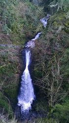
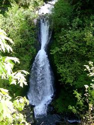
Young Creek is located just west of Bridal Veil in the Columbia River Gorge. The Historic Columbia River Highway (HCRH) crosses the creek on a beautiful high bridge built in 1915. Signs denote this as “Shepperds Dell". A short paved trail leads down to the top of one of the waterfalls (R4). However, there are two more big falls just upstream and another waterfall under the bridge. The bridge is conveniently located for assessing the flow on the creek prior to committing to the canyon. The canyon sees substantially higher flow in winter and spring.
- Beware poison oak, briars, and rockfall on the approach and exit.
- Use caution when walking along the road; it's narrow and there's little to no shoulder. This may be the most dangerous part of the canyon.
- Watershed: ~2.0mi^2.
Approach[edit]
Directions[edit]
Take I-84 to exit 28 (Bridal Veil). Turn right on the Old Columbia River Hwy and continue 1.7mi to a signed pullout for Shepperds Dell.
Hike In[edit]
- Classic Approach
From the pullout, cross the bridge and continue west along the road a hundred yards to the next obvious drainage on the south side. Leave the road and follow a dirty user trail upward about 200ft. It's steep, but goes quickly. Helmet recommend per loose rocks. Head for the obvious notch above, avoiding thickets of briars and poison oak. Once through the notch, the terrain abruptly flattens out. Follow the bench left (east) until you reach the creek, now deeply entrenched below. Looking down, you should be able to spot the top of R2 where the creek abruptly plunges into a slot.
- Shuttle Approach
It might be possible to shuttle up Alex Barr Road and hike/bushwhack north from the obvious switchback, staying on public land. Eventually, meet the classic route and follow it to the creek (~3mi, losing some 600ft of elevation).
Descent[edit]
Like most of the Columbia Gorge, the rock quality in Young Creek is poor. Inspect all bolts carefully before use.
- R1: 30ft approach rappel from tree high DCL to enter the drainage. This rappel drops you right on top of R2.
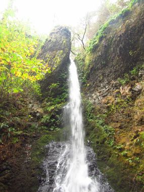
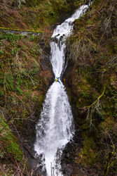
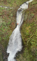
- R2: 115ft from two bolts connected with a Y-anchor high along the DCL wall. (Station can be overgrown with moss; the bolts are almost directly under the tree anchor for R1.) Option to be in or out of the flow.
- Below the pool is a mossy V-slot with three short drops (3-5ft in quick succession). Can be downclimbed in lower water - or follow high shelf DCR to 40ft rappel from a tree.
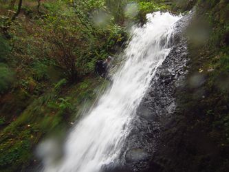
- R3: traverse (15ft) + rappel (95ft). Rappel (or traverse) from two-bolt anchor to second unlinked bolt station at the brink. This rappel is the crux. At high flow, be prepared to stem over the torrent and use a narrow unseen ledge DCR. Forces will be very pushy as you enter the flow; must be confident in your high water skills. The anchor manager will not be able to see rappellers. It may be wise to manage abrasion on this pitch.
- Downclimb or rappel 20ft from rock pinch DCR. Continue to the railed pedestrian walkway atop R4. Escape is possible via the trail.
- R4: 60ft from concrete post at the end of the walkway. It's recommended to set a temporary anchor, then go back and remove it after finishing the canyon.
- R5: 20ft from a large rock DCR.
A short downclimb exits the narrows. Make your way downstream to the railroad tracks.
Exit[edit]
Walking along the railroad line is trespassing (not to mention trains come barreling through here at 60mph), so stay off the tracks. Keep back in the woods and head west until you reach the next gulley. Climb upwards wherever is easiest (avoiding thickets of briars, and poison oak) until you reach the wall below the old highway about 100ft above. If you come up in the right spot, there’s a nice person-sized opening in the stone guardrail (seemingly designed for canyoneers). Walk back along the road to your car. Declare victory.
Red tape[edit]
- Please stay on public land during the approach and exit.
- Canyoneers will be in full view from the bridge and pedestrian walkway on the last two rappels. Canyoning is still not a well known activity in the Columbia Gorge, and it's good not to linger or overstay your welcome. Please help us be good stewards, and pack out any trash you find under the bridge. This helps keep us in the good graces of Oregon state park officials.
- Land managers have requested that no more bolts be added to the creek, but we have permission to replace the current anchors when the time comes.
- Please do not leave anchors in publicly accessible areas to keep the inexperienced / curious from attempting to follow you.
Beta sites[edit]
Shepperd's Dell State Natural Area
Trip reports and media[edit]
Background[edit]
Young Creek was first descended by Keith Campbell and Kevin Clark in October 2015.
