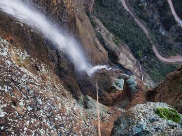
Zigzag Canyon
| Rating: | |||||||||||||||||||||||||||||||
|---|---|---|---|---|---|---|---|---|---|---|---|---|---|---|---|---|---|---|---|---|---|---|---|---|---|---|---|---|---|---|---|
| | Difficulty:3A II (v3a1 II) Raps:4, max ↨190ft
Red Tape:No permit required Shuttle:Optional 5min Vehicle:Passenger | ||||||||||||||||||||||||||||||
| Start: | |||||||||||||||||||||||||||||||
| Parking: | |||||||||||||||||||||||||||||||
| Shuttle: | |||||||||||||||||||||||||||||||
| Condition Reports: | 22 Nov 2025
"Nice trickle from recent rains. Solid chain anchors all the way. Completely staying out of the canyon till basically at the edge is the way to minimiz |
||||||||||||||||||||||||||||||
| Best season: | BEST in Nov;Dec;Jan;Feb
|
||||||||||||||||||||||||||||||
| Regions: | |||||||||||||||||||||||||||||||
Introduction[edit]
Zigzag is the absolute epitome of a "cliffaneering" route. Horrible bushwacking in a drainage that is no more scenic than any other in the area leads to a series of big rappels down a climbing route. The most commonly used approach route completely skips the canyon itself and with it all the bushwacking except for maybe the last 100 feet - this approach is shown on the map. Worth doing only when flowing (somewhat rare, and often if it is flowing the road getting to it is closed or impassable due to flash flooding) or if simply looking to do some big rappels. This area of the Superstition Mountains is absolutely beautiful though, so if your are looking for canyon scenery do nearby Minnow Canyon instead.
Approach[edit]
Don't bother with the canyon itself at all, but hike along the slopes and easy ridge north of the drainage to make it to the point where the drainage drops off of the cliff. Stay on the very top of the ridge and "zig zag" your way down to completely avoid the brushy drainage until you reach the edge of the cliff which you will soon be rappelling down. The head back to the drainage to your south and make your way down to the canyon start. This approach has been added to the map.
Descent[edit]
ZigZag is now broken up into 4 drops all off bolted anchors. This canyon warrants the use of a PSA, due to the fact you're always close to the edge.
R1: 90' into a small alcove. To find the first anchor, cross the drainage and go up and look for the chains. It may be helpful if the first person down takes a rope to rig the second rappel.
R2: 190' to a ledge. With the second drop rigged, you can easily sequence the rest of the group through this alcove to avoid overcrowding. Depending on group size, this is a fairly large alcove and will hold your typical group (6-8) if necessary.
For the third rappel, downclimb and then make your way RDC and look for the chains not the webbing.
R3: 60’ and will drop you down to a nice flat section where the final drop can be rigged.
R4: 170’ to the base of the wall.
Exit[edit]
The exit is now hiking up Fish Creek hill to the lookout at the top. I recommend having a shuttle vehicle to get back to the trailhead from the lookout. The hike back up the road is about 2.5 miles and 1000 feet of elevation gain.
Red tape[edit]
Beta sites[edit]
 Super Amazing Map : Zigzag Canyon
 HikeArizona.com : Zigzag Canyon
 OnRopeCanyoneering.com : ZigZag Canyon
Trip reports and media[edit]
https://youtu.be/QqYSbwznuRw?si=0uzOJ_QW7BYc4kTm
