Allison Mine Loop
| Rating: | |||||||||||||||||||||||||||||||
|---|---|---|---|---|---|---|---|---|---|---|---|---|---|---|---|---|---|---|---|---|---|---|---|---|---|---|---|---|---|---|---|
| | Difficulty:3A III (v3a1 III) Raps:3, max ↨80ft
Red Tape:No permit required Shuttle:None Vehicle:Passenger | ||||||||||||||||||||||||||||||
| Location: | |||||||||||||||||||||||||||||||
| Condition Reports: | 30 May 2021
"Had a great time running the full canyon and exploring the mine. The traverse approach starting from halfway between the saddle and the summit was fin |
||||||||||||||||||||||||||||||
| Best season: | Spring;Summer;Fall;Winter
|
||||||||||||||||||||||||||||||
| Regions: | |||||||||||||||||||||||||||||||
Introduction[edit]
Allison Mine is a lot of work for just 5 rappels (yes, we did five).
The Brennen beta refers to the 'steep gully' route, which we took. I don't recommend this route unless your team is highly conditioned.
If you're up for a challenge, the upper section offers 6+ great rappels and a killer approach workout.
Approach[edit]
Park at the East Fork Trailhead. Follow the trail towards the bridge to nowhere, but at about the three mile mark, with Swan Rock on your left, find the trail up the Allison Gulch (34°15'46"N 117°44'47"W, elevation 2410ft). This is an obvious turnoff where the Allison creek joins the San Gabriel river, right after two successive river crossings. The trail up the gulch starts out okay, but after the first creek crossing becomes pretty washed out, so it involves some easy bushwhacking and scrambling. After about 3/4 mile in the creek, look out for the cairn on the north side, up on a rise just after the first big draw to the north (34°16'01"N 117°44'07"W, elevation 3060ft). This draw is obvious on a map.
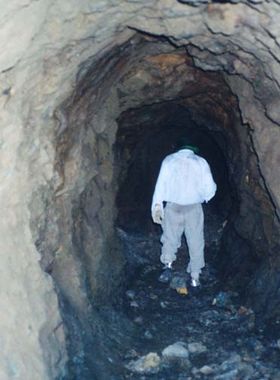
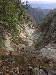
From the cairn the trail is steep but clear. Tons of switchbacks and some scrambling, with a few false trails, but the main trail is very clear. After the trail levels and straightens out a bit, it traverses the northwest face of the steep Allison gulch narrows. There are some sketchy washed out sections, but with some fortitude the mine comes into sight, and finally the trail drops into the old settlement where building remains and campgrounds can be found (34°16'16"N 117°43'42"W, elevation 4110ft). This is one of the best and yet most remote camping spots in the whole San Antonio Ridge neighborhood. It's highly recommended that you camp here and explore the area at your leisure!
An alternate route involves hiking the Heaton flats trail towards Iron Mountain and peeling off to the left at a significant saddle, altitude 4582, along an unmaintained but very flat trail to the mine site. Great betas of both these routes along with additional mine info can be found below, or in the classic "Trails of the Angeles" by J.W. Robinson.
A third route, extremely strenuous but rewarding, involves continuing on the Heaton flats trail towards Iron Mountain, stopping on the wooded shoulder (34°16'27"N 117°43'00"W), bushwhacking across a steep but wooded slope following pretty nice game trails, then scrambling down a NNW facing scree chute (34°16'44"N 117°43'14"W) into the gulch. A large boulder corridor at the base of the chute signify the entrance to the canyon propper. Despite the additional elevation and 1.7 miles of rough hiking, this approach adds six great waterfalls and a lot more of that beautiful riparian canyon. As of April '17, all required raps are slung or bolted. Betas to Iron Mountain are available on various hiking sites.
Approximate trail specs:
Trailhead to Allison Gulch: 3 miles, 200ft
Gulch cutoff to Cairn: 3/4 mile, 700ft
Cairn to top of "steep part", where the trail levels off a bit: 1/2 mile, 900ft
There to the mine: 1/2 mile, 400ft
Total: 5+ miles, 2200ft
The first rap of the lower section is down a thousand feet or so from the campsite along the creek.
Descent[edit]
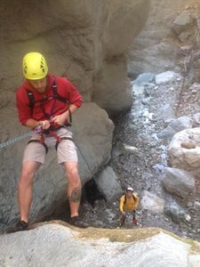
There are 5 rappels in the lower canyon section starting from the mine. Water is usually mid-calf deep, but has been reported waist deep in the past.
Lower canyon obstacle breakdown:
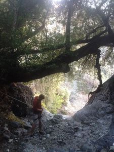
- 20ft rap, sling around tree DCR, watch for ants and falling rocks!
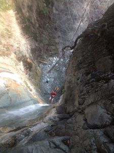
- 30-40ft rap, depending on where you start it, muddy but easy.
- 20ft rap, sling around tree high DCL.
- 40ft rap, easy and pretty.
- 80ft rap, muddy, easiest by far.
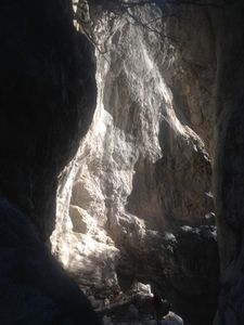
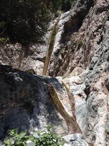
Soak in the scenery around #2. This is one of the most stunning slots in the area. The rest of the descent follows the creek and trails you came up in. Bring a headlamp in case it gets dark.
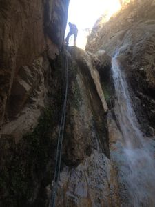
In the upper section there are an additional 5-6 rappels, all with slings or bolts as of April 2017.
Upper canyon obstacle breakdown:
- 25ft, high tree DCL or walk around it to the left. This should be bolted in the future. A cascade of carved granite scrambles and 1000ft of rock-hopping follows.
- 15ft, sling around tree DCL.
- 60ft, bolts DCL.
- 50ft, sling around tree DCR, beware of gear hanging on the branches. This tree should be "trimmed" in the future. About half a mile of walking follows.
- Three 15ft'ers, downclimb the first and third, sling around tree DCR on second.
- 50ft, sling around tree DCL, check out the mine entrance DCL, then downclimb DCL the little guy just downstream.
Proceed with lower canyon section from here.
Exit[edit]
Red tape[edit]
Apparently you're supposed to have an adventure pass at the east fork trailhead, but the dozen or more times I've parked there without one I've only received a $5 ticket once.
Beta sites[edit]
 Chris Brennen's Adventure Hikes (St Gabriels) : Allison Mine Loop
 Super Amazing Map : Allison Mine Loop
- [1]
- [2]
 SummitPost.org : Allison Gulch
