Alpine Canyon
| Rating: | ||||||||||||
|---|---|---|---|---|---|---|---|---|---|---|---|---|
| | Difficulty:3A II (v3a1 II) Raps:4, max ↨250ft
Red Tape:No permit required Shuttle:None Vehicle:Passenger | |||||||||||
| Location: | ||||||||||||
| Condition Reports: | 15 Dec 2018
"Just a trickle of water made the canyon easy going on a chilly morning; only the ropes were getting wet. The big 250 foot rappels large moss covered |
|||||||||||
| Best season: | ||||||||||||
| Regions: | ||||||||||||
Introduction[edit]
Approach[edit]
Starting at the large metal gate (5113'), hike about .6 miles slightly uphill, passing through a tunnel to the water tank at markham saddle. This tank marks the highest point in this hike at (5325'). From here it is a steady 2.15 mile descent down the fire road. After passing around the west shoulder of mount lowe and then back east, at about 2.75 miles (4661') into the hike you will see a cement and stone drainage chute on your right hand side. This chute is just before a right hand bend in the fire road. This is the drop-in to alpine canyon (34 13.71'N 118 6.61'W).
Descent[edit]
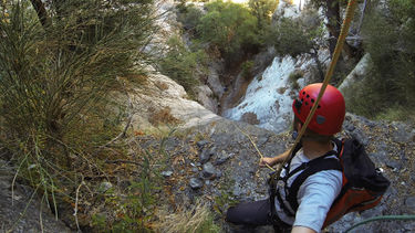
After a quick slide down the drainage chute, the initial descent into this canyon involves a series of small downclimbs down solid granite bedrock. After a few hundred yards of this, you reach the 1st of 5 rappels, all back to back within a few hundred yards of each other.
Rappel 1: 30'.
Rappel 2: 50' from tree ldc.
Rappel 3: 40' 2-step from tree on ldc about 30' back from lip.
Rappel 4 (chapman falls): 250' multi-step, anchored off tree ldc.
After reaching the bottom of chapman falls(4040'), it is a short hike out of alpine canyon to its confluence with Grand Canyon.
Exit[edit]
Once at the confluence, there are two options to exit the canyon. One involves turning left and hiking up Grand Canyon until reaching the point where it intersects the mount Lowe fire road near the campgrounds. The second option is to turn right and hike down Grand Canyon past the scree slope on your left. After this scree slope, you will see a wooded area on your left. This will allow for an ascent with relatively lower risk of loose rocks falling. Climb up the slope on the left. Higher up, the earthen slope turns into a boulder field. Just beyond the boulder field is the mount Lowe fire road. Total ascent is about 250'. Once on the fire road, turn left on follow the road past the campground, where it winds it's way around until coming to a t- junction. Take a left at this junction, passing by the trailheads for the east then the west path to mount Lowe on the right. After a few more minutes you return to the head of alpine canyon again. Continue past this point, retracing the approach route back to the metal gate.
Red tape[edit]
Beta sites[edit]
 Chris Brennen's Adventure Hikes (St Gabriels) : Alpine Canyon
 Super Amazing Map : Alpine Canyon and Chapman Falls
