Anderson Creek
| Rating: | |||||||||||||||||||||||||||||||
|---|---|---|---|---|---|---|---|---|---|---|---|---|---|---|---|---|---|---|---|---|---|---|---|---|---|---|---|---|---|---|---|
| | Raps:7+1traverse, max ↨110ft
Red Tape:No permit required Shuttle:Optional 4.5mi Vehicle:Passenger Rock type:Granite | ||||||||||||||||||||||||||||||
| Location: | |||||||||||||||||||||||||||||||
| Shuttle: | |||||||||||||||||||||||||||||||
| Condition Reports: | 23 Aug 2023
"My friends commemt: "This is a creeking route with waterfalls". We spent 4:50 in the canyon. Over 3hrs of this was creeking, boulder hopping, DCin |
||||||||||||||||||||||||||||||
| Best season: | Summer, Fall (avg for this region)
|
||||||||||||||||||||||||||||||
| Regions: | |||||||||||||||||||||||||||||||
Introduction[edit]
Anderson creek Makes for an amazing canyon day due to the 0 approach shuttle and the termination of the canyon directly at baker lake! The canyon is sprinkled with impressive old growth log jams and interesting rock formations. Seven rappels and a sustained downclimbing section coupled with the minimal approach and exit make this canyon an instant classic. Make sure you take a victory swim in the lake before the exit hike for a superb view of mt baker!! Getting there From highway 20 take the baker lake road past the dam to the baker lake trailhead (this is the bottom parking for the shuttle).
Approach[edit]
There are technically two options for approach to this canyon. The first and preferred option would be to shuttle. Park the return car/cars at the baker lake trailhead and pack up into one maybe two vehicles. Drive up the somewhat rough baker lake road 4.5mi until you reach the bridge that crosses Anderson creek. There is a small pullout/turnaround just before the bridge with enough room for probably 2 vehicles. High clearance will help with this road but is not necessary. The bridge is where you will drop into the canyon. The second Option for the approach would be to leave from the baker lake trailhead on foot and hike the 4.5mi up the road to the bridge. I would assume this would take around 2 hours.
Descent[edit]
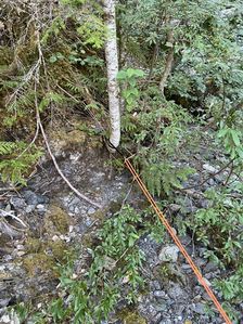
R1+traverse-(20+110) a short way down from the bridge you will come upon the first and largest drop of this canyon. A webbing anchor from a tree on the dcr side of the watercourse allows a approx 20ft traverse through the watercourse (may be difficult in higher flows) to a single bolt anchor at the lip of the falls dcl approx 110ft
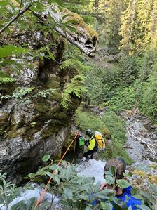
R2-(50) webbing on a tree route dcl 50ft in the watercourse. after this rap there is a fairly sustained creek walking downclimbing section to get to r3
R3-(75) after the creek walk you will come upon an obvious boulder in the watercourse there is a bolt on the backside of this boulder that provides a 75ft rappel in the watercourse
R4-(65) 65ft rappel from single bolt dcr in watercourse
R5-(55) double bolt station unlinked dcr to a 55ft rappel in watercourse
R6-(55) single bolt dcl from under a shelf 55ft in watercourse
R7-(65) bolt from high dcr above chute 65ft rap in watercourse. There are lots of chalk stones in this chute consider stemming and watch your step.
Exit[edit]
Not long after r7 the canyon will intersect the baker lake trail take this trail headed dcl for 1.3mi back to the cars. This is a very well maintained trail. It is recommended to continue a very short distance down canyon after the trail crossing to take a swim in the beautiful baker lake. A small swim into the lake will grant you access to a very spectacular view of mt baker.
Red tape[edit]
A northwest forest pass is required to park at baker lake trailhead
Beta sites[edit]
Trip reports and media[edit]
Background[edit]
First decent of this canyon was done on 9/08/2022 team was Frank Mayfield, Austin Abseils, Ryan Lepine, And Sean Szymanski


