Angel Creek (Upper)
| Rating: | |||||||||||||||||||||||||||||||
|---|---|---|---|---|---|---|---|---|---|---|---|---|---|---|---|---|---|---|---|---|---|---|---|---|---|---|---|---|---|---|---|
| | Raps:15, max ↨200ft
Red Tape:No permit required Shuttle:Required 5min Vehicle:Passenger Rock type:Cutler | ||||||||||||||||||||||||||||||
| Location: | |||||||||||||||||||||||||||||||
| Condition Reports: | |||||||||||||||||||||||||||||||
| Best season: | Jun-Oct
|
||||||||||||||||||||||||||||||
| Regions: | |||||||||||||||||||||||||||||||
Introduction[edit]
The upper reaches of Angel Creek are generally not descended because it is the only major Cutler Sandstone canyon in Ouray without a defined trail for access. It is beautiful and there are big rappels, but the energy spent to access these will take this adventure off most people's lists. Upper Angel has an unfavorable pay-to-play ratio. Read on!
Clarity of names: In 2009, Middle Angel Creek was first explored by hiking up to the top of the classic and guided Lower Angel Creek descent by continuing up an arduous steep and unrelenting climb of the hill on the south side of Angel Creek. The 2020 Canyoning in the Colorado San Juan Mountains guidebook calls this Middle Angel Creek and matches this approach and section of canyon (now Upper Angel R10-R15).
When this ropewiki entry was made, it was created as Angel Creek (Upper). This entry for Upper Angel Creek now includes everything above the 4 rappels in Lower Angel and the Middle Angel Creek hillside approach.
This updated entry is not a first descent. Other anchors were found in the canyon's upper rappels.
Approach[edit]
Upper Angel Set a car shuttle. Park the return vehicle by the signs at the Angel Creek Campground next to Camp Bird Road rather than taking space in the campground itself. Drive to the Weehawken Trailhead, just 0.65 miles to the south to start the hike.
Hike the Weehawken Trail to the first junction. Left continues to the upper reaches of Weehawken Creek. Go Right toward the Alpine Mine. The trail is good, but steepens.
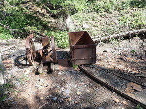
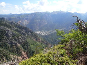
Once at the Alpine Mine, the trail stops. There is an optional Overlook Trail to the Right (East). To continue to the ridge and gain access to the Angel Creek catchment, follow the tiny creek that runs through the Alpine Mine uphill. At an elevation just above 11,000', one could contour to the ridge, then continue following the ridge to the drop in point. Don't drop in too soon. The goal is to gain a large tributary and a forested slope. Follow the topo/gps maps.
Middle Angel From the Angel Creek Campground parking by Camp Bird Road, hike to the top of Lower Angel Creek and continue uphill. It is a bit arduous due to the steep and unrelenting climb with an 800 foot gain. While difficult to find your way to the drop in, after several pesky gulch crossings, if you stay high above 9600 feet it is possible to have an easy walk down. If you find yourself rappelling in, there is an easier way.
Descent[edit]
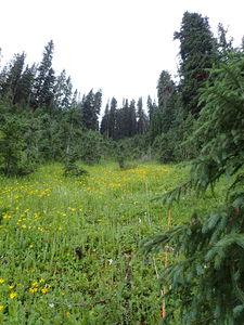
Forested Slope from the Upper Angel ridgeline
R0: The first rappel off the ridge is marked with webbing around a tree. This might be a downclimb, but the ridge is initially rocky and steep until the trees downslope begin.
It's a personal choice if people prefer to downclimb or use ropes. The slope is steep, but there is a lot of vegetation and trees of a variety of sizes.
R00: Marks a short rappel from trees into a drainage leading to the tribtary rappel sequence
Angel Tributary
R1: 110' from a stump into the flowing tributary below
R2: 45' off a log midstream, followed by 3 downclimbs
R3: 185' from a smaller stump/tree
R4: 90' just downstream from R3, deadman required for two short drops of 15' and 35'
R5: 40' rope for two stage 10' then 15' vertical drops, bypassable on CL
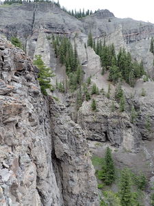
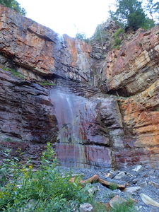
R6 (in the watercourse): 260' (estimated) from a small tree CR, about 60' through the first three drops and exposure of the cutler formation, then a 200' vertical rappel.
R6a (alternate): 50' from tree 1st stage
R6b (alternate): 200' from tree 2nd stage through a narrower slot, which is the a fault line between the cutler and another more crumbly layer, to the debris fan below
Hike around to enter Angel Creek above the next rappel.
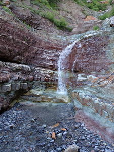
Upper Angel Creek
R7: 110' for two stage rappel: 35' falls, 35' platform, then 45' falls
R8: 45' rope 20' rap from a rock pinch
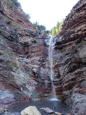
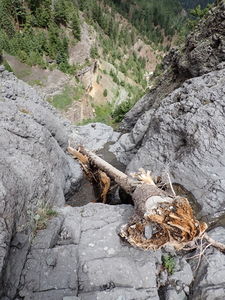
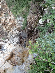
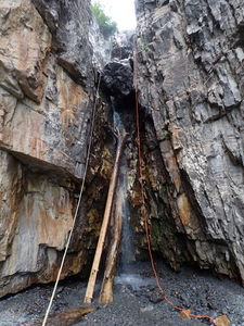
R9: 180' from a tree CR. Skip the first 25' falls and rappel the canyon side to a great 65' chute rappel (see main photo)
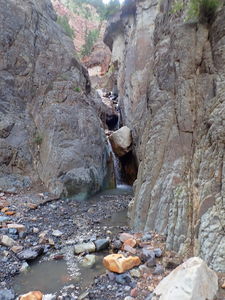
Middle Angel Creek
R10: 70' total, 55' overhung falls from tree CL
R11: 110' from tree CR, free hang twice
R12: 50' corkscrew falls, bypassable CL
R13: 75' two stage
R14: 25' from rock pinch CL
R15: 15' short rappel from a rock pinch after several down climbs
Exit[edit]
Rock hop down stream after the last rappel and either exit at the Lower Angel approach when the first rappel in Lower Angel is reached, or add the four rappels of Lower Angel to the day.
