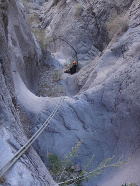
Antenna Canyon
| Rating: | |||||||||||||||||||||||||||||||
|---|---|---|---|---|---|---|---|---|---|---|---|---|---|---|---|---|---|---|---|---|---|---|---|---|---|---|---|---|---|---|---|
| | Difficulty:3A III (v3a1 III) Raps:7-9, max ↨175ft
Red Tape: Shuttle: Vehicle:4WD | ||||||||||||||||||||||||||||||
| Location: | |||||||||||||||||||||||||||||||
| Condition Reports: | 23 Dec 2023
"The road in got hit bad by Hurricane Hillary. MUST HAVE HIGH CLEARANCE 4X4. Took us 50 minutes from the tunnel to the parking. Very rough road with l |
||||||||||||||||||||||||||||||
| Best season: | Oct - May (avg for this region)
|
||||||||||||||||||||||||||||||
| Regions: | |||||||||||||||||||||||||||||||
Introduction[edit]
According to Rick Ianiello (author of Las Vegas Slots) this is the most rappel intensive canyon in the State Line Hills.
The locals use natural anchors and sometimes make artwork of the cairn anchors. Groups need to be competent in building/inspecting/backup of natural anchors/webbing as well as proper technique in rappelling on marginal anchors.
Approach[edit]
Drive: a street sedan will not make it to the trailhead, vehicles with 8" clearance will still scrape on some sections. It is a good idea to move the spare tire from under the vehicle so that it will not get scraped.
Hike east and up the wash with a few scrambles uphill. There will be various abandoned mining and relics along the way. A short distance after the 2nd mine, go left up the steep loose rock slope about 900' elevation gain. Stay on the ridge for a bit and up the further ridge which goes to the 2nd big drainage that is the canyon.
Descent[edit]
R1: ~30 cairn
R2: ~50 cairn
R3: ~20 cairn
R4: ~30 rock back
R5: ~60 cairn or pocket
R6: ~20 cairn not delicate small tree
R7: ~20 cairn
(R7-R8): there are 3 drops in between that some groups may prefer to build an anchor depending on skill
R8: ~30 cairn or pocket
R9: ~170' initial vertical portion with some steps, middle overhang, bottom section slanted wall
+ Plus a lot of down climbs that some groups may prefer to build an anchor to descend
Exit[edit]
After exiting the finale 170' rappel, the wash will start heading right(east) but the start point on the KML file is more towards the left (north).
Red tape[edit]
Beta sites[edit]
- Las Vegas Slots Facebook Beta
 Las Vegas Slots Book by Rick Ianiello : Antenna Canyon
 HikeArizona.com : Antenna Canyon
- https://www.stavislost.com/hikes/trail/antenna-canyon
