Arroyo Seco - Switzer Falls
| Rating: | |||||||||||||||||||||||||||||||
|---|---|---|---|---|---|---|---|---|---|---|---|---|---|---|---|---|---|---|---|---|---|---|---|---|---|---|---|---|---|---|---|
| | Raps:1-2, max ↨80ft
Red Tape:No permit required Shuttle:None Vehicle:Passenger | ||||||||||||||||||||||||||||||
| Location: | |||||||||||||||||||||||||||||||
| Condition Reports: | 28 Dec 2025
"Comboed with baby Colby. Surprising amount of water resulted in the first rappel (upper Switzer) being too dicey to rappel in the flow path. We ended |
||||||||||||||||||||||||||||||
| Best season: | Year round. Beware of high water in Winter
|
||||||||||||||||||||||||||||||
| Regions: | |||||||||||||||||||||||||||||||
Introduction[edit]
> Please carry your favorite Gardening tools to every canyon (Folding Saw, Pruners, Loppers, Machete). We all need to help with trail and canyon maintenance on every trip.
Switzer Falls (named after Commodore Perry Switzer) has been an attraction and a big tourist destination for over 135 years (see "Background" below for more info).
That said, I was very surprised that no one seems to have ever rappelled it? There’s no writing anywhere on it, not even Chris Brennen and we saw no signs of older anchors left behind. I still won’t presume we were the first ones to rappel these 2 falls in 2019...
Approach[edit]
Getting There:
From the 210 freeway, take the “2 / Angeles Crest Hwy” exit North. Drive about 16.8 miles and turn Right (South) to “Switzer Truck Trail”. Follow to the end and park. The trailhead is at: 34.266250, -118.145719.
Approach:
Follow the Gabrielino Trail for 1 mile to the drop-in point near the ruins of the old Switzer-land Resort.
Descent[edit]
The Canyon:
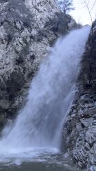
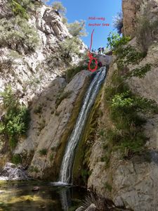
Once you drop in it’s a very short walk to the first waterfall. The canyon offers 2 waterfall, you have to rappel the first one, but can bypass the second.
Waterfalls:
| Number | Tiers | Total height | Anchor (looking down stream) | Anchor Gear | Rope* |
|---|---|---|---|---|---|
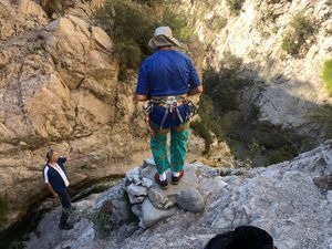
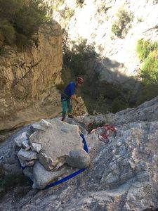
| 1 | 1 | 80' | R - Loop around old concrete post | 5-10’ Webbing or rope | 180’ |
| 2 | 2 | 10' + 30' | L - Large tree | 5-10’ Webbing or rope | 80’ |
- Rope - Recommended length based on rappel height and distance between tiers (when applicable) and to anchors x 2
Waterfall notes:
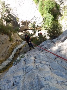
1. This waterfall is 80’. The first 30’ is a 45 degree slope and then it goes vertical for another 40’. In order to avoid rope pulling issues, after the group was down I wrapped the rope around the concrete post and rappelled to the middle then anchored to a small tree and rappelled the rest.
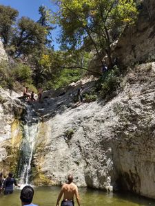
2. Go around the 10’ drop and use the large tree on the left for a fun rappel into the pool.
Exit[edit]
From the bottom of the last rappel walk down stream to meet the Bear Canyon Trail, turn Right (West) and start climbing the West canyon wall to join back with the Gabrielino Trail that will lead back to the parking lot.
Red tape[edit]
Beta sites[edit]
Trip reports and media[edit]
Background[edit]
Switzer-Land history: https://www.kcet.org/shows/departures/peering-into-the-chasm-vanished-canyon-resorts-of-la
