Bandit Canyon
| Rating: | |||||||||||||||||||||||||||||||
|---|---|---|---|---|---|---|---|---|---|---|---|---|---|---|---|---|---|---|---|---|---|---|---|---|---|---|---|---|---|---|---|
| | Difficulty:3A II (v3a1 II) Raps:4-5, max ↨160ft
Red Tape:No permit required Shuttle:None Vehicle:4WD - High Clearance Rock type:Sandstone | ||||||||||||||||||||||||||||||
| Start: | |||||||||||||||||||||||||||||||
| Parking: | |||||||||||||||||||||||||||||||
| Condition Reports: | |||||||||||||||||||||||||||||||
| Best season: | May-June, Sep-Oct
|
||||||||||||||||||||||||||||||
| Regions: | |||||||||||||||||||||||||||||||
Introduction[edit]
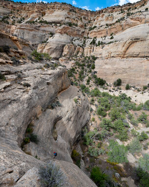
Bandit Canyon is a short canyon located within Dinosaur National Monument in Colorado. It is a tributary to Sand Canyon located to the South of the Yampa river, and features several downclimbs, and rappels with shallow potholes
Approach[edit]
Driving:
Drive East of Dinosaur, CO turning north at the Canyon Visitor Center onto Harper's Corner Rd for 25.5 miles on pavement. Along the way, a bathroom is available at the Plug Hat Butte parking and dispersed camping is available down Blue Mountain Road.
Late arrivals beware the many deer and black cows on the open range along Harper's Corner Road.
Turn right toward Echo Park at Sand Canyon Road, which is easily passable with 4WD HC in dry conditions. Drive Sand Canyon Rd 7.5 miles to the intersection with Yampa Bench Road. Echo Park is to the Left. Turn right on Yampa Bench Road for 1.1 miles. Yampa Bench Road is also easily passable with 4WD HC in dry conditions to where it intersects Sand Canyon. Park next to Yampa Bench Road on a small pull off just past Sand Canyon creek.
Hiking:
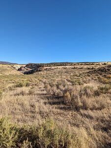
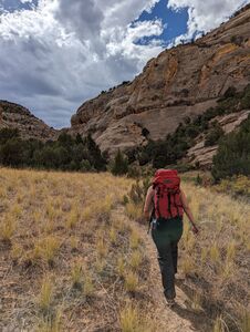
Once parked, begin making your way North-Northeast, avoiding dropping into Sand Creek canyon. Faint game trails may appear making travel faster. The terrain is largely open prairie which makes for fast and easy travel. As you travel north, you will cross 3 dry creeks, each of which is larger than the prior. The 3rd creek may require some scrambling to get past.
Once you reach the 4th and largest dry creek, descend into the watercourse and follow it down until you reach the canyon.
Descent[edit]
Downclimbs (3): The first downclimb encountered is a dryfall, easily downclimbed DCR, or can be bypassed DCL. As the canyon narrows and begins to turn, you will reach the 2nd downclimb which drops down a few ledges. Shortly after is the 3rd down climb which is down a fluted chute
R1 or DC: 30’ from a cairn anchor in the watercourse.
R2: 85’ from a chock stone in the slot in this pothole section (a large log in the pothole disappeared between Sep2023 and Oct2024)
R3: 125’ from juniper tree DCL. Rappel drops into a large but shallow pothole, at most knee deep.
R4: 20’ from a tree DCR down a small dry fall
R5: 160’ from a tree DCL down a large amphitheater featuring wide open views of Sand Canyon below, a long chute and a final 20' vertical drop.
Exit[edit]
After the fifth rappel, the technical portion of the canyon is over. After a short walk down canyon, you will reach Sand Canyon. Going left/South will take you back to your vehicles. Going right/North will take you into Lower Sand Canyon eventually reaching the Yampa river. While there is no formal trail, a well worn social trail exists, and the creek is typically dry and flat for when a social trail isn't found. Follow the trail for about 1.3 miles until you reach your vehicle.
Red tape[edit]
A National Park's pass or a Dinosaur National Monument entrance fee is required.
Beta sites[edit]
Trip reports and media[edit]
Summer 2018: explored by Gunnar Olson and partner, no sign of previous descent
September 30 2023: Trip details and kml added to ropewiki.


