Basin Creek
| Rating: | |||||||||||||||||||||||||||||||
|---|---|---|---|---|---|---|---|---|---|---|---|---|---|---|---|---|---|---|---|---|---|---|---|---|---|---|---|---|---|---|---|
| | Difficulty:3B II (v3a1 II) Raps:6, max ↨150ft
Red Tape:No permit required Shuttle:Optional 10 min Vehicle:Passenger | ||||||||||||||||||||||||||||||
| Location: | |||||||||||||||||||||||||||||||
| Condition Reports: | 30 Jul 2021
"Trip was on a very hot and sunny day, and the canyon walls did not offer much shade during descent. Our team got to NF Kings and split up into hiking |
||||||||||||||||||||||||||||||
| Best season: | All year
|
||||||||||||||||||||||||||||||
| Regions: | |||||||||||||||||||||||||||||||
Introduction[edit]
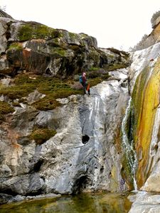
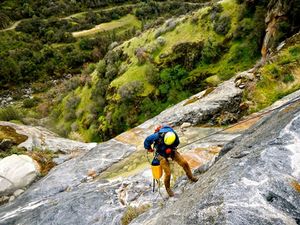
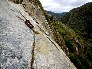
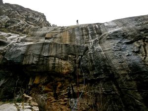
Basin Creek is a good quality, short side canyon that enters the NF Kings about halfway from Balch Camp to the powerhouse that makes a great alternative to the high-flow canyons often found in the Sierra Mountains. The route is primarily a series of rappels next to low flowing waterfalls. The creek has a very small drainage, so flows will seldom be large enough to cause problems and suitable for year-round enjoyment. The total hiking distance from road to road is about 1/2 mile. This a mostly bolted canyon featuring several large, straight-forward rappels, 1 minor downclimbing obstacle, and 1 optional traverse; making it a fairly beginner friendly canyon. Poison oak is present in and around the canyon.
Approach[edit]
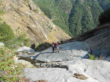
As you drive up the Black Rock Road from Balch Camp, the road crosses an exciting cliff face with a couple of bridges to span short chasms. When the road leaves that cliff face, it enters the small Basin Creek drainage. There is a turnout near where the creek plunges down the cliff. The hillside below this turnout is less bushy than other areas, allowing an easy approach to the creek. The creek is very close at this point. Head south and follow the path of least resistance to the first rappel on bolted anchors DCR. Little to no bushwhacking is required.
Descent[edit]
R1: 2 bolts DCR 70' into a shallow pool.
R2: Large boulder, 25'
5' Downclimb
R3: 2 bolts DCL 150'. There is a ledge 100' down with deadman anchor options so it is possible to do the rappel in 2 stages.
R4: 2 bolts DCL 115'.
R5: 2 bolts DCR 140'. There is another set of bolts DCC requiring an easy but exposed traverse to reach. The DCC anchor allows for a better position to exit the canyon.
Exit[edit]
The canyon can be done as a loop or car shuttle. If shuttling, a river crossing on exit is required which may require swimming or be impassible at times. The loop exit consists of an easy scramble up a talus field.
Shuttle: After R5, continue downstream. There is an additional ~8' down climb and R6 50' from 2 bolts DCC. This route ends on the Balch Powerhouse road, about halfway between Balch Camp and the powerhouse. As you drive up the road to the powerhouse you will see a flat terrace below the road. There is a ramp from the road down to the terrace and a further ramp leading down close to the river. This provides easy access from the river back up to the road. Basin Creek enters the river about 100 yards upstream of this ramp. Hiking from Basin Creek along the NF Kings, across the NF Kings and then up to the road is pretty easy most of the year. Do not attempt this route if there is high flow in the NF as it could be impossible to cross. High flows on the NF only occur when Balch afterbay dam spills in the spring of wet years and periodically in January during maintenance operations.
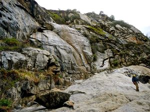
Loop: After R5, head up the slope DCR following one of the several game trails. Continue up and around to the right, skirting the class 3 scramble to access the talus slope in the gully. From here it is an easy scramble up, however, be mindful of loose rock. As you approach the road and the top of the gully, look for a trail UCR that leads to the turnout where you left your car.
Red tape[edit]
Beta sites[edit]
Trip reports and media[edit]
As you drive up the road to the powerhouse you will see a flat terrace below the road. There is a ramp from the road down to the terrace and a further ramp leading down close to the river. This provides easy access from the river back up to the road. Basin Creek enters the river about 100 yards upstream of this ramp. In the winter there is a pretty and impressive 3 or 4 step waterfall down Basin creek visible from the road. The horizontal distance from Black Rock Road to the Balch Powerhouse Road is about 1/4, while the drop is 900 feet. We had 6 rappels, with 5 bolted stations and one slung chockstone on a very short rappel or downclimb. The longest rap was about 40 meters, while most were in the 30 to 35 meter range. (We had a 70 meter rope, hence my use of meters) There is a bit of bushwacking at the start of the trip and near the end which could have been easily alleviated if I had brought the pruning shears that I intended to bring. There is also a fair bit of poison oak in the canyon which can be mostly avoided with care. On the last rappel of the main waterfall, the rope fell into poison oak when we pulled it, so I intend to move those anchors when I go back.
We took 4 hours on the first descent of Basin Creek, so subsequent trips by a competent group could be done in a couple hours. It will also be decent winter trip as it faces south and is fully exposed to the sun.
Information on this canyon was extracted from an email Paul Martzen sent to some friends on Jun 2013, reproduced here with permission from the author.
Background[edit]
Original canyon beta from an email by Paul Martzen, updated by a second descent done by Amanda C.
