Baxter Gulch
| Rating: | |||||||||||||||||||||||||||||||
|---|---|---|---|---|---|---|---|---|---|---|---|---|---|---|---|---|---|---|---|---|---|---|---|---|---|---|---|---|---|---|---|
| | Raps:3, max ↨185ft
Red Tape:No permit required Shuttle: Vehicle:4WD - High Clearance | ||||||||||||||||||||||||||||||
| Start: | |||||||||||||||||||||||||||||||
| Parking: | |||||||||||||||||||||||||||||||
| Condition Reports: | |||||||||||||||||||||||||||||||
| Best season: | Jul-Sep
|
||||||||||||||||||||||||||||||
| Regions: | |||||||||||||||||||||||||||||||
Introduction[edit]
Baxter Gulch is an unassuming drainage south of the prominent Augusta Falls and a good follow up canyon to https://ropewiki.com/Augusta_Falls since the approach starts at the end of the Augusta Falls Exit. The first and third rappels are decent, but it's the second multi stage rappel plus the great pay to play that make Baxter Gulch worth doing.
Approach[edit]
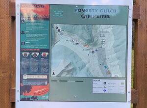
Drive North out of Crested Butte on CR 317 toward Mt. Crested Butte. Turn Left (West) on CR 734 for 8 miles to parallel the Slate River heading North and passing the Oh-Be-Joyful Campground. Turn Left on Forest Service Road 552, where high clearance 4WD will be required. Follow signs to avoid private driveways and cross the Slate River, then dodge cattle on the open range. Select one of the seven Poverty Gulch dispersed campsites or Park near the end of the road for both Baxter Gulch and Augusta Falls.
Hike Daisy Pass Trail 404 until it nears Baxter Gulch above the first rappel. Depart the trail to the south and descend a game trail to the watercourse below.
Descent[edit]
Downclimb a short low angle cataract
R1: 130' from a rock or rock stack in Canyon Center
R2: 185' from a tree on Canyon Left for a multistage rappel with a 100' vertical falls first, past two potholes and a final 20' vertical falls into a deep pool
R3: 60' from a tree on Canyon Right
Exit[edit]
Follow Baxter Gulch downstream until it merges with Poverty Gulch. The shortest path back to the road is to pick up an old dirt two track on the North side of Poverty Gulch and follow this to the Northeast.
Red tape[edit]
Beta sites[edit]
Trip reports and media[edit]
2024-08-10 First known descent. Ira Lewis, Carl Bern, Wayne Herrick, Ryan Humphries, Rob Demis, Jim Rickard


