Bear Cloud Canyon
| Rating: | |||||||||||||||||||||||||||||||
|---|---|---|---|---|---|---|---|---|---|---|---|---|---|---|---|---|---|---|---|---|---|---|---|---|---|---|---|---|---|---|---|
| | Difficulty:3A IV PG (v4a1 IV) Raps:9, max ↨200ft
Red Tape:Permit required Shuttle:Required 11 min Vehicle:Passenger Rock type:Granite | ||||||||||||||||||||||||||||||
| Location: | |||||||||||||||||||||||||||||||
| Condition Reports: | 15 Aug 2020
"Pretty easy approach at first with good use-trail until after Supercloud Hollow. I got too far right after that; it looks like staying on or to the le |
||||||||||||||||||||||||||||||
| Best season: | oct-may
|
||||||||||||||||||||||||||||||
| Regions: | |||||||||||||||||||||||||||||||
Introduction[edit]
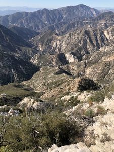
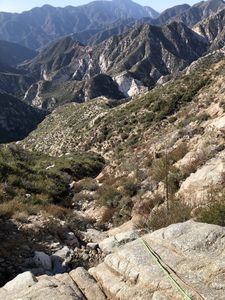
Bear Cloud Canyon offers almost continuously outstanding views hiking out the long approach ridge, with minimal bushwhacking thanks to a use trail much of the way and animal runs with some trimming the rest of the way. The last part of the ridge, and the downclimb into the canyon proper do have much loose white granite, so do be careful climbing on it. The canyon itself is open in shape, not deep like a "proper" canyon, but it has features worthy of any good canyon. Much of the travel is over an amazing amount of clean granite slabs and drops with nearly zero bushwhacking (and really zero brush after we cut it back). The rappels are mostly cairn anchors or large rock chocks, so proper inspection, testing and or rebuilding will be needed. The final two stage rappel at 300 feet drops you directly into Bear Canyon creek bed nearly on top of its USFS trail for ease of exit. And best of all, no poison oak on the approach, descent, or exit! (caveat: except for a bit of PO on the Arroyo Seco exit trail which is totally avoidable)
Approach[edit]
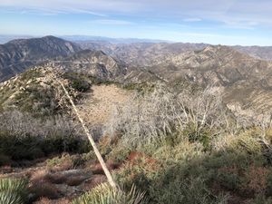
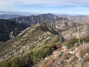
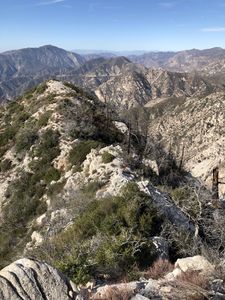
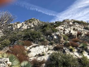
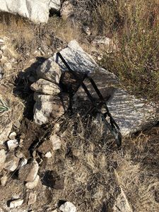
Park one vehicle at the Lower Switzer parking area, and shuttle the other up to the Bill Riley Trailhead parking (0.3 miles past Red Box Gap on the Mt Wilson Road). Hike up the Bill Riley trail until you come close to the road for the second time, then get onto the road. Hike up the road until you reach the old dirt road (now a trail) that heads to Super Cloud Canyon. Somewhere near here (or a another 1/4 mile up the road) is the use trail to Mt Deception summit. As of the first descent we did not find this connection, but instead went along the old road trail to Super Cloud, and then cut a path straight up to the ridge line from the Super Cloud drop-in point. From the ridge top, hike West on a good use trail and various animal runs to the Super Cloud Hollow. On the opposite side of the hollow it becomes harder to find a reasonable path through the brush, but easier as we cut some of the brush back. Continue out past a couple of summit knobs eventually having to scramble around on white granite buttresses sticking out of the ridge. Be careful climbing on this rock as much of it is loose. Eventually you get to a long thin and flat part of the ridge without the granite buttresses. At the end is a rock cairn with some rusty solid steel wire (bundled up). This marks the end of the approach.
Descent[edit]
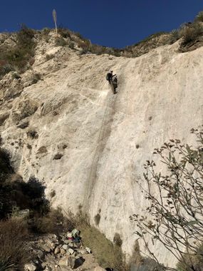
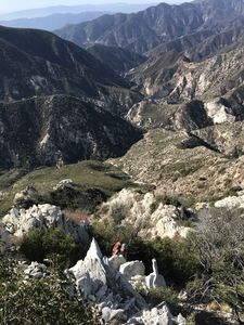
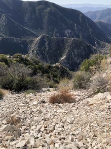
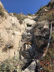
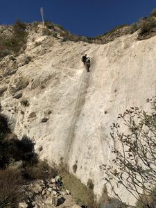
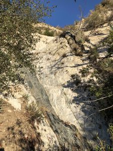
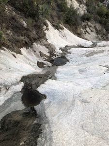
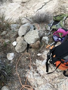
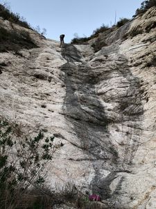
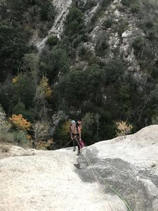
From the rock cairn, head West until you can see Bear Cloud Canyon below. Downclimb toward a white buttress splitting the 2 gullies that make the top of Bear Cloud. There is a brown buttress further North, which you definitely want to be South (left side) of it. There is a unusual phallic shaped rock which is a good target for the downclimb direction. Once at the white buttress, choose a side for further descent. The North side is yet to be explored but has more brush and unknown rappels. The South side starts with a few hundred feet of bright white granite, loose large scree / small talus at the angle of repose. Be careful here as large amounts of rock can slide with any given footstep. At the bottom of the scree slide the downclimb become earthen and at one point we rappelled 200 feet to avoid sliding and falling down the super steep slope (R1). From there we ghosted a bush for a short R2 down a short low angle drop with much loose gravel on it. R3 is another short stair stepped drop off a bush DCL. Numerous easy downclimbs lead to the first white granite wall (banner photo) 102 feet R4 with a rock cairn anchor DCL. R5 starts from a rock chock in the water course bed next to a large boulder. R5 drop awkwardly at first, then walk over to a low angle ramp, total 120 feet. R6 from a rock cairn DCL is low angle white granite wall with a wide grey seam. R7 from a rock cairn DCL. From there the canyon goes down a clean trough, reaching a large deadfall tree with a path cut through the branches. Below is more clean trough with tiny shallow potholes. Below which is the 102 foot R8 with rock cairn anchor DCL, leading to a enclosed shelf (large flat pothole) with no escape on either side. R9 (final) from a rock cairn center in the water puddle drops 200 feet directly into Bear Canyon creek bed.
Exit[edit]
From the bottom of the final rappel, hike about 300 feet down stream in Bear Canyon creek bed until you see the trail on the West side. Hike this trail to Arroyo Seco and continue to the junction (marked with posts) for Switzer Falls, Switzers, and Bear Canyon (the way you came). Hike up the switchbacks to Switzers, not the dead end towards the falls (unless you just want to see the falls). At the top of the climb you reach the Gabrielino Trail junction. Continue toward Switzers (1.4 miles) and your vehicle.
Red tape[edit]
Forest Adventure Pass required for parking.
Beta sites[edit]
Trip reports and media[edit]
Background[edit]
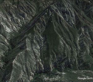
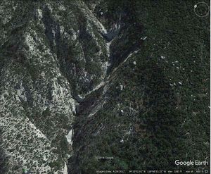
This is just one of those canyons that seen from Google Earth says "just do it", as I was browsing around a week before Thanksgiving 2018. A query sent out to the usual first descent guru's confirmed that none of them had explored it. And for good reason, it's a long approach out a brush covered ridge, and the canyon itself is fed by a small drainage area, thus not likely to yield an awesome canyon. Still Google Earth says a lot, so Brad Torsone and myself (Willie Hunt) ran it 25NOV2018:
