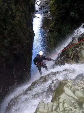
Boston Creek
| Rating: | |||||||||||||||||||||||||||||||
|---|---|---|---|---|---|---|---|---|---|---|---|---|---|---|---|---|---|---|---|---|---|---|---|---|---|---|---|---|---|---|---|
| | Raps:14, max ↨72ft
Red Tape: Shuttle:Required 45 min Vehicle:Passenger | ||||||||||||||||||||||||||||||
| Location: | |||||||||||||||||||||||||||||||
| Condition Reports: | |||||||||||||||||||||||||||||||
| Best season: | summer
|
||||||||||||||||||||||||||||||
| Regions: | |||||||||||||||||||||||||||||||
Introduction[edit]
The canyon, cut into a mix of basalt and volcanic breccia, provides a strenuous and scenic canyoneering route that includes fourteen rappels as well as numerous downclimbs and swims, ending at the shore of Comox Lake.
Approach[edit]
The original approach is by hiking up from the bottom, following bike trails (or the Boston Main trail) to the drop in at the top. The new closed gate at the Dam forces to hike in an almost 2 additional miles.
With a closed gate at the dam, it may be preferable to run a shuttle to the top (45 minutes each way) and avoid most of the approach hike.
Another possibility may be to run just 1/2 the canyon, by rappeling into the creek from the cliffs shortly after the approach bike trail crosses a side drainage (see map).
Descent[edit]
The full descent of Boston Creek canyon is a fairly long and strenuous canyoneering adventure, requiring at least 8 hours for a reasonable descent time (approach exit are extras).
The descent is described in great detail in the Beta Sites listed below. However, it may be possible to shortcut the descent by dropping into the canyon early, dropping into the creek rappeling off trees when the bike trail gets in the proximity of the creek (see map).
Exit[edit]
The exit is at the bridge right before the Comox Lake. The new closed gate at the Dam forces now to hike 2miles in order to reach the car.
Red tape[edit]
Beta sites[edit]
 CanyoneeringNorthwest.com (archive.org) : Boston Creek
 Super Amazing Map : Looper and Boston Creek Canyons
Trip reports and media[edit]
Background[edit]
Dusty Goldsheider pioneered the descent of Boston Creek in 2003. Information about this canyon was provided by Dusty Goldsheider.
