Box of Crumbs (Dinosaur)
| Rating: | |||||||||||||||||||||||||||||||
|---|---|---|---|---|---|---|---|---|---|---|---|---|---|---|---|---|---|---|---|---|---|---|---|---|---|---|---|---|---|---|---|
| | Difficulty:3A III (v3a1 IV) Raps:3, max ↨95ft
Red Tape:No permit required Shuttle:None Vehicle:Passenger Rock type:Sandstone | ||||||||||||||||||||||||||||||
| Start: | |||||||||||||||||||||||||||||||
| Parking: | |||||||||||||||||||||||||||||||
| Condition Reports: | |||||||||||||||||||||||||||||||
| Best season: | Best in Spring and Fall, Hot in Summer, Cold in Winter
|
||||||||||||||||||||||||||||||
| Regions: | |||||||||||||||||||||||||||||||
Introduction[edit]
Box of Crumbs has a few good morsels in it, but the three okay rappels are separated by too much canyon walking. Consider descending Box of Cookies and upclimbing past R3 to the base of R2 in Box of Crumbs instead.
Pay attention to the property lines and review the specific instructions in the Red Tape section.
Approach[edit]
Drive east of the town of Dinosaur, Colorado and the Dinosaur National Monument Canyon Visitor Center on Highway 40. Turn north on County Road 165 at (40.25068, -108.77781). Follow the well-graded dirt road a quick left then right and on to a ranch gate 1.75 miles away. Note the quantity of No Trespassing signs posted on both sides of the road. County Road runs through one parcel of private property to the front gate of another
Park in front of the ranch gate at the end of the road. Park in front of this gate out of the way at (40.26486, -108.79989), such that a large trailer could turn around. See the Red Tape section below.
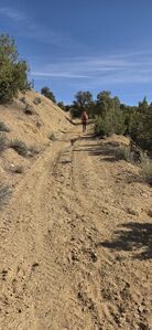
Hike 0.2 miles back down the road. Depart the road to hike north through a small BLM parcel. Aim for a low point on the east side of the parcel where the ridge is lowest. Follow an animal trail down the ridge and walk across a field to the Colorado State Trust Land boundary. Hike north around the next ridge and pick up an old dirt road, which is washed out in a few places, but has a cattle trail to follow. Follow the kml track in Box of Cookies and hike the easy ridge west of Box Canyon to hike a shorter, but slightly steeper path around the top the West Fork.
The stats included here reference hiking further west from the mouth of Box Canyon on maintained two-tracks. This is further, but about the fastest hiking possible. A gate crosses the road at (40.30435, -108.79955), which keeps cattle to the south for grazing. This has been confirmed with the White River BLM Field Office that this is indeed public land and there should not be any No Trespassing signs posted at this location. Leave the gate open or closed as you found it.
Hike to the top tributary to reach the first rappel.
Descent[edit]
DC: 30'
DC: 10' DCL
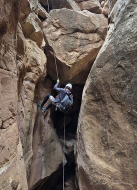
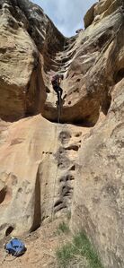
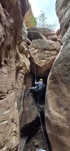
R1: 60' from a tree DCR + another 10' of rope to fiddle.
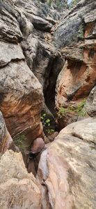
Enter the Middle Box Canyon drainage and hike a long way
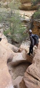
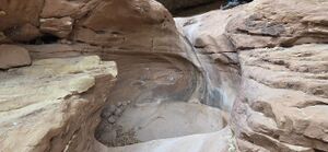
R2: 45' from a boulder pinch DCR into a pretty alcove and narrows
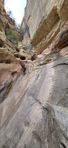
R3: 95' from a tree set back DCR +20' extra to fiddle, bypassable DCR
Box Canyon West Fork (Box of Cookies) enters DCR.
The most overgrown section of the canyon is from the confluence of the West (Cookies) and Middle (Crumbs) Forks until this drainage meets the large Main (East) Box Canyon. Shortly after this next confluence, one could escape the canyon DCR by scrambling up the slope.
Several downclimbs of 10'-20' exist in the main Box Canyon.
Exit[edit]
From the mouth of Box Canyon, hike south on cattle trails to the old road and retrace roads and cattle trails back to the car carefully following the track to stay within designated public land.
Red tape[edit]
Private Land is the challenge of the Cookies and Crumbs Box Canyon forks.
Download and follow the kml track. Here are more details about performing the required dance:
County Road
Exit Highway 40 and turn North onto County Road 165, which runs through one parcel of private property to the front gate of another. Park in front of this gate out of the way (40.26486, -108.79989), such that a large trailer could turn around.
A deputy at the Moffat County Sheriff (970) 824-4495 confirmed parking is allowed within the 60 foot right-of-way along County Road 165, even if it is surrounded by Private Property, as long as the parked vehicle does not block the road and is not left there for long (daylight hours).
BLM parcel
Walk 0.2 miles back down CR 165 to a small square of BLM land, which abuts a one acre parcel of Colorado State Trust Land to the north.
Colorado State Trust Land
Hike over the small ridge and move past the barbed wire fence of the Colorado State Trust Land boundary. This appears be used as grazing land by the ranch to the south. Leave gates open or shut as found.
Sometimes Colorado State Trust Land is leased for profit back to the state, which means the typical rules of carrying a valid Hunting or Fishing permit still won't allow passage or these activities on that land. The leasing changes and can be hard to verify, but this State Trust Land Finder may help. As of 2025, the only State Trust Land (Baking Powder Ridge) in the area references STL areas East of Massadona around Wolf Creek, which is well East of the Skull Creek Wilderness Study Area.
Skull Creek Wilderness Study Area surrounds this Colorado State Trust Parcel to the west, north and east. Willow Creek Wilderness Study Area begins west of a two-track in good condition referenced in the Box of Crumbs beta.
Consider leaving the following note on your dash in large font when parking at (40.26486, -108.79989)
To Whom it May Concern,
We will be parked here during daylight hours [trip date] while accessing Skull Creek Wilderness Study Area and Colorado State Trust Land to the North.
A deputy at the Moffat County Sheriff’s office (970) 824-4495 confirmed that parking within the 60-foot right-of-way of County Road 165 is legal as long as we are not blocking the road.
Please leave a note under a wiper if this information is incorrect.
Thank You
Beta sites[edit]
Trip reports and media[edit]
2025-05-04 Beta added to ropewiki. Ira Lewis, Wayne Herrick, Eva & Aether Vaitkus, Cassie Taylor, Duane & Lyle, Arick Calhoun
